

Portillo Storm Snowfall Total Passes 5m / 17 Feet
A snow storm that has now continued for nine days has taken Chilean ski resort Portillo to a snowfall total of 5.2 metres (17 feet) so far, with more snow forecast.

Next 4 days weather summary:Lluvia moderada (totál 15.0mm), más pesada el miércoles por la tarde. Cálido (max 24°C el jueves por la tarde, min 10°C el lunes por la noche). El viento será generalmente ligero. | Días 5-7 Resúmen del Tiempo para Radstadt/AltenmarktLluvia moderada (totál 13.0mm), más pesada el domingo por la tarde. Cálido (max 25°C el viernes por la tarde, min 14°C el sábado por la noche). El viento será generalmente ligero. | |||||||||||||||
martes 28 | miércoles 29 | jueves 30 | viernes 31 | sábado 1 | ||||||||||||
noche | mañana | tarde | noche | mañana | tarde | noche | mañana | tarde | noche | mañana | tarde | noche | mañana | tarde | noche | |
chuba scos | claro | claro | claro | claro | lluvia mod. | chuba scos | claro | claro | claro | claro | semi nublado | chuba scos | semi nublado | claro | chuba scos | |
km/h | ||||||||||||||||
Mapa de Nieve |  |  |  |  |  |  | ||||||||||
— | — | — | — | — | — | — | — | — | — | — | — | — | — | — | — | |
mm | 1 | — | — | — | — | 10 | 4 | — | — | — | — | — | 3 | — | — | 4 |
max °C | 11 | 15 | 20 | 17 | 20 | 22 | 18 | 21 | 24 | 22 | 23 | 25 | 18 | 21 | 23 | 22 |
min °C | 10 | 11 | 19 | 15 | 16 | 16 | 16 | 19 | 23 | 19 | 20 | 23 | 16 | 20 | 23 | 14 |
chill °C | 10 | 11 | 19 | 15 | 16 | 16 | 16 | 19 | 23 | 19 | 20 | 23 | 15 | 20 | 23 | 14 |
Humed. % | 84 | 59 | 44 | 71 | 53 | 82 | 55 | 40 | 30 | 46 | 31 | 44 | 45 | 43 | 41 | 70 |
Altura de Hielo m | 3800 | 4150 | 4550 | 4550 | 4450 | 4350 | 4350 | 4300 | 4550 | 4500 | 4600 | 4600 | 4700 | 4450 | 4600 | 4600 |
— | 5:37 | — | — | 5:39 | — | — | 5:39 | — | — | 5:41 | — | — | 5:43 | — | — | |
— | — | — | 8:45 | — | — | 8:44 | — | — | 8:43 | — | — | 8:42 | — | — | 8:39 | |
Hazte pro y carve en:
Información de avalanchas: European Avalanche Warning Services (EAWS)
Ultimo parte de nieve cerca Radstadt/Altenmarkt:
| Profundidad de nieve arriba: | 0 cm |
|---|---|
| Profundidad de nieve abajo: | 0 cm |
| Profundidad de la nevada fresca: | — |
| Última nevada: | 16 May 2026 |
0.0 | Dias de Nieve en Polvo Nieve fresca, mayormente soleado, viento suave. |
|---|---|
0.0 | Dias de nieve en polvo Nieve fresca, sol limitado, sin viento. |
0.0 | Dia perfecto para esquiar Nieve promedio, mayormente soleado, viento suave. |
La tabla anterior muestra el pronóstico de tiempo para Radstadt/Altenmarkt en la altitud específica de 1700 m. Nuestros modelos meteorológicos sofisticados permiten prever pronósticos para la cumbre, la mitad y la base de Radstadt/Altenmarkt. Para aceder a los pronósticos de tiempo a otras alturas, pinche en la navegación en la parte superior de la tabla. Para una visión general, consulte el Mapa meteorológico de Austria.
Pinche aquí para más información sobre niveles de congelación y sobre cómo pronosticamos las temperaturas.
Generalmente 4.2 En base a 14 votos y 2 comentarios
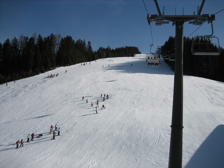
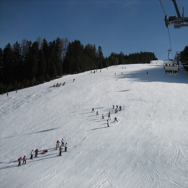
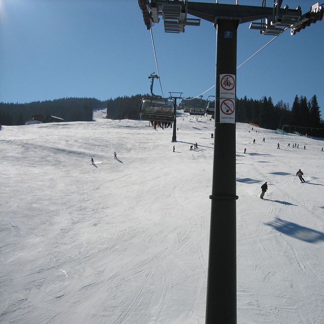
Radstadt is a small town with a few hotels, bars and restaurants, just over an hour from Salzburg. The ski area is fairly small, about 30kms of runs and 5 lifts. The runs are nice, tree lined and mostly red or blue. There is a fast gondola from the village and the other lifts are all quad chairs, fast and efficient. The lift pass covers the whole Salzburgerland ski area, so places like Flachau, Schladming, Zauchenzee, Filzmoos and Obertauern are included. So if you fancy a change just get the bus to the other local resorts, most are within 30min bus ride. A good tip is to get the gondola up, ski down the Altenmarkt side of the mountain and get the ski bus from there 15 minutes down the valley to the higher Zauchensee area which has guaranteed snow and about 20 lifts and links to Kleinarl. Although Radstadt ski area is low (900 - 1700m) it is mostly north facing so can survive warm weather. When I was there is was 18 degrees in mid March but most runs were still open and you could ski to the bottom despite the warmest and most snow-less winter for decades (2006-07). Would recommend Radstadt for good links, cheap accommodation and for families. If you want to party then go to Flachau or Schladming.
David Hosking de United Kingdom escribe:
Radstadt is a small town with a few hotels, bars and restaurants, just over an hour from Salzburg. The ski area is fairly small, about 30kms of runs and 5 lifts. The runs are nice, tree lined and mostly red or blue. There is a fast gondola from the village and the other lifts are all quad chairs, fast and efficient. The lift pass covers the whole Salzburgerland ski area, so places like Flachau, Schladming, Zauchenzee, Filzmoos and Obertauern are included. So if you fancy a change just get the bus to the other local resorts, most are within 30min bus ride. A good tip is to get the gondola up, ski down the Altenmarkt side of the mountain and get the ski bus from there 15 minutes down the valley to the higher Zauchensee area which has guaranteed snow and about 20 lifts and links to Kleinarl. Although Radstadt ski area is low (900 - 1700m) it is mostly north facing so can survive warm weather. When I was there is was 18 degrees in mid March but most runs were still open and you could ski to the bottom despite the warmest and most snow-less winter for decades (2006-07). Would recommend Radstadt for good links, cheap accommodation and for families. If you want to party then go to Flachau or Schladming.
Lea 1 otras críticas de Radstadt/Altenmarkt o entrega su propio comentario


 Nearest