Emitido por Snow-Forescast.com a:1 am (hora local) / 01 Aug 2026
Últimos 6 díasDesplázate a la izquierda para los últimos 6 díasAhora
Next 3 days weather summary:
Fuerte lluvia (totál 30.0mm), más pesada durante la noche de lunes. Cálido (max 30°C el lunes por la tarde, min 16°C el sábado por la noche). El viento será generalmente ligero.
Días 4-6 Resúmen del Tiempo para Radstadt/Altenmarkt
Fuerte lluvia (totál 34.0mm), más pesada durante la tarde de jueves. Cálido (max 30°C el martes por la tarde, min 15°C el jueves por la noche). El viento será generalmente ligero.
La tabla anterior muestra el pronóstico de tiempo para Radstadt/Altenmarkt en la altitud específica de 856 m. Nuestros modelos meteorológicos sofisticados permiten prever pronósticos para la cumbre, la mitad y la base de Radstadt/Altenmarkt. Para aceder a los pronósticos de tiempo a otras alturas, pinche en la navegación en la parte superior de la tabla. Para una visión general, consulte el Mapa meteorológico de Austria.
Pinche aquí para más información sobre niveles de congelación y sobre cómo pronosticamos las temperaturas.
Comentarios de Visitantes para Radstadt/Altenmarkt
Generalmente 4.2 En base a 14 votos y 2 comentarios
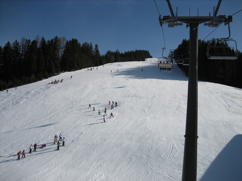
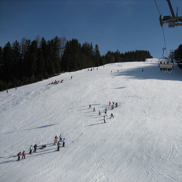
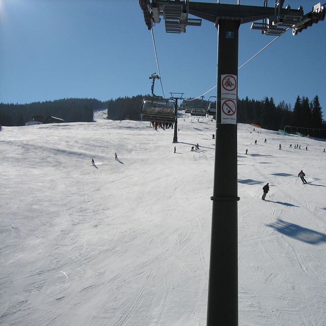
Radstadt is a small town with a few hotels, bars and restaurants, just over an hour from Salzburg. The ski area is fairly small, about 30kms of runs and 5 lifts. The runs are nice, tree lined and mostly red or blue. There is a fast gondola from the village and the other lifts are all quad chairs, fast and efficient. The lift pass covers the whole Salzburgerland ski area, so places like Flachau, Schladming, Zauchenzee, Filzmoos and Obertauern are included. So if you fancy a change just get the bus to the other local resorts, most are within 30min bus ride. A good tip is to get the gondola up, ski down the Altenmarkt side of the mountain and get the ski bus from there 15 minutes down the valley to the higher Zauchensee area which has guaranteed snow and about 20 lifts and links to Kleinarl. Although Radstadt ski area is low (900 - 1700m) it is mostly north facing so can survive warm weather. When I was there is was 18 degrees in mid March but most runs were still open and you could ski to the bottom despite the warmest and most snow-less winter for decades (2006-07). Would recommend Radstadt for good links, cheap accommodation and for families. If you want to party then go to Flachau or Schladming.
Comentarios de Visitantes para Radstadt/Altenmarkt
Generalmente: 4.2 En base a 14 votos y 2 comentarios
Nieve segura
4.0
Variedad de pistas
3.9
Fuera de pista
2.2
Escenografía
4.8
Después del esquí
3.2
David Hosking de United Kingdom escribe:
Radstadt is a small town with a few hotels, bars and restaurants, just over an hour from Salzburg. The ski area is fairly small, about 30kms of runs and 5 lifts. The runs are nice, tree lined and mostly red or blue. There is a fast gondola from the village and the other lifts are all quad chairs, fast and efficient. The lift pass covers the whole Salzburgerland ski area, so places like Flachau, Schladming, Zauchenzee, Filzmoos and Obertauern are included. So if you fancy a change just get the bus to the other local resorts, most are within 30min bus ride. A good tip is to get the gondola up, ski down the Altenmarkt side of the mountain and get the ski bus from there 15 minutes down the valley to the higher Zauchensee area which has guaranteed snow and about 20 lifts and links to Kleinarl. Although Radstadt ski area is low (900 - 1700m) it is mostly north facing so can survive warm weather. When I was there is was 18 degrees in mid March but most runs were still open and you could ski to the bottom despite the warmest and most snow-less winter for decades (2006-07). Would recommend Radstadt for good links, cheap accommodation and for families. If you want to party then go to Flachau or Schladming.
Gratis Snow-Forecast.com Widget del Tiempo para su sitio web
El widget del tiempo para esquiar para Radstadt/Altenmarkt está disponible para ser empotrado en sitios web externos sin costo alguno. Proporciona un resumen diario de nuestro pronóstico de nieve en Radstadt/Altenmarkt y estados de tiempo actuales. Vaya simplemente a la página para su configuración y siga los 3 pasos sencillos. Tome el código de transferencia del hipertexto y péguelo en su propio sitio web. Puede escoger la elevación en el pronóstico de nieve (cumbre, ascensor de medio-montaña o fondo) y unidades métrico/imperiales para el motor del pronóstico de nieve y convenir su propio website…. Click aquí para obtener el código


 Nearest