

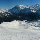
Portillo Re-Opens To Guests Arriving By Helicopter
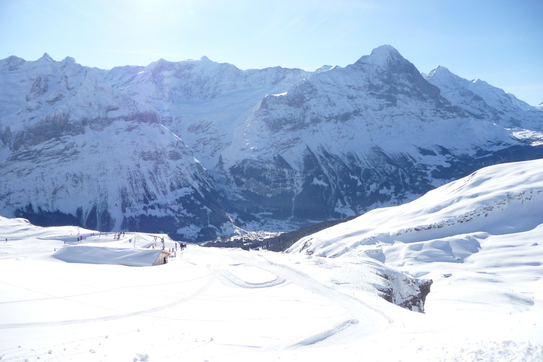
Chile’s famous Portillo ski resort is reported to have re-opened to guests arriving by helicopter after being cut off by road for more than two weeks by over 6m/20 feet of snowfall.

Next 3 days weather summary:Fuerte lluvia (totál 23.0mm), más pesada durante la noche de martes. Cálido (max 22°C el lunes por la tarde, min 16°C el martes por la noche). El viento será generalmente ligero. | Días 4-6 Resúmen del Tiempo para GrindelwaldFuerte lluvia (totál 32.0mm), más pesada durante la noche de jueves. Muy templado (max 18°C el jueves por la tarde, min 12°C el jueves por la noche). El viento será generalmente ligero. | ||||||||||||||||
lun 3 | martes 4 | miércoles 5 | jueves 6 | viernes 7 | sábado 8 | ||||||||||||
tarde | noche | mañana | tarde | noche | mañana | tarde | noche | mañana | tarde | noche | mañana | tarde | noche | mañana | tarde | noche | |
riesgo truenos | chuba scos | claro | riesgo truenos | chuba scos | claro | riesgo truenos | chuba scos | riesgo truenos | lluvia mod. | chuba scos | semi nublado | riesgo truenos | chuba scos | claro | chuba scos | chuba scos | |
km/h | |||||||||||||||||
Mapa de Nieve |  |  |  |  |  |  | |||||||||||
— | — | — | — | — | — | — | — | — | — | — | — | — | — | — | — | — | |
mm | 2 | 4 | — | 1 | 5 | — | 4 | 6 | 1 | 9 | 18 | — | 2 | 1 | — | 1 | 1 |
max °C | 22 | 17 | 19 | 21 | 16 | 18 | 19 | 16 | 18 | 18 | 14 | 14 | 16 | 15 | 16 | 18 | 16 |
min °C | 20 | 17 | 17 | 20 | 16 | 16 | 18 | 16 | 16 | 16 | 12 | 12 | 15 | 14 | 14 | 18 | 15 |
chill °C | 20 | 17 | 17 | 20 | 16 | 16 | 18 | 16 | 16 | 16 | 12 | 12 | 15 | 14 | 14 | 18 | 15 |
Humed. % | 59 | 67 | 58 | 61 | 68 | 62 | 73 | 74 | 69 | 90 | 87 | 79 | 80 | 74 | 65 | 66 | 66 |
Altura de Hielo m | 4550 | 4450 | 4350 | 4500 | 4400 | 4350 | 4400 | 4400 | 4250 | 4250 | 4050 | 4050 | 4100 | 4150 | 4150 | 4200 | 4350 |
— | — | 6:11 | — | — | 6:11 | — | — | 6:13 | — | — | 6:13 | — | — | 6:16 | — | — | |
— | 8:57 | — | — | 8:55 | — | — | 8:53 | — | — | 8:52 | — | — | 8:51 | — | — | 8:50 | |
Hazte pro y carve en:
Información de avalanchas: European Avalanche Warning Services (EAWS)
Ultimo parte de nieve cerca Grindelwald:
| Profundidad de nieve arriba: | 0 cm |
|---|---|
| Profundidad de nieve abajo: | 0 cm |
| Profundidad de la nevada fresca: | — |
| Última nevada: | 16 May 2026 |
0.0 | Dias de Nieve en Polvo Nieve fresca, mayormente soleado, viento suave. |
|---|---|
0.0 | Dias de nieve en polvo Nieve fresca, sol limitado, sin viento. |
0.0 | Dia perfecto para esquiar Nieve promedio, mayormente soleado, viento suave. |
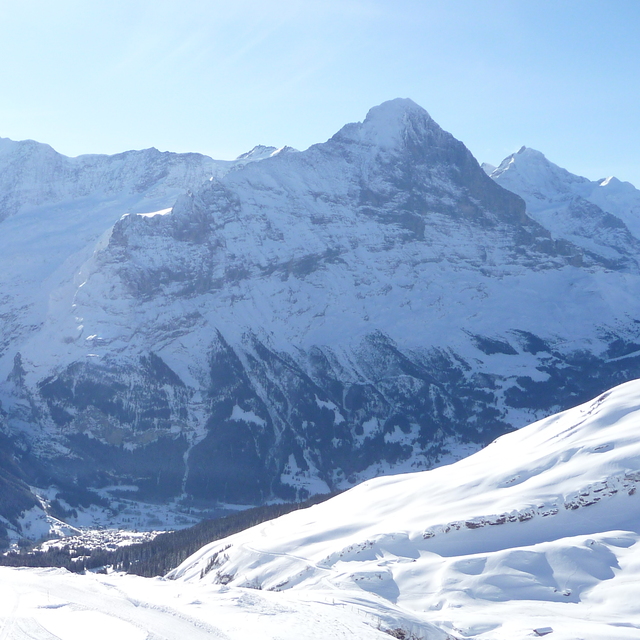
La tabla anterior muestra el pronóstico de tiempo para Grindelwald en la altitud específica de 1709 m. Nuestros modelos meteorológicos sofisticados permiten prever pronósticos para la cumbre, la mitad y la base de Grindelwald. Para aceder a los pronósticos de tiempo a otras alturas, pinche en la navegación en la parte superior de la tabla. Para una visión general, consulte el Mapa meteorológico de Switzerland.
Pinche aquí para más información sobre niveles de congelación y sobre cómo pronosticamos las temperaturas.
Generalmente 4.4 En base a 37 votos y 13 comentarios
Très déçu de voir le comportement de la personne qui s’est occupé du téléski Arven ce matin, commence à s’énerver et à m’insulter en allemand parce que je voulais simplement lui poser une question. Sinon Grindelwald est une excellent station ❤️
Dylann Moreno de Switzerland escribe:
Très déçu de voir le comportement de la personne qui s’est occupé du téléski Arven ce matin, commence à s’énerver et à m’insulter en allemand parce que je voulais simplement lui poser une question.
Sinon Grindelwald est une excellent station ❤️
Lea 12 otras críticas de Grindelwald o entrega su propio comentario


 Nearest