

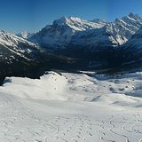
Portillo Storm Snowfall Total Passes 5m / 17 Feet
A snow storm that has now continued for nine days has taken Chilean ski resort Portillo to a snowfall total of 5.2 metres (17 feet) so far, with more snow forecast.

Next 3 days weather summary:Fuerte lluvia (totál 31.0mm), más pesada durante la tarde del viernes. Cálido (max 29°C el jueves por la tarde, min 18°C el miércoles por la noche). El viento será generalmente ligero. | Días 4-6 Resúmen del Tiempo para GrindelwaldFuerte lluvia (totál 24.0mm), más pesada durante la noche de lunes. Cálido (max 28°C el lunes por la tarde, min 17°C el sábado por la noche). El viento será generalmente ligero. | ||||||||||||||||
mié 29 | jueves 30 | viernes 31 | sábado 1 | domingo 2 | lunes 3 | ||||||||||||
tarde | noche | mañana | tarde | noche | mañana | tarde | noche | mañana | tarde | noche | mañana | tarde | noche | mañana | tarde | noche | |
riesgo truenos | chuba scos | claro | semi nublado | chuba scos | semi nublado | fuerte lluvia | chuba scos | riesgo truenos | riesgo truenos | chuba scos | claro | riesgo truenos | chuba scos | claro | chuba scos | chuba scos | |
km/h | |||||||||||||||||
Mapa de Nieve |  |  |  |  |  |  | |||||||||||
— | — | — | — | — | — | — | — | — | — | — | — | — | — | — | — | — | |
mm | 2 | 2 | — | — | 2 | — | 20 | 4 | 1 | 5 | 2 | — | 3 | 3 | — | 1 | 7 |
max °C | 27 | 22 | 27 | 29 | 22 | 27 | 29 | 20 | 24 | 25 | 21 | 25 | 26 | 22 | 26 | 28 | 22 |
min °C | 26 | 18 | 21 | 29 | 20 | 23 | 18 | 18 | 21 | 23 | 17 | 21 | 24 | 18 | 20 | 26 | 17 |
chill °C | 26 | 18 | 21 | 29 | 20 | 23 | 18 | 18 | 21 | 23 | 17 | 21 | 24 | 18 | 20 | 26 | 17 |
Humed. % | 53 | 54 | 31 | 29 | 57 | 44 | 89 | 53 | 56 | 60 | 65 | 53 | 63 | 67 | 47 | 47 | 74 |
Altura de Hielo m | 4550 | 4500 | 4550 | 4750 | 4750 | 4650 | 4550 | 4550 | 4350 | 4400 | 4500 | 4450 | 4550 | 4650 | 4550 | 4650 | 4500 |
— | — | 6:05 | — | — | 6:05 | — | — | 6:07 | — | — | 6:07 | — | — | 6:09 | — | — | |
— | 9:02 | — | — | 9:01 | — | — | 9:00 | — | — | 9:00 | — | — | 8:58 | — | — | 8:57 | |
Hazte pro y carve en:
Información de avalanchas: European Avalanche Warning Services (EAWS)
Ultimo parte de nieve cerca Grindelwald:
| Profundidad de nieve arriba: | 0 cm |
|---|---|
| Profundidad de nieve abajo: | 0 cm |
| Profundidad de la nevada fresca: | — |
| Última nevada: | 16 May 2026 |
0.0 | Dias de Nieve en Polvo Nieve fresca, mayormente soleado, viento suave. |
|---|---|
0.0 | Dias de nieve en polvo Nieve fresca, sol limitado, sin viento. |
0.0 | Dia perfecto para esquiar Nieve promedio, mayormente soleado, viento suave. |
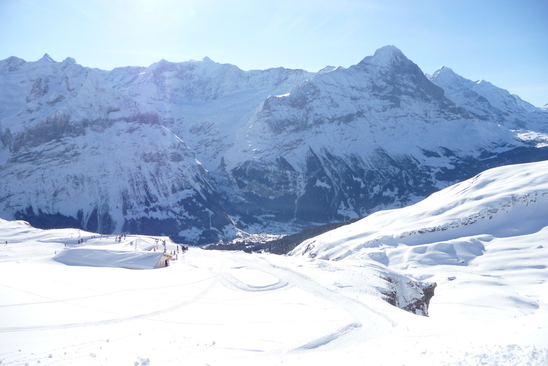
La tabla anterior muestra el pronóstico de tiempo para Grindelwald en la altitud específica de 945 m. Nuestros modelos meteorológicos sofisticados permiten prever pronósticos para la cumbre, la mitad y la base de Grindelwald. Para aceder a los pronósticos de tiempo a otras alturas, pinche en la navegación en la parte superior de la tabla. Para una visión general, consulte el Mapa meteorológico de Switzerland.
Pinche aquí para más información sobre niveles de congelación y sobre cómo pronosticamos las temperaturas.
Generalmente 4.4 En base a 37 votos y 13 comentarios
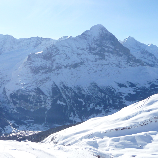
Well, Grindelwald is not as pretty as Wengen but I won't call it ugly. Stayed at the Kirschbuhl hotel; 120 euros a night, breakfast included; this was in February 2017. The breakfast was superb and the view through the mountains to the Eiger just mind blowing. The suppers were fabulous but a tad expensive. Hey, fabulous food is almost never cheap. This is a 4 star hotel but having supper and looking out to the moonlight drenched snowy mountains is just amazing; they seem so immediate. The staff at the hotel were incredible and jolly helpful. Heh, heh the cake and pastries at tea time were free and freshly baked. There are lots of good cheap restaurants, actually dirt cheap if you compare them to Zermatt, Verbier, Saas Fee and Crans Montana.
ettienne nel de Germany escribe:
Well, Grindelwald is not as pretty as Wengen but I won't call it ugly. Stayed at the Kirschbuhl hotel; 120 euros a night, breakfast included; this was in February 2017. The breakfast was superb and the view through the mountains to the Eiger just mind blowing. The suppers were fabulous but a tad expensive. Hey, fabulous food is almost never cheap. This is a 4 star hotel but having supper and looking out to the moonlight drenched snowy mountains is just amazing; they seem so immediate. The staff at the hotel were incredible and jolly helpful. Heh, heh the cake and pastries at tea time were free and freshly baked. There are lots of good cheap restaurants, actually dirt cheap if you compare them to Zermatt, Verbier, Saas Fee and Crans Montana.
Lea 12 otras críticas de Grindelwald o entrega su propio comentario


 Nearest