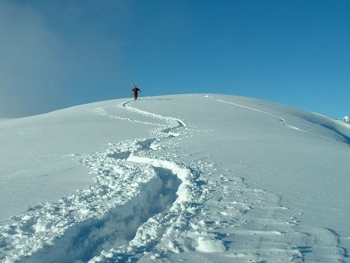


Portillo Re-Opens To Guests Arriving By Helicopter
Chile’s famous Portillo ski resort is reported to have re-opened to guests arriving by helicopter after being cut off by road for more than two weeks by over 6m/20 feet of snowfall.

Next 3 days weather summary:Nueva espolvoreada de nieve. condiciones de congelación y descongelación (max 2°C el lunes por la tarde, min -7°C el martes por la mañana). El viento será generalmente ligero. | Días 4-6 Resúmen del Tiempo para CraigieburnNueva espolvoreada de nieve. condiciones de congelación y descongelación (max 1°C el jueves por la tarde, min -3°C el jueves por la tarde). El viento será generalmente ligero. | ||||||||||||||||
lun 3 | martes 4 | miércoles 5 | jueves 6 | viernes 7 | sábado 8 | ||||||||||||
tarde | noche | mañana | tarde | noche | mañana | tarde | noche | mañana | tarde | noche | mañana | tarde | noche | mañana | tarde | noche | |
nevadas | nieve ligera | nieve ligera | nevadas | claro | claro | semi nublado | claro | claro | claro | semi nublado | nieve ligera | nieve ligera | nieve ligera | nieve ligera | nieve ligera | nubl ado | |
km/h | |||||||||||||||||
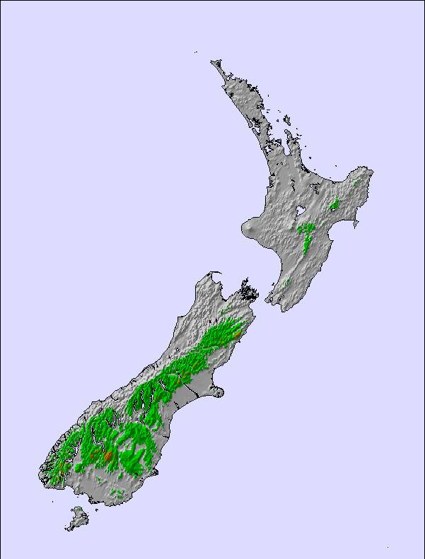
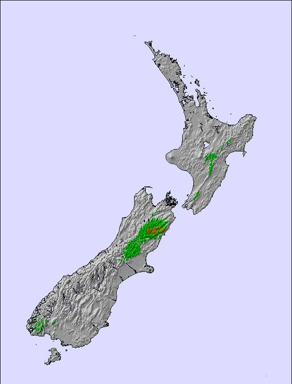
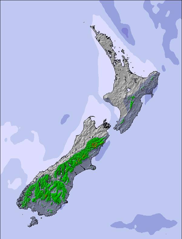
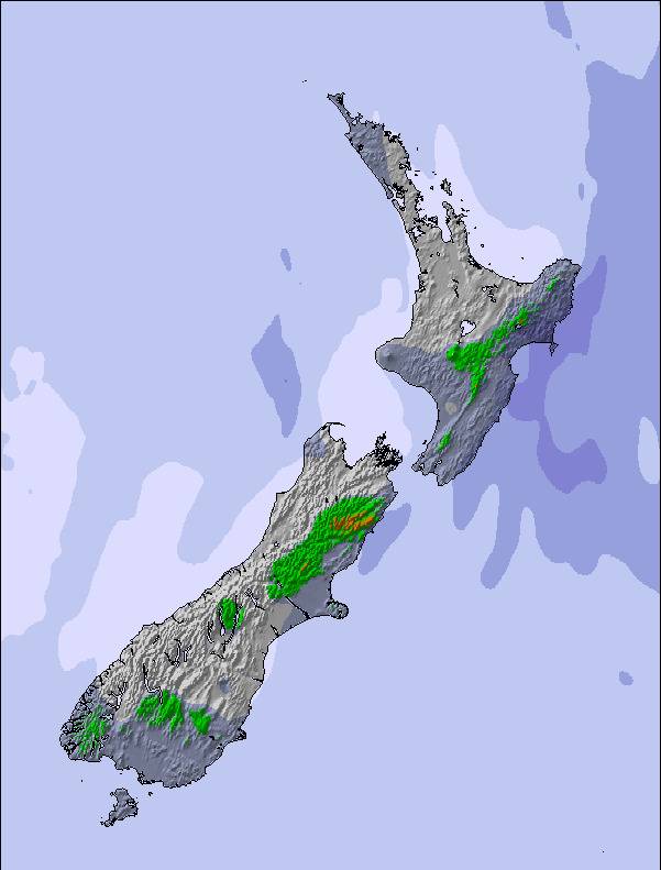
Mapa de Nieve |  |  |  | 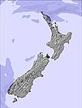 | 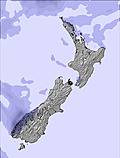 | 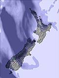 | |||||||||||
— | 1 | 1 | — | — | — | — | — | — | — | — | — | 1 | — | — | — | — | |
mm | — | — | — | — | — | — | — | — | — | — | — | — | — | — | — | — | — |
max °C | 2 | -2 | -5 | -5 | -7 | 0 | 0 | -3 | 1 | 1 | -2 | 1 | 0 | 1 | 1 | 1 | 0 |
min °C | -1 | -6 | -7 | -7 | -7 | -4 | -3 | -4 | -2 | -3 | -3 | -1 | 0 | 0 | 1 | 0 | -1 |
chill °C | -5 | -11 | -13 | -14 | -13 | -4 | -3 | -4 | -4 | -6 | -6 | -6 | -5 | -4 | -2 | -3 | -4 |
Humed. % | 74 | 97 | 96 | 70 | 71 | 36 | 45 | 37 | 20 | 40 | 35 | 57 | 93 | 87 | 93 | 97 | 90 |
Altura de Hielo m | 1700 | 1000 | 400 | 650 | 300 | 750 | 1350 | 1100 | 1500 | 1450 | 1350 | 1550 | 1700 | 1800 | 1750 | 1650 | 1550 |
— | — | 7:43 | — | — | 7:41 | — | — | 7:39 | — | — | 7:39 | — | — | 7:37 | — | — | |
5:35 | — | — | 5:36 | — | — | 5:37 | — | — | 5:37 | — | — | 5:38 | — | — | 5:39 | — | |
Hazte pro y carve en:
Información de avalanchas: New Zealand Avalanche Advisory
Ultimo parte de nieve cerca Craigieburn:
Recent light rain reported from Arthur's Pass National Park Visitor Centre at 737 metres elevation only 3 kms S of Temple Basin but it is forecast cold enough for snow at the ski area desde Temple Basin
| Profundidad de nieve arriba: | — |
|---|---|
| Profundidad de nieve abajo: | — |
| Profundidad de la nevada fresca: | — |
| Última nevada: | 31 Jul 2026 |
0.4 | Dias de Nieve en Polvo Nieve fresca, mayormente soleado, viento suave. |
|---|---|
0.6 | Dias de nieve en polvo Nieve fresca, sol limitado, sin viento. |
0.6 | Dia perfecto para esquiar Nieve promedio, mayormente soleado, viento suave. |
La tabla anterior muestra el pronóstico de tiempo para Craigieburn en la altitud específica de 1422 m. Nuestros modelos meteorológicos sofisticados permiten prever pronósticos para la cumbre, la mitad y la base de Craigieburn. Para aceder a los pronósticos de tiempo a otras alturas, pinche en la navegación en la parte superior de la tabla. Para una visión general, consulte el Mapa meteorológico de New Zealand.
Pinche aquí para más información sobre niveles de congelación y sobre cómo pronosticamos las temperaturas.
Generalmente 3.2 En base a 8 votos y 3 comentarios
Please, if you cannot ski, if you cannot ride, if you hate powder, if you hate it steep & if you love 4+ star hotels - DO NOT COME TO THIS RESORT. Craigieburn is, to put it in simple terms, bloody 'AMAZING'. Known to the locals as steep, deep and cheap it certaintly lives up to the reputation. In 2002 I took 16 good buddies over there for the ski trip of our lives and to film a documentary. On the 2nd night it snowed 40cm's of superb light snow and we had the whole mountain (1,000's upon 1,000's or acres inbounds and easy access BC) to ourselves. Ok well maybe not entirely,we had to let the 8 staff members cut a few lines too! The peaks of the southern alps are insane! The lines you can find gnarly. Chutes (some over 55 degrees), bowls, ridges, cornices...BIG MOUNTAIN. Infact 95% of the inbound terrain is located in an avalanche start zone, path or run out. Lot's of control? Bombs go off pretty much every morning after it pukes fluff. Rustic? Yes. Accomodation is generally bunkroom style with communal bathrooms (private ensuite rooms are available but in limited supply)and a communal eating area. BUT, CV is the only NZ resort where you can walk to the ski lifts, and that takes about 4 minutes. For around 60 bucks NZ you can get fed three huge meals a day, lift tickets, lessons and accom. Oh, and there is a kick ass cosy bar upstairs in the main lodge. Last year was the completion of the panoramic day lodge located at 7000ft on a razor sharp ridgeline offering a superb place for lunch, views and kicking back on the terrace surrounded by stunning peaks with a beer. SENSATIONAL. No doubt in my mind. The best resort in the world...a place made by riders, for riders.
Ajburn de Australia escribe:
Please, if you cannot ski, if you cannot ride, if you hate powder, if you hate it steep & if you love 4+ star hotels - DO NOT COME TO THIS RESORT.
Craigieburn is, to put it in simple terms, bloody 'AMAZING'. Known to the locals as steep, deep and cheap it certaintly lives up to the reputation.
In 2002 I took 16 good buddies over there for the ski trip of our lives and to film a documentary. On the 2nd night it snowed 40cm's of superb light snow and we had the whole mountain (1,000's upon 1,000's or acres inbounds and easy access BC) to ourselves. Ok well maybe not entirely,we had to let the 8 staff members cut a few lines too!
The peaks of the southern alps are insane! The lines you can find gnarly. Chutes (some over 55 degrees), bowls, ridges, cornices...BIG MOUNTAIN. Infact 95% of the inbound terrain is located in an avalanche start zone, path or run out. Lot's of control? Bombs go off pretty much every morning after it pukes fluff.
Rustic? Yes. Accomodation is generally bunkroom style with communal bathrooms (private ensuite rooms are available but in limited supply)and a communal eating area. BUT, CV is the only NZ resort where you can walk to the ski lifts, and that takes about 4 minutes.
For around 60 bucks NZ you can get fed three huge meals a day, lift tickets, lessons and accom. Oh, and there is a kick ass cosy bar upstairs in the main lodge.
Last year was the completion of the panoramic day lodge located at 7000ft on a razor sharp ridgeline offering a superb place for lunch, views and kicking back on the terrace surrounded by stunning peaks with a beer. SENSATIONAL.
No doubt in my mind. The best resort in the world...a place made by riders, for riders.
Lea 2 otras críticas de Craigieburn o entrega su propio comentario

 Nearest