

Portillo Storm Snowfall Total Passes 5m / 17 Feet
A snow storm that has now continued for nine days has taken Chilean ski resort Portillo to a snowfall total of 5.2 metres (17 feet) so far, with more snow forecast.

Next 3 days weather summary:Lluvia moderada (totál 17.0mm), más pesada el miércoles por la noche. Cálido (max 21°C el jueves por la tarde, min 15°C el martes por la noche). El viento será generalmente ligero. | Días 4-6 Resúmen del Tiempo para AlpbachtalFuerte lluvia (totál 29.0mm), más pesada durante la noche de sábado. Cálido (max 22°C el viernes por la tarde, min 13°C el sábado por la tarde). El viento será generalmente ligero. | ||||||||||||||||
mar 28 | miércoles 29 | jueves 30 | viernes 31 | sábado 1 | domingo 2 | ||||||||||||
tarde | noche | mañana | tarde | noche | mañana | tarde | noche | mañana | tarde | noche | mañana | tarde | noche | mañana | tarde | noche | |
claro | claro | riesgo truenos | riesgo truenos | chuba scos | claro | claro | semi nublado | claro | chuba scos | chuba scos | claro | riesgo truenos | chuba scos | claro | claro | chuba scos | |
km/h | |||||||||||||||||
Mapa de Nieve |  |  |  |  |  |  | |||||||||||
— | — | — | — | — | — | — | — | — | — | — | — | — | — | — | — | — | |
mm | — | — | 1 | 6 | 10 | — | — | — | — | 2 | 1 | — | 5 | 14 | — | — | 7 |
max °C | 18 | 16 | 18 | 19 | 16 | 19 | 21 | 20 | 20 | 22 | 17 | 18 | 18 | 15 | 18 | 20 | 16 |
min °C | 16 | 15 | 16 | 17 | 15 | 17 | 21 | 16 | 17 | 16 | 15 | 17 | 13 | 13 | 16 | 20 | 14 |
chill °C | 16 | 15 | 16 | 17 | 15 | 17 | 21 | 16 | 17 | 16 | 15 | 17 | 13 | 13 | 16 | 20 | 13 |
Humed. % | 49 | 66 | 56 | 71 | 55 | 34 | 28 | 37 | 37 | 63 | 58 | 51 | 88 | 57 | 42 | 51 | 57 |
Altura de Hielo m | 4550 | 4550 | 4350 | 4350 | 4350 | 4400 | 4650 | 4600 | 4700 | 4600 | 4700 | 4450 | 4400 | 4450 | 4550 | 4650 | 4650 |
— | — | 5:45 | — | — | 5:47 | — | — | 5:48 | — | — | 5:48 | — | — | 5:50 | — | — | |
— | 8:52 | — | — | 8:50 | — | — | 8:49 | — | — | 8:47 | — | — | 8:45 | — | — | 8:45 | |
Hazte pro y carve en:
Información de avalanchas: European Avalanche Warning Services (EAWS)
Ultimo parte de nieve cerca Alpbachtal:
| Profundidad de nieve arriba: | 0 cm |
|---|---|
| Profundidad de nieve abajo: | 0 cm |
| Profundidad de la nevada fresca: | — |
| Última nevada: | 16 May 2026 |
0.0 | Dias de Nieve en Polvo Nieve fresca, mayormente soleado, viento suave. |
|---|---|
0.0 | Dias de nieve en polvo Nieve fresca, sol limitado, sin viento. |
0.0 | Dia perfecto para esquiar Nieve promedio, mayormente soleado, viento suave. |
La tabla anterior muestra el pronóstico de tiempo para Alpbachtal en la altitud específica de 2025 m. Nuestros modelos meteorológicos sofisticados permiten prever pronósticos para la cumbre, la mitad y la base de Alpbachtal. Para aceder a los pronósticos de tiempo a otras alturas, pinche en la navegación en la parte superior de la tabla. Para una visión general, consulte el Mapa meteorológico de Austria.
Pinche aquí para más información sobre niveles de congelación y sobre cómo pronosticamos las temperaturas.
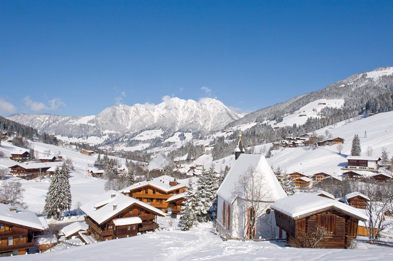
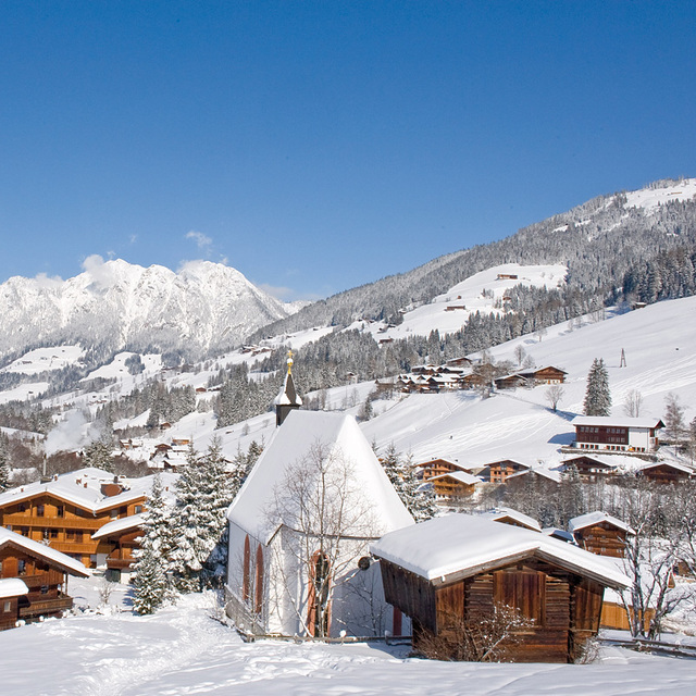
Nombre de la estación también escrito como Alpbach.
Generalmente 4.2 En base a 22 votos y 15 comentarios
Another Christmas in Alpbach spent with my family, good snow and, as usual, fantastic hospitality, hotel Alphof.. thank you for great time,... slopes and food restaurants top draw!! You got to see it to believe it!!!
Mark Henry Lampe de United Kingdom escribe:
Another Christmas in Alpbach spent with my family, good snow and, as usual, fantastic hospitality, hotel Alphof.. thank you for great time,... slopes and food restaurants top draw!!
You got to see it to believe it!!!
Lea 14 otras críticas de Alpbachtal o entrega su propio comentario


 Nearest