


America’s Next Indoor Snow Centre Takes Shape
Construction of a new indoor snow centre for skiers, boarders and tubers appears to be making good progress at Heritage Farm in Wayne County, West Virginia.

Next 3 days weather summary:Lluvia ligera (totál 8.0mm), cayendo mayormente el martes por la mañana. Muy templado (max 11°C el miércoles por la tarde, min 6°C el martes por la noche). El viento será generalmente ligero. | Días 4-6 Resúmen del Tiempo para VerbierFuerte lluvia (totál 42.0mm), más pesada durante la noche de sábado. Muy templado (max 16°C el sábado por la tarde, min 5°C el domingo por la noche). El viento será generalmente ligero. | |||||||||||||||||
martes 21 | miércoles 22 | jueves 23 | viernes 24 | sábado 25 | domingo 26 | |||||||||||||
mañana | tarde | noche | mañana | tarde | noche | mañana | tarde | noche | mañana | tarde | noche | mañana | tarde | noche | mañana | tarde | noche | |
riesgo truenos | riesgo truenos | chuba scos | claro | claro | claro | semi nublado | semi nublado | claro | claro | claro | claro | semi nublado | riesgo truenos | fuerte lluvia | riesgo truenos | llovizna | lluvia mod. | |
km/h | ||||||||||||||||||
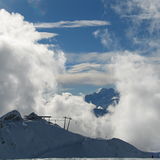
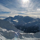
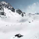
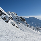
Mapa de Nieve |  |  |  |  |  |  | ||||||||||||
— | — | — | — | — | — | — | — | — | — | — | — | — | — | — | — | — | — | |
mm | 4 | 3 | 1 | — | — | — | — | — | — | — | — | — | — | 1 | 27 | 2 | 5 | 7 |
max °C | 9 | 10 | 8 | 9 | 11 | 9 | 8 | 9 | 8 | 10 | 12 | 12 | 14 | 16 | 11 | 8 | 8 | 6 |
min °C | 8 | 9 | 6 | 7 | 10 | 7 | 7 | 9 | 6 | 9 | 12 | 11 | 12 | 15 | 7 | 8 | 6 | 5 |
chill °C | 6 | 7 | 5 | 6 | 9 | 6 | 6 | 7 | 5 | 9 | 12 | 10 | 12 | 15 | 5 | 8 | 4 | 3 |
Humed. % | 65 | 71 | 55 | 29 | 53 | 44 | 46 | 57 | 44 | 22 | 44 | 37 | 37 | 51 | 91 | 80 | 82 | 96 |
Altura de Hielo m | 3650 | 3550 | 3600 | 3850 | 3850 | 3850 | 3600 | 3600 | 3850 | 4150 | 4150 | 4300 | 4300 | 4350 | 3600 | 3500 | 3550 | 3300 |
6:00 | — | — | 6:01 | — | — | 6:01 | — | — | 6:03 | — | — | 6:03 | — | — | 6:05 | — | — | |
— | — | 9:14 | — | — | 9:13 | — | — | 9:12 | — | — | 9:10 | — | — | 9:09 | — | — | 9:08 | |
Hazte pro y carve en:
Información de avalanchas: European Avalanche Warning Services (EAWS)
Ultimo parte de nieve cerca Verbier:
| Profundidad de nieve arriba: | 0 cm |
|---|---|
| Profundidad de nieve abajo: | 0 cm |
| Profundidad de la nevada fresca: | — |
| Última nevada: | 10 Jun 2026 |
0.0 | Dias de Nieve en Polvo Nieve fresca, mayormente soleado, viento suave. |
|---|---|
0.1 | Dias de nieve en polvo Nieve fresca, sol limitado, sin viento. |
0.0 | Dia perfecto para esquiar Nieve promedio, mayormente soleado, viento suave. |
La tabla anterior muestra el pronóstico de tiempo para Verbier en la altitud específica de 2415 m. Nuestros modelos meteorológicos sofisticados permiten prever pronósticos para la cumbre, la mitad y la base de Verbier. Para aceder a los pronósticos de tiempo a otras alturas, pinche en la navegación en la parte superior de la tabla. Para una visión general, consulte el Mapa meteorológico de Switzerland.
Pinche aquí para más información sobre niveles de congelación y sobre cómo pronosticamos las temperaturas.
Generalmente 4.1 En base a 103 votos y 97 comentarios
Verbier, one of the few places remaining on my bucket list after 37yrs of skiing all over the world. I ticked it off with friends in Jan 23 and it was so good I'm taking my family of 5 there for Christmas! It's pricey for food and drink but we have an apartment this year and the skiing itineraries and off-piste make it stand out as one of the very best. Attelas to Carrefour is also an amazing piste run.
Nigel Hawkins de Jersey escribe:
Verbier, one of the few places remaining on my bucket list after 37yrs of skiing all over the world. I ticked it off with friends in Jan 23 and it was so good I'm taking my family of 5 there for Christmas! It's pricey for food and drink but we have an apartment this year and the skiing itineraries and off-piste make it stand out as one of the very best. Attelas to Carrefour is also an amazing piste run.
Lea 96 otras críticas de Verbier o entrega su propio comentario


 Nearest