
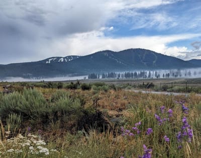
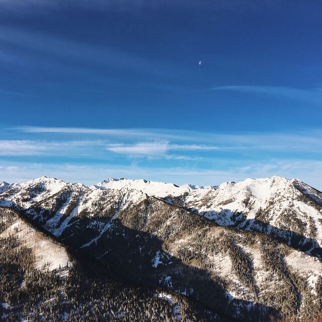
Coldest July Night Hits Glaciers: -12°C and Powder in the Alps
Updated July 30, 2025: Fresh snow dusts Lake Tahoe, Alpine glaciers score up to 40cm (16"), and Scandinavia clings to ski season.
By using Snow-Forecast, you agree to our Terms & Services.
Don't have an account? Join now
Alternatively, you can now use your Outside account to sign in to any brand in the Outside digital ecosystem, including Snow-Forecast, Surf-Forecast, and Mountain-Forecast.


Val d'Isere Weather (Next 3 days): The snow forecast for Val d'Isere is: Lluvia ligera (totál 2.0mm), cayendo mayormente el sábado por la tarde. Muy templado (max 11°C el martes por la mañana, min 1°C el sábado por la noche). El viento será generalmente ligero.
Val d'Isere Weather (Days 4-6): Mayormente seco. Muy templado (max 13°C el jueves por la tarde, min 7°C el martes por la noche). El viento será generalmente ligero.
| Estación | Profundidad de Nieve | Temp. (°C) | Viento (km/h) | Tiempo | ||
|---|---|---|---|---|---|---|
| Remonte de arriba: | -3 | |||||
| Remonte de la mitad: | 4 | |||||
| Remonte de abajo: | 11 |
Ultimo parte de nieve cerca Val d'Isere:

Sat 2 | Sunday 3 | Monday 4 | Tuesday 5 | Wednesday 6 | Thursday 7 | Friday 8 | ||||||||||||||
tarde | noche | mañana | tarde | noche | mañana | tarde | noche | mañana | tarde | noche | mañana | tarde | noche | mañana | tarde | noche | mañana | tarde | noche | |
chuba scos | semi nublado | claro | semi nublado | semi nublado | semi nublado | claro | claro | claro | claro | semi nublado | nubl ado | semi nublado | claro | claro | claro | claro | semi nublado | riesgo true- nos | chuba scos | |
km/h | ||||||||||||||||||||
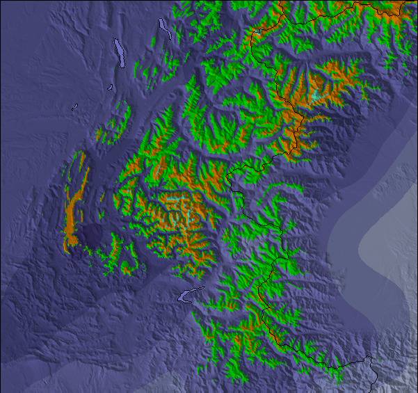
Snow map |  |  |  |  |  |  |  | |||||||||||||
cm | — | — | — | — | — | — | — | — | — | — | — | — | — | — | — | — | — | — | — | — |
mm | 2 | — | — | — | — | — | — | — | — | — | — | — | — | — | — | — | — | — | 1 | 3 |
max°C | 4 | 2 | 4 | 7 | 7 | 9 | 10 | 10 | 11 | 11 | 9 | 10 | 10 | 10 | 10 | 13 | 12 | 12 | 15 | 13 |
min°C | 3 | 1 | 3 | 6 | 5 | 8 | 10 | 9 | 10 | 11 | 7 | 9 | 10 | 9 | 9 | 12 | 11 | 11 | 14 | 12 |
chill°C | 0 | -2 | 1 | 4 | 3 | 7 | 9 | 8 | 9 | 10 | 5 | 9 | 10 | 9 | 9 | 12 | 11 | 11 | 14 | 12 |
Humed.% | 83 | 63 | 58 | 66 | 56 | 34 | 64 | 54 | 51 | 62 | 37 | 24 | 38 | 42 | 37 | 49 | 59 | 50 | 46 | 53 |
Altura de Hielo (m) | 3150 | 3000 | 3200 | 3600 | 3850 | 4150 | 4250 | 4550 | 4450 | 4450 | 4250 | 4250 | 4200 | 4450 | 4400 | 4700 | 4550 | 4500 | 4650 | 4450 |
— | — | 6:16 | — | — | 6:18 | — | — | 6:20 | — | — | 6:20 | — | — | 6:22 | — | — | 6:22 | — | — | |
— | 8:59 | — | — | 8:58 | — | — | 8:57 | — | — | 8:54 | — | — | 8:53 | — | — | 8:52 | — | — | 8:51 | |
Lluvia ligera (totál 2.0mm), cayendo mayormente el sábado por la tarde. Muy templado (max 11°C el martes por la mañana, min 1°C el sábado por la noche). El viento será generalmente ligero.
Mayormente seco. Muy templado (max 13°C el jueves por la tarde, min 7°C el martes por la noche). El viento será generalmente ligero.
Ultimo parte de nieve cerca Val d'Isere:
| Profundidad de nieve arriba: | — |
|---|---|
| Profundidad de nieve abajo: | — |
| Profundidad de la nevada fresca: | — |
| Última nevada: | 8 Jul 2025 |
0.0 | Dias de Nieve en Polvo Nieve fresca, mayormente soleado, viento suave. |
|---|---|
0.0 | Dias de nieve en polvo Nieve fresca, sol limitado, sin viento. |
0.0 | Dia perfecto para esquiar Nieve promedio, mayormente soleado, viento suave. |
La tabla anterior muestra el pronóstico de tiempo para Val d'Isere en la altitud específica de 2700 m. Nuestros modelos meteorológicos sofisticados permiten prever pronósticos para la cumbre, la mitad y la base de Val d'Isere. Para aceder a los pronósticos de tiempo a otras alturas, pinche en la navegación en la parte superior de la tabla. Para una visión general, consulte el Mapa meteorológico de France.
Pinche aquí para más información sobre niveles de congelación y sobre cómo pronosticamos las temperaturas.
Generalmente 4.2 En base a 73 votos y 64 comentarios
Ok, been in Val d'Isere for 3 and a bit weeks now, since arriving in town 4th March for a 7 or 8 week sejour. And since I arrived it seems I've brought the snow with me that was so absent for most of January and all of Feb. Think we've been well over 2m fresh now, and there is about another 60-80cm in the next 6 days or thereabout so the forecast goes. So what to say about the place? 1. The town and lifts: Val D is a rather nice place compared to many rival French resorts, like Tignes, La Plagne, Les Menuires and Val Thorens. It has some really nice old stone built chalets around the centre around the church, which is where we were located for the first 3 weeks. Very nice. The town also has lots of nice places to eat and drink. And the terrace areas on the main slope side area are south-ish facing so get the sun on those nice days. Costs for food are 25-30 Euros for a main of pasta type stuff in a nice restaurant or on mountain. But you can also find really nice bakeries for a sandwich in town for 5 or 6 Euros and there are takeaway places for burger and frites for 10 Euros 'round town. The choice is yours. I would say Val D resorts are rather spread out and there are a few different areas, being Val D centre, La Daille and Le Fornet. I would say the linking between these sectors is ok, but not the best I've seen. And for me there are too many gondolas, I defo prefer the convenience of detachable fast chairs for not having to get skis off and on. And in the post Covid era, I'm sure many older people would benefit from not being in a small poorly ventilated capsule with 6 to 100 people some with seasonal viruses. I know I don't want to waste a week in resort with flu or similar. 2. Skiing: I would say Espace Killy is a good resort with loads to offer. For me I think Tignes is the better part of it though, even though the town of Val is far nicer aesthetically. For me Val D is a little too spread out and much of the higher altitude skiing has a fair bit of flatter terrain, and lacks a little as a result. This applies both to off-piste and on. You will find there are long stretches of green run flats in many runs. The best terrain around for me are the Tignes areas around Tovier and The Grande Motte. The area off TSD Manchet in Val D looks great, but for me is too much pain to get too with gondola Solais, which means I tend toward Tignes. Park skiing here is well catered for with two decent parks, one in Val D and the other in Tignes Val Claret. My preference is DC park in Tignes. Another reviewer here mentioned it was closed for an extended period this season, which is true. It would be a bit of a let down if you were in Tignes for a week or two for that reason and find it shut for 2 weeks, disappointing and probably not good enough from a resort of that pedigree. Tignes after all has been synonymous with freestyle since the 80s and the Albertville Olympics. However, the Val D park is fun enough on its own, so can keep you going I would say. 3. Pass price - reasonable for the area you get, particularly a season pass for Tignes at 800 Euros. I think this is defo a good deal. Val D also is 800 notes, I would tend to opt for the whole area if I were in Val as I said I prefer the skiing of Tignes and feel the DC park is the better one, when its open. Compared to other large French resorts the cost is comparable to most, except a full 3V pass, which for me is mental at 1550 euros now. Weekly passes are similar most places. Overall and comparisons: I would say if you are coming to Espace Killy, and you are good standard, Val is great if you also want a nice looking place. For me Tignes has the better skiing, is more ski in-ski out accomm (which is a defo plus), has the better park and also the better terrain, both on and off the piste (unless you need trees on low vis days - then its Le Fornet trees but its miles out of the way, even in Val). For me if you're an off-piste chaser there are better places to go in France for sure, mainly owing to the general lack of long steep sections at higher altitudes such as you will find in Les 3V, La Plagne, Les Deux Alpes and Alpe D'Huez. Similarly I would say there are better piste skiing options around, notably 3V again but this is possibly the best place in the world for such. Park skiing is a strong point here despite the closure of the DC park for a couple of weeks, so you'll enjoy this here for sure.
Baz de United Kingdom escribe:
Ok, been in Val d'Isere for 3 and a bit weeks now, since arriving in town 4th March for a 7 or 8 week sejour. And since I arrived it seems I've brought the snow with me that was so absent for most of January and all of Feb. Think we've been well over 2m fresh now, and there is about another 60-80cm in the next 6 days or thereabout so the forecast goes. So what to say about the place?
1. The town and lifts: Val D is a rather nice place compared to many rival French resorts, like Tignes, La Plagne, Les Menuires and Val Thorens. It has some really nice old stone built chalets around the centre around the church, which is where we were located for the first 3 weeks. Very nice. The town also has lots of nice places to eat and drink. And the terrace areas on the main slope side area are south-ish facing so get the sun on those nice days. Costs for food are 25-30 Euros for a main of pasta type stuff in a nice restaurant or on mountain. But you can also find really nice bakeries for a sandwich in town for 5 or 6 Euros and there are takeaway places for burger and frites for 10 Euros 'round town. The choice is yours. I would say Val D resorts are rather spread out and there are a few different areas, being Val D centre, La Daille and Le Fornet. I would say the linking between these sectors is ok, but not the best I've seen. And for me there are too many gondolas, I defo prefer the convenience of detachable fast chairs for not having to get skis off and on. And in the post Covid era, I'm sure many older people would benefit from not being in a small poorly ventilated capsule with 6 to 100 people some with seasonal viruses. I know I don't want to waste a week in resort with flu or similar.
2. Skiing: I would say Espace Killy is a good resort with loads to offer. For me I think Tignes is the better part of it though, even though the town of Val is far nicer aesthetically. For me Val D is a little too spread out and much of the higher altitude skiing has a fair bit of flatter terrain, and lacks a little as a result. This applies both to off-piste and on. You will find there are long stretches of green run flats in many runs. The best terrain around for me are the Tignes areas around Tovier and The Grande Motte. The area off TSD Manchet in Val D looks great, but for me is too much pain to get too with gondola Solais, which means I tend toward Tignes. Park skiing here is well catered for with two decent parks, one in Val D and the other in Tignes Val Claret. My preference is DC park in Tignes. Another reviewer here mentioned it was closed for an extended period this season, which is true. It would be a bit of a let down if you were in Tignes for a week or two for that reason and find it shut for 2 weeks, disappointing and probably not good enough from a resort of that pedigree. Tignes after all has been synonymous with freestyle since the 80s and the Albertville Olympics. However, the Val D park is fun enough on its own, so can keep you going I would say.
3. Pass price - reasonable for the area you get, particularly a season pass for Tignes at 800 Euros. I think this is defo a good deal. Val D also is 800 notes, I would tend to opt for the whole area if I were in Val as I said I prefer the skiing of Tignes and feel the DC park is the better one, when its open. Compared to other large French resorts the cost is comparable to most, except a full 3V pass, which for me is mental at 1550 euros now. Weekly passes are similar most places.
Overall and comparisons: I would say if you are coming to Espace Killy, and you are good standard, Val is great if you also want a nice looking place. For me Tignes has the better skiing, is more ski in-ski out accomm (which is a defo plus), has the better park and also the better terrain, both on and off the piste (unless you need trees on low vis days - then its Le Fornet trees but its miles out of the way, even in Val). For me if you're an off-piste chaser there are better places to go in France for sure, mainly owing to the general lack of long steep sections at higher altitudes such as you will find in Les 3V, La Plagne, Les Deux Alpes and Alpe D'Huez. Similarly I would say there are better piste skiing options around, notably 3V again but this is possibly the best place in the world for such. Park skiing is a strong point here despite the closure of the DC park for a couple of weeks, so you'll enjoy this here for sure.
Lea 63 otras críticas de Val d'Isere o entrega su propio comentario
El widget del tiempo para esquiar para Val d'Isere está disponible para ser empotrado en sitios web externos sin costo alguno. Proporciona un resumen diario de nuestro pronóstico de nieve en Val d'Isere y estados de tiempo actuales. Vaya simplemente a la página para su configuración y siga los 3 pasos sencillos. Tome el código de transferencia del hipertexto y péguelo en su propio sitio web. Puede escoger la elevación en el pronóstico de nieve (cumbre, ascensor de medio-montaña o fondo) y unidades métrico/imperiales para el motor del pronóstico de nieve y convenir su propio website…. Click aquí para obtener el código
Panorama detallado del Pronóstico de Nieve para Val d'Isere en:
snow-forecast.com

 Nearest