Emitido por Snow-Forescast.com a:7 pm (hora local) / 02 Aug 2026
Últimos 6 díasDesplázate a la izquierda para los últimos 6 díasAhora
Next 4 days weather summary:
Lluvia moderada (totál 11.0mm), más pesada el domingo por la noche. Cálido (max 23°C el lunes por la tarde, min 14°C el domingo por la noche). El viento será generalmente ligero.
Días 5-7 Resúmen del Tiempo para See
Fuerte lluvia (totál 57.0mm), más pesada durante la noche de jueves. Cálido (max 22°C el jueves por la tarde, min 13°C el jueves por la noche). El viento será generalmente ligero.
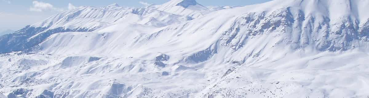
La tabla anterior muestra el pronóstico de tiempo para See en la altitud específica de 1745 m. Nuestros modelos meteorológicos sofisticados permiten prever pronósticos para la cumbre, la mitad y la base de See. Para aceder a los pronósticos de tiempo a otras alturas, pinche en la navegación en la parte superior de la tabla. Para una visión general, consulte el Mapa meteorológico de Austria.
Pinche aquí para más información sobre niveles de congelación y sobre cómo pronosticamos las temperaturas.
Comentarios de Visitantes para See
Generalmente 4.3 En base a 12 votos y 2 comentarios
What an absolutely brilliant and under-rated ski area! We stayed in See for 4 weeks (Feb-March, as part of a whole ski season) because it was cheap. We expected to ski there occasionally, and to get the ski bus to Ischgl most days. Boy, was I wrong! We ended up staying in See most days due to the excellent terrain, the uncrowded slopes, the cheap food, and the relaxed atmosphere and we actually ended up avoiding Ischgl.
It's easy to be unimpressed initially when looking at a piste map of See... only 4 lifts of any size (excluding the T-bars). But, wow, if ever there was a ski area that proves it's not the number of lifts but what you do with them, then surely See is it. Particularly if you catch this place after a fresh dump of snow, there simply is nowhere better.
The off-piste potential is amazing. Huge areas of excellent terrain to the left and right of Rossmoos lift, at a perfect red gradient, which remain untracked for days due to the low people density. And that's just for starters. Head over to the relatively new Versing lift, over in its own valley, and you are literally spoilt for freeride choice. This one single lift can keep you happy for days after a dump.
We heard that another lift is already approved and awaiting construction for the 22/23 season which will go up to Medrigjoch and open up vast freeride areas to the right of Rossmoos, and ending up below at the no. 1 valley run. There is also talk (as yet fruitless) of joining the area with Serfaus/Fiss/Ladis, which is just on the other side of the ridge, not least because Serfaus suffers from it's predominantly south-facing aspect.
Add to all of that cheap and excellent food, 1500m of vertical, and predominantly north-facing slopes, and you have one of the best and most overlooked small resorts in Austria. It's simply great, and we will definitely be back. Explore it before the crowds find it!
PS: the apres-ski in See is quite chilled, and obviously not up there with the likes of Ischgl, but hey, Ischgl is just a free 20 min bus ride away.
Generalmente: 4.3 En base a 12 votos y 2 comentarios
Nieve segura
4.9
Variedad de pistas
4.1
Fuera de pista
4.5
Escenografía
3.5
Después del esquí
3.0
JM_72 de United Kingdom escribe:
What an absolutely brilliant and under-rated ski area! We stayed in See for 4 weeks (Feb-March, as part of a whole ski season) because it was cheap. We expected to ski there occasionally, and to get the ski bus to Ischgl most days. Boy, was I wrong! We ended up staying in See most days due to the excellent terrain, the uncrowded slopes, the cheap food, and the relaxed atmosphere and we actually ended up avoiding Ischgl.
It's easy to be unimpressed initially when looking at a piste map of See... only 4 lifts of any size (excluding the T-bars). But, wow, if ever there was a ski area that proves it's not the number of lifts but what you do with them, then surely See is it. Particularly if you catch this place after a fresh dump of snow, there simply is nowhere better.
The off-piste potential is amazing. Huge areas of excellent terrain to the left and right of Rossmoos lift, at a perfect red gradient, which remain untracked for days due to the low people density. And that's just for starters. Head over to the relatively new Versing lift, over in its own valley, and you are literally spoilt for freeride choice. This one single lift can keep you happy for days after a dump.
We heard that another lift is already approved and awaiting construction for the 22/23 season which will go up to Medrigjoch and open up vast freeride areas to the right of Rossmoos, and ending up below at the no. 1 valley run. There is also talk (as yet fruitless) of joining the area with Serfaus/Fiss/Ladis, which is just on the other side of the ridge, not least because Serfaus suffers from it's predominantly south-facing aspect.
Add to all of that cheap and excellent food, 1500m of vertical, and predominantly north-facing slopes, and you have one of the best and most overlooked small resorts in Austria. It's simply great, and we will definitely be back. Explore it before the crowds find it!
PS: the apres-ski in See is quite chilled, and obviously not up there with the likes of Ischgl, but hey, Ischgl is just a free 20 min bus ride away.
Gratis Snow-Forecast.com Widget del Tiempo para su sitio web
El widget del tiempo para esquiar para See está disponible para ser empotrado en sitios web externos sin costo alguno. Proporciona un resumen diario de nuestro pronóstico de nieve en See y estados de tiempo actuales. Vaya simplemente a la página para su configuración y siga los 3 pasos sencillos. Tome el código de transferencia del hipertexto y péguelo en su propio sitio web. Puede escoger la elevación en el pronóstico de nieve (cumbre, ascensor de medio-montaña o fondo) y unidades métrico/imperiales para el motor del pronóstico de nieve y convenir su propio website…. Click aquí para obtener el código


 Nearest