

Portillo Re-Opens To Guests Arriving By Helicopter
Chile’s famous Portillo ski resort is reported to have re-opened to guests arriving by helicopter after being cut off by road for more than two weeks by over 6m/20 feet of snowfall.

Next 3 days weather summary:Fuerte lluvia (totál 31.0mm), más pesada durante la noche de miércoles. Cálido (max 25°C el martes por la tarde, min 15°C el miércoles por la noche). El viento será generalmente ligero. | Días 4-6 Resúmen del Tiempo para Saalbach HinterglemmFuerte lluvia (totál 39.0mm), más pesada durante la noche de jueves. Cálido (max 20°C el jueves por la tarde, min 12°C el jueves por la noche). El viento será generalmente ligero. | ||||||||||||||||
lun 3 | martes 4 | miércoles 5 | jueves 6 | viernes 7 | sábado 8 | ||||||||||||
tarde | noche | mañana | tarde | noche | mañana | tarde | noche | mañana | tarde | noche | mañana | tarde | noche | mañana | tarde | noche | |
llovizna | chuba scos | claro | riesgo truenos | chuba scos | riesgo truenos | riesgo truenos | fuerte lluvia | riesgo truenos | riesgo truenos | fuerte lluvia | lluvia mod. | riesgo truenos | chuba scos | semi nublado | riesgo truenos | chuba scos | |
km/h | |||||||||||||||||
Mapa de Nieve |  |  |  |  |  |  | |||||||||||
— | — | — | — | — | — | — | — | — | — | — | — | — | — | — | — | — | |
mm | 3 | 2 | — | 1 | 2 | 1 | 6 | 13 | 3 | 10 | 13 | 8 | 4 | 1 | — | 2 | 1 |
max °C | 23 | 19 | 23 | 25 | 22 | 20 | 22 | 18 | 19 | 20 | 15 | 12 | 15 | 14 | 16 | 18 | 16 |
min °C | 18 | 18 | 20 | 24 | 17 | 17 | 21 | 15 | 17 | 18 | 12 | 12 | 13 | 12 | 13 | 17 | 14 |
chill °C | 18 | 18 | 20 | 24 | 17 | 17 | 21 | 15 | 17 | 18 | 12 | 12 | 13 | 12 | 13 | 17 | 14 |
Humed. % | 68 | 55 | 42 | 42 | 57 | 65 | 65 | 88 | 69 | 74 | 94 | 98 | 84 | 90 | 71 | 73 | 82 |
Altura de Hielo m | 4500 | 4500 | 4500 | 4550 | 4600 | 4450 | 4500 | 4500 | 4400 | 4400 | 4000 | 3800 | 4050 | 4100 | 3950 | 4100 | 4150 |
— | — | 5:50 | — | — | 5:50 | — | — | 5:52 | — | — | 5:54 | — | — | 5:54 | — | — | |
— | 8:40 | — | — | 8:38 | — | — | 8:37 | — | — | 8:36 | — | — | 8:35 | — | — | 8:32 | |
Hazte pro y carve en:
Información de avalanchas: European Avalanche Warning Services (EAWS)
Ultimo parte de nieve cerca Saalbach Hinterglemm:
| Profundidad de nieve arriba: | — |
|---|---|
| Profundidad de nieve abajo: | — |
| Profundidad de la nevada fresca: | — |
| Última nevada: | 10 Jun 2026 |
0.0 | Dias de Nieve en Polvo Nieve fresca, mayormente soleado, viento suave. |
|---|---|
0.0 | Dias de nieve en polvo Nieve fresca, sol limitado, sin viento. |
0.0 | Dia perfecto para esquiar Nieve promedio, mayormente soleado, viento suave. |
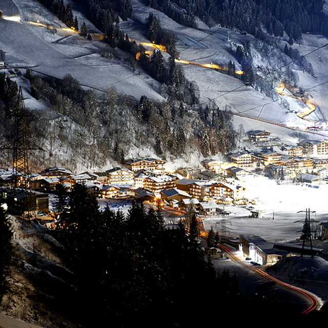
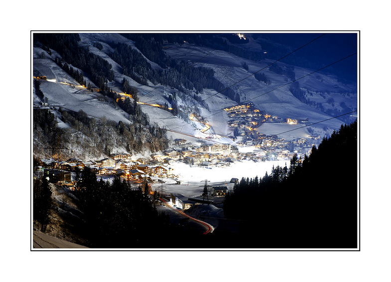
La tabla anterior muestra el pronóstico de tiempo para Saalbach Hinterglemm en la altitud específica de 1552 m. Nuestros modelos meteorológicos sofisticados permiten prever pronósticos para la cumbre, la mitad y la base de Saalbach Hinterglemm. Para aceder a los pronósticos de tiempo a otras alturas, pinche en la navegación en la parte superior de la tabla. Para una visión general, consulte el Mapa meteorológico de Austria.
Pinche aquí para más información sobre niveles de congelación y sobre cómo pronosticamos las temperaturas.
Generalmente 4.3 En base a 38 votos y 47 comentarios
Toto stredisko jsem odjakziva milovala, letos jsem zde po asi 7 letech ted v terminu 28.3.-2.4. kdy uz zacina docela obleva a sjezd do udoli je znacne neprijemny. I presto jsme ale za skipasy zaplatili plnou palbu! Drive na konci sezony pri nizke kvalite snehu a sjezdovek byla cena se slevou. Dost me to znechutilo a nemyslela jsem, ze uz i Rakusaci budou takovi vydriduchove :-)
Pavlina de Czechia escribe:
Toto stredisko jsem odjakziva milovala, letos jsem zde po asi 7 letech ted v terminu 28.3.-2.4. kdy uz zacina docela obleva a sjezd do udoli je znacne neprijemny. I presto jsme ale za skipasy zaplatili plnou palbu! Drive na konci sezony pri nizke kvalite snehu a sjezdovek byla cena se slevou. Dost me to znechutilo a nemyslela jsem, ze uz i Rakusaci budou takovi vydriduchove :-)
Lea 46 otras críticas de Saalbach Hinterglemm o entrega su propio comentario


 Nearest