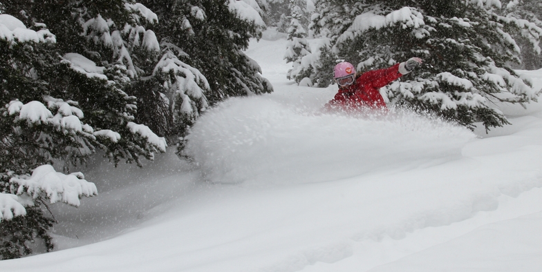


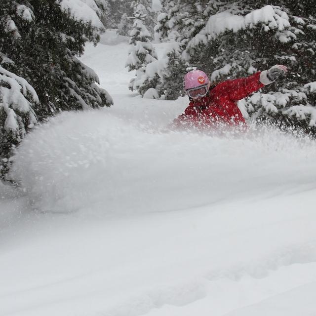
Portillo Re-Opens To Guests Arriving By Helicopter
Chile’s famous Portillo ski resort is reported to have re-opened to guests arriving by helicopter after being cut off by road for more than two weeks by over 6m/20 feet of snowfall.

Next 4 days weather summary:Mayormente seco. Cálido (max 23°C el domingo por la noche, min 16°C el lunes por la noche). El viento será generalmente ligero. | Días 5-7 Resúmen del Tiempo para Park CityMayormente seco. Cálido (max 27°C el viernes por la tarde, min 18°C el miércoles por la noche). El viento será generalmente ligero. | |||||||||||||||
lunes 3 | martes 4 | miércoles 5 | jueves 6 | viernes 7 | ||||||||||||
noche | mañana | tarde | noche | mañana | tarde | noche | mañana | tarde | noche | mañana | tarde | noche | mañana | tarde | noche | |
claro | claro | claro | claro | claro | claro | claro | semi nublado | semi nublado | claro | claro | claro | claro | claro | claro | claro | |
km/h | ||||||||||||||||
Mapa de Nieve |  |  |  |  | 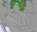 | 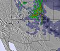 | ||||||||||
— | — | — | — | — | — | — | — | — | — | — | — | — | — | — | — | |
mm | — | — | — | — | — | — | — | — | — | — | — | — | — | — | — | — |
max °C | 23 | 20 | 21 | 18 | 21 | 21 | 17 | 21 | 22 | 20 | 24 | 25 | 22 | 26 | 27 | 24 |
min °C | 17 | 18 | 21 | 16 | 17 | 20 | 16 | 18 | 22 | 18 | 21 | 24 | 20 | 23 | 26 | 21 |
chill °C | 17 | 18 | 21 | 16 | 17 | 20 | 16 | 18 | 22 | 18 | 21 | 24 | 20 | 23 | 26 | 21 |
Humed. % | 15 | 22 | 15 | 18 | 18 | 12 | 12 | 12 | 10 | 13 | 12 | 9 | 12 | 12 | 11 | 14 |
Altura de Hielo m | 5650 | 5150 | 5300 | 5150 | 5100 | 5250 | 5150 | 5050 | 5250 | 5300 | 5300 | 5450 | 5500 | 5450 | 5500 | 5550 |
— | 6:24 | — | — | 6:24 | — | — | 6:26 | — | — | 6:26 | — | — | 6:28 | — | — | |
— | — | 8:38 | — | — | 8:37 | — | — | 8:37 | — | — | 8:35 | — | — | 8:34 | — | |
Hazte pro y carve en:
Información de avalanchas: National Avalanche Center
Ultimo parte de nieve cerca Park City:
| Profundidad de nieve arriba: | 0 cm |
|---|---|
| Profundidad de nieve abajo: | 0 cm |
| Profundidad de la nevada fresca: | — |
| Última nevada: | 28 Jun 2026 |
0.0 | Dias de Nieve en Polvo Nieve fresca, mayormente soleado, viento suave. |
|---|---|
0.0 | Dias de nieve en polvo Nieve fresca, sol limitado, sin viento. |
0.0 | Dia perfecto para esquiar Nieve promedio, mayormente soleado, viento suave. |
La tabla anterior muestra el pronóstico de tiempo para Park City en la altitud específica de 2574 m. Nuestros modelos meteorológicos sofisticados permiten prever pronósticos para la cumbre, la mitad y la base de Park City. Para aceder a los pronósticos de tiempo a otras alturas, pinche en la navegación en la parte superior de la tabla. Para una visión general, consulte el Mapa meteorológico de United States.
Pinche aquí para más información sobre niveles de congelación y sobre cómo pronosticamos las temperaturas.
Generalmente 4.5 En base a 17 votos y 5 comentarios
Ski runs are featureless and unvaried, The ski patrol is very rude and unprofessional and will blame you for made up transgressions.
Benjamin Posch de United States escribe:
Ski runs are featureless and unvaried, The ski patrol is very rude and unprofessional and will blame you for made up transgressions.
Lea 4 otras críticas de Park City o entrega su propio comentario

 Nearest