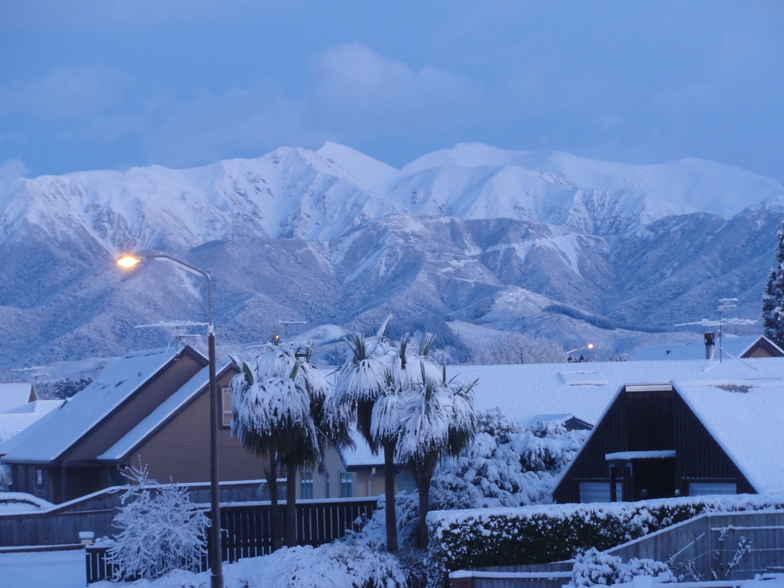
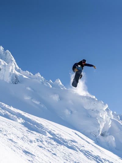
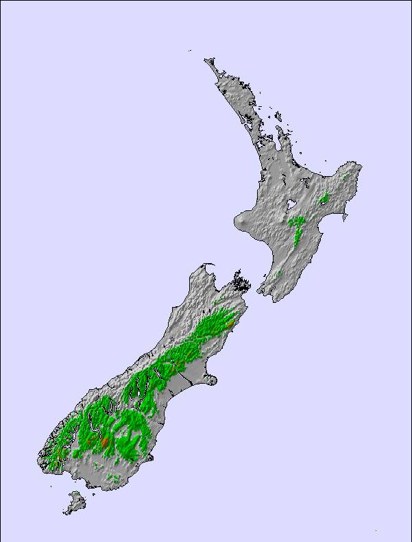
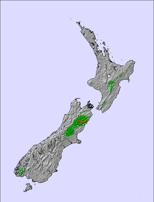
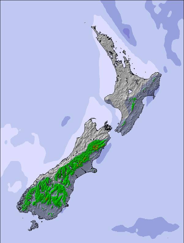
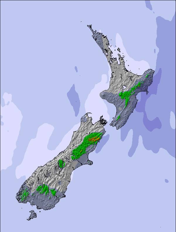
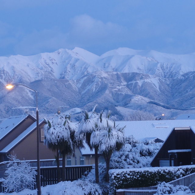
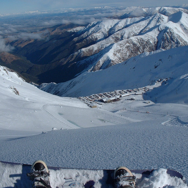
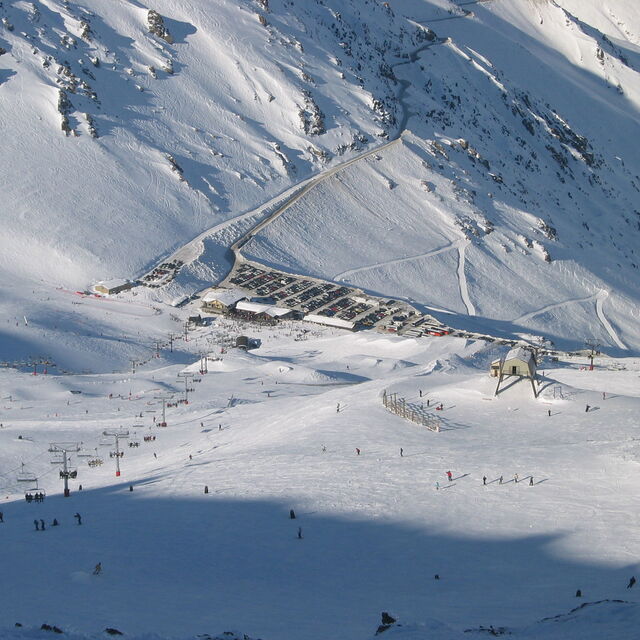
Mt Hutt snow
Esquí New Zealand

Pronóstico de Nieve para Mt Hutt

Pronóstico de tiempo para Mt Hutt a 1400 m
Emitido: 6 pm  25 Dec 2025 (hora local)

Nueva nieve en Mt Hutt

1.6cm0.6in
Lun 29th (NGT)
El pronostico del tiempo para Mt Hutt es: Fuerte lluvia (totál 37.0mm), más pesada durante la tarde de jueves. Temperaturas templadas (max 7°C el jueves por la tarde, min 2°C el jueves por la noche). Vientos decreciente (vientos fuertes desde el NO el jueves por la tarde, calma por la noche de sábado).

Mt Hutt Weather (Next 3 days): The snow forecast for Mt Hutt is: Fuerte lluvia (totál 37.0mm), más pesada durante la tarde de jueves. Temperaturas templadas (max 7°C el jueves por la tarde, min 2°C el jueves por la noche). Vientos decreciente (vientos fuertes desde el NO el jueves por la tarde, calma por la noche de sábado).

Mt Hutt Weather (Days 4-6): Espolvoreada de nieve pasando a lluvia moderada (totál 18.0mm) más pesada el martes por la mañana. Temperaturas templadas (max 7°C el lunes por la mañana, min 2°C el domingo por la noche). El viento será generalmente ligero.


Tiempo actual en Mt Hutt

EstaciónProfundidad de NieveTemp. (°C)Viento (km/h)Tiempo
Remonte de arriba: 0.0m
2
55
snow showers
Remonte de la mitad: 
3
45
rain showers
Remonte de abajo: 0.0m
5
35
rain showers
6 Day Forecast
Emitido: 6 pm 25 Dec 2025 / Actualizaciones en ::
Cambiar altura de pronóstico
Elegir pronóstico
Last 6 daysScroll left for last 6 daysNow
Thu
25
Friday
26
Saturday
27
Sunday
28
Monday
29
Tuesday
30
tarde
noche
mañana
tarde
noche
mañana
tarde
noche
mañana
tarde
noche
mañana
tarde
noche
mañana
tarde
noche
rain showers
rain showers
clear
clear
part cloud
rain showers
thunderstorm
mod rain
rain showers
rain showers
clear
clear
light rain
light snow
light rain
light rain
light rain
chuba
scos
chuba
scos
claro
claro
semi
nublado
chuba
scos
riesgo true- nos
lluvia
mod.
chuba
scos
chuba
scos
claro
claro
lloviz­na
nieve
ligera
lloviz­na
lloviz­na
lloviz­na
 km/h
40
NW
25
NW
35
NW
35
NW
15
NW
10
NW
5
ESE
5
ESE
5
E
10
SE
5
SE
5
E
10
ESE
10
SE
10
ESE
10
E
10
SE
Snow map
2
9
10
1
8
7
2
2
2
2
4
2
4
max °C
7
3
7
7
3
7
7
3
5
6
4
7
6
3
3
3
3
min °C
5
2
6
5
2
5
4
2
3
5
2
5
5
2
2
3
3
0
-4
1
1
-1
3
2
1
3
4
0
3
2
-1
-1
0
0
78
75
59
65
57
66
69
99
93
87
91
88
94
90
100
98
100
2450
2100
2100
2250
2000
1900
2100
1800
1900
2250
2400
2550
2650
2250
2200
2350
2300
nivel del mar1000m2000m3000m4000m5000m
2011-1-1-1-2-11222101163763663463663333
5:50
5:52
5:52
5:52
5:54
9:15
9:15
9:15
9:16
9:16
9:16

Radar de nieve

Ultimo parte de nieve cerca Mt Hutt:

No hay parte de nieve reciente

No hay parte de nieve reciente

Condiciones de Nieve en Mt Hutt

Profundidad de nieve arriba:0cm
Profundidad de nieve abajo:0cm
Profundidad de la nevada fresca:
Última nevada:20 Dec 2025
Otras estaciones en New Zealand están reportando: Nieve en polvo (0) / buena pista (0)


Historial de nevadas

Semana 4 of December tiene en promedio:
0.0
Dias de Nieve en Polvo
Nieve fresca, mayormente soleado, viento suave.
0.0
Dias de nieve en polvo
Nieve fresca, sol limitado, sin viento.
0.0
Dia perfecto para esquiar
Nieve promedio, mayormente soleado, viento suave.