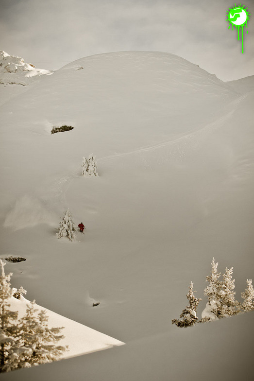


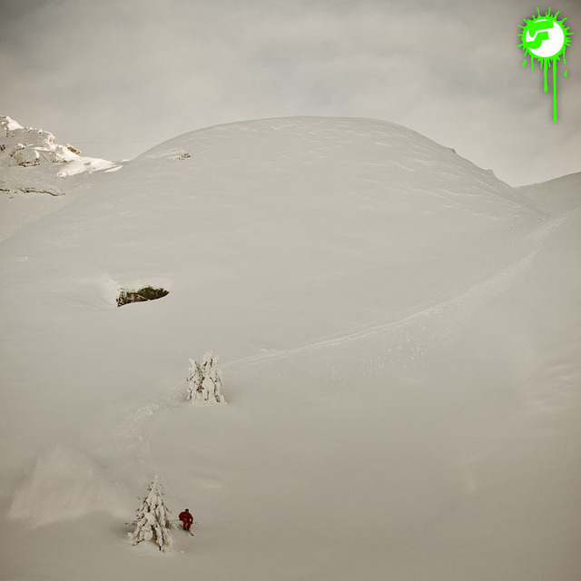
Portillo Storm Snowfall Total Passes 5m / 17 Feet
A snow storm that has now continued for nine days has taken Chilean ski resort Portillo to a snowfall total of 5.2 metres (17 feet) so far, with more snow forecast.

Next 3 days weather summary:Fuerte lluvia (totál 28.0mm), más pesada durante la noche del viernes. Cálido (max 30°C el viernes por la tarde, min 15°C el viernes por la noche). El viento será generalmente ligero. | Días 4-6 Resúmen del Tiempo para MontafonFuerte lluvia (totál 26.0mm), más pesada durante la noche de sábado. Cálido (max 27°C el sábado por la tarde, min 17°C el sábado por la noche). El viento será generalmente ligero. | |||||||||||||||||
miércoles 29 | jueves 30 | viernes 31 | sábado 1 | domingo 2 | lunes 3 | |||||||||||||
mañana | tarde | noche | mañana | tarde | noche | mañana | tarde | noche | mañana | tarde | noche | mañana | tarde | noche | mañana | tarde | noche | |
riesgo truenos | riesgo truenos | chuba scos | claro | claro | claro | claro | semi nublado | chuba scos | claro | riesgo truenos | chuba scos | claro | nubl ado | chuba scos | semi nublado | chuba scos | lluvia mod. | |
km/h | ||||||||||||||||||
Mapa de Nieve |  |  |  |  |  |  | ||||||||||||
— | — | — | — | — | — | — | — | — | — | — | — | — | — | — | — | — | — | |
mm | 1 | 1 | 6 | — | — | — | — | — | 20 | — | 1 | 9 | — | — | 4 | — | 4 | 8 |
max °C | 25 | 27 | 22 | 27 | 29 | 25 | 28 | 30 | 17 | 25 | 27 | 19 | 27 | 27 | 22 | 27 | 26 | 22 |
min °C | 22 | 26 | 19 | 22 | 29 | 18 | 23 | 29 | 15 | 20 | 24 | 17 | 21 | 26 | 18 | 22 | 24 | 17 |
chill °C | 22 | 26 | 19 | 22 | 29 | 18 | 23 | 29 | 14 | 20 | 24 | 17 | 21 | 26 | 18 | 22 | 24 | 17 |
Humed. % | 49 | 48 | 50 | 28 | 21 | 48 | 36 | 36 | 82 | 44 | 59 | 60 | 43 | 47 | 69 | 41 | 51 | 89 |
Altura de Hielo m | 4350 | 4500 | 4350 | 4500 | 4650 | 4700 | 4600 | 4800 | 4400 | 4500 | 4400 | 4500 | 4550 | 4650 | 4600 | 4600 | 4550 | 4250 |
5:54 | — | — | 5:56 | — | — | 5:56 | — | — | 5:58 | — | — | 5:58 | — | — | 6:01 | — | — | |
— | — | 8:57 | — | — | 8:55 | — | — | 8:54 | — | — | 8:52 | — | — | 8:52 | — | — | 8:51 | |
Hazte pro y carve en:
Información de avalanchas: European Avalanche Warning Services (EAWS)
Ultimo parte de nieve cerca Montafon:
| Profundidad de nieve arriba: | 0 cm |
|---|---|
| Profundidad de nieve abajo: | 0 cm |
| Profundidad de la nevada fresca: | — |
| Última nevada: | 16 May 2026 |
0.0 | Dias de Nieve en Polvo Nieve fresca, mayormente soleado, viento suave. |
|---|---|
0.0 | Dias de nieve en polvo Nieve fresca, sol limitado, sin viento. |
0.0 | Dia perfecto para esquiar Nieve promedio, mayormente soleado, viento suave. |
La tabla anterior muestra el pronóstico de tiempo para Montafon en la altitud específica de 1000 m. Nuestros modelos meteorológicos sofisticados permiten prever pronósticos para la cumbre, la mitad y la base de Montafon. Para aceder a los pronósticos de tiempo a otras alturas, pinche en la navegación en la parte superior de la tabla. Para una visión general, consulte el Mapa meteorológico de Austria.
Pinche aquí para más información sobre niveles de congelación y sobre cómo pronosticamos las temperaturas.
Generalmente 4.1 En base a 20 votos y 3 comentarios
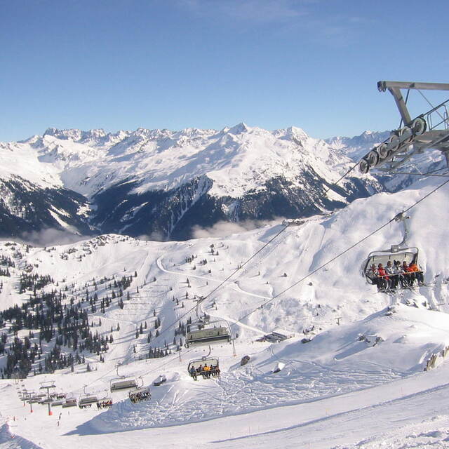
The Montafon Valley is an excellent destination for good intermediate and advanced skiers and boarders. There are two good lifts from St Gallenkirch which take you to two different areas. The newest one is only in its first year of operation and is state of the art. Both areas offer good open skiing above the tree line and a good range of groomed runs and also un-pisted but marked itinerary routes. The Grasjoch side has the longest continuous run in the Vorarlberg and also the longest ski tunnel at 475m which you ski through to get to the Kappel area. Skiinfo.de has it as number one Freeride spot in Austria in their recent review. For boarders there are two dedicated parks for jumps and rails. Free buses connect to other areas in the valley (Gargallen and Golms) if you fancy a change.
Rene Watts de United Kingdom escribe:
The Montafon Valley is an excellent destination for good intermediate and advanced skiers and boarders. There are two good lifts from St Gallenkirch which take you to two different areas. The newest one is only in its first year of operation and is state of the art. Both areas offer good open skiing above the tree line and a good range of groomed runs and also un-pisted but marked itinerary routes. The Grasjoch side has the longest continuous run in the Vorarlberg and also the longest ski tunnel at 475m which you ski through to get to the Kappel area. Skiinfo.de has it as number one Freeride spot in Austria in their recent review. For boarders there are two dedicated parks for jumps and rails. Free buses connect to other areas in the valley (Gargallen and Golms) if you fancy a change.
Lea 2 otras críticas de Montafon o entrega su propio comentario


 Nearest