

Portillo Re-Opens To Guests Arriving By Helicopter
Chile’s famous Portillo ski resort is reported to have re-opened to guests arriving by helicopter after being cut off by road for more than two weeks by over 6m/20 feet of snowfall.

Next 3 days weather summary:Fuerte lluvia (totál 25.0mm), más pesada durante la tarde de martes. Cálido (max 22°C el lunes por la tarde, min 13°C el martes por la noche). El viento será generalmente ligero. | Días 4-6 Resúmen del Tiempo para Le TourLluvia moderada (totál 16.0mm), más pesada el jueves por la tarde. Muy templado (max 18°C el jueves por la mañana, min 12°C el jueves por la noche). El viento será generalmente ligero. | |||||||||||||||||
lunes 3 | martes 4 | miércoles 5 | jueves 6 | viernes 7 | sábado 8 | |||||||||||||
mañana | tarde | noche | mañana | tarde | noche | mañana | tarde | noche | mañana | tarde | noche | mañana | tarde | noche | mañana | tarde | noche | |
claro | riesgo truenos | chuba scos | riesgo truenos | chuba scos | chuba scos | claro | riesgo truenos | chuba scos | claro | lluvia mod. | chuba scos | semi nublado | riesgo truenos | chuba scos | claro | claro | claro | |
km/h | ||||||||||||||||||
Mapa de Nieve |  |  |  |  |  |  | ||||||||||||
— | — | — | — | — | — | — | — | — | — | — | — | — | — | — | — | — | — | |
mm | — | 2 | 4 | 1 | 9 | 4 | — | 3 | 2 | — | 8 | 5 | — | 2 | 1 | — | — | — |
max °C | 21 | 22 | 17 | 19 | 20 | 15 | 18 | 19 | 17 | 18 | 17 | 14 | 14 | 16 | 14 | 16 | 18 | 16 |
min °C | 17 | 17 | 15 | 16 | 15 | 13 | 15 | 18 | 15 | 16 | 14 | 12 | 12 | 15 | 13 | 13 | 18 | 14 |
chill °C | 17 | 17 | 15 | 16 | 15 | 12 | 15 | 18 | 15 | 16 | 14 | 12 | 12 | 15 | 13 | 13 | 18 | 14 |
Humed. % | 42 | 71 | 73 | 52 | 77 | 75 | 57 | 66 | 64 | 54 | 87 | 88 | 74 | 78 | 71 | 49 | 48 | 49 |
Altura de Hielo m | 4550 | 4550 | 4500 | 4450 | 4400 | 4400 | 4300 | 4400 | 4450 | 4300 | 4350 | 4200 | 4150 | 4200 | 4350 | 4300 | 4250 | 4350 |
6:16 | — | — | 6:16 | — | — | 6:18 | — | — | 6:18 | — | — | 6:20 | — | — | 6:22 | — | — | |
— | — | 8:59 | — | — | 8:58 | — | — | 8:57 | — | — | 8:54 | — | — | 8:53 | — | — | 8:52 | |
Hazte pro y carve en:
Información de avalanchas: European Avalanche Warning Services (EAWS)
Ultimo parte de nieve cerca Le Tour:
| Profundidad de nieve arriba: | — |
|---|---|
| Profundidad de nieve abajo: | — |
| Profundidad de la nevada fresca: | — |
| Última nevada: | 16 May 2026 |
0.0 | Dias de Nieve en Polvo Nieve fresca, mayormente soleado, viento suave. |
|---|---|
0.0 | Dias de nieve en polvo Nieve fresca, sol limitado, sin viento. |
0.0 | Dia perfecto para esquiar Nieve promedio, mayormente soleado, viento suave. |
La tabla anterior muestra el pronóstico de tiempo para Le Tour en la altitud específica de 1868 m. Nuestros modelos meteorológicos sofisticados permiten prever pronósticos para la cumbre, la mitad y la base de Le Tour. Para aceder a los pronósticos de tiempo a otras alturas, pinche en la navegación en la parte superior de la tabla. Para una visión general, consulte el Mapa meteorológico de France.
Pinche aquí para más información sobre niveles de congelación y sobre cómo pronosticamos las temperaturas.
Generalmente 3.2 En base a 3 votos y 2 comentarios
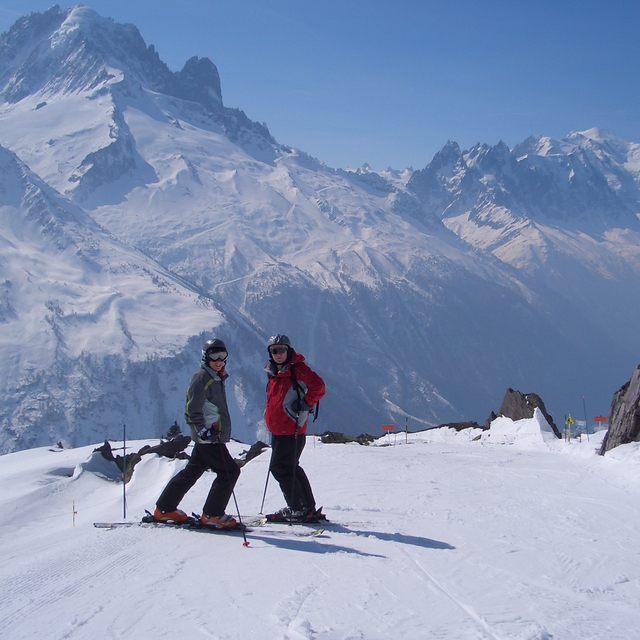
Le Tour. Feb 2012. POW, WOW...a great place for the family, long open runs mainly in the easy red which is great as our 5 year old, having spent the morning at ski school on the best nursery slope in the valley, can spend the afternoon on the hill with the family. Our 11 year old is now grabbing some air on the great natural pipes...and dad loves the off-piste at full speed. Accom is limited but great value...omelets are great at the Olympic. Truely a great little resort (can get cold in a blow). Booked again for 3 weeks in Jan 13. And best of all only a quick skip down to Grand Montet etc... Forest runs down to Vallorcein in POW are simply beautiful.
Grey on a Tray de United Kingdom escribe:
Le Tour. Feb 2012. POW, WOW...a great place for the family, long open runs mainly in the easy red which is great as our 5 year old, having spent the morning at ski school on the best nursery slope in the valley, can spend the afternoon on the hill with the family. Our 11 year old is now grabbing some air on the great natural pipes...and dad loves the off-piste at full speed. Accom is limited but great value...omelets are great at the Olympic. Truely a great little resort (can get cold in a blow). Booked again for 3 weeks in Jan 13.
And best of all only a quick skip down to Grand Montet etc...
Forest runs down to Vallorcein in POW are simply beautiful.
Lea 1 otras críticas de Le Tour o entrega su propio comentario


 Nearest