Últimos 6 díasDesplázate a la izquierda para los últimos 6 díasAhora
Next 4 days weather summary:
Fuerte lluvia (totál 28.0mm), más pesada durante la noche del viernes. Cálido (max 26°C el jueves por la tarde, min 15°C el miércoles por la noche). El viento será generalmente ligero.
Días 5-7 Resúmen del Tiempo para Kaprun
Fuerte lluvia (totál 43.0mm), más pesada durante la noche de domingo. Cálido (max 21°C el domingo por la mañana, min 9°C el domingo por la noche). El viento será generalmente ligero.
La tabla anterior muestra el pronóstico de tiempo para Kaprun en la altitud específica de 911 m. Nuestros modelos meteorológicos sofisticados permiten prever pronósticos para la cumbre, la mitad y la base de Kaprun. Para aceder a los pronósticos de tiempo a otras alturas, pinche en la navegación en la parte superior de la tabla. Para una visión general, consulte el Mapa meteorológico de Austria.
Pinche aquí para más información sobre niveles de congelación y sobre cómo pronosticamos las temperaturas.
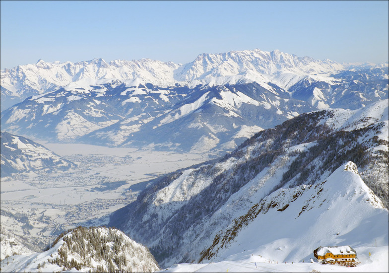
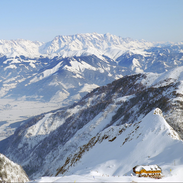
Comentarios de Visitantes para Kaprun
Generalmente 4.2 En base a 28 votos y 29 comentarios
We had a week's skiing basing ourselves in Maishofen which is between Zell am See and Saalfelden. We bought the Salzburg Super Ski Card which is only about 15 Euros more than the standard pass for Saalbach/Hinterglemm and is excellent value as it gives access to Kaprun, Zell, Saalbach, the whole of the Ski Amade area, Kitzbuhel and about a dozen other resorts. We had one day at Kaprun and one day at Zell.
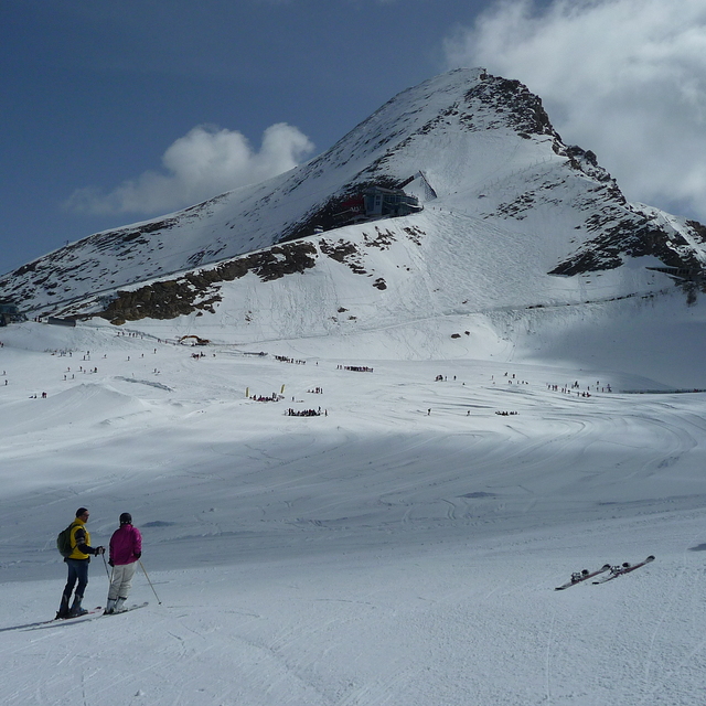
Kaprun is very good for intermediates and good beginners. However, make sure that you go there when the wind is not blowing hard. There were no queues at the bottom of the mountain, but if the higher lifts are closed because of wind (which they were on and off all day when we were there) then the queue for the Gletscherjet 2 becomes very long. If you can put up with the T bars the runs on either side of the Kitzlifte are wide and will flatter your technique; great cruising territory. The trip to the summit (and museum) is well worth it for the view. One drawback in that the only easy piste back to the gondola mid station gets really busy during mid/late afternoon and many beginners would find it quite difficult.
If you're going to Zell and using the Areitbahn, get there early i.e. before 9 a.m. This was the longest queue we experienced all week; about 45 mins to the top of the mountain. However, once up, the queues dissipate as people spread out and there's plenty of easy cruising. Black run 9 is a soft touch, although the blacks lower down towards the resort tend to be a bit icy. It was fairly busy when we were there so many of the blues and most of the reds have pretty big bumps on them by mid afternoon. As it faces more or less due south, piste 4 back down to the Areitbahn car park gets heavy by late afternoon. In summary, the Kaprun/Zell combination probably have just enough to keep a competent intermediate happy for a week.
Generalmente: 4.2 En base a 28 votos y 29 comentarios
Nieve segura
4.9
Variedad de pistas
4.1
Fuera de pista
3.6
Escenografía
4.4
Después del esquí
4.0
Howard Beanland de United Kingdom escribe:
We had a week's skiing basing ourselves in Maishofen which is between Zell am See and Saalfelden. We bought the Salzburg Super Ski Card which is only about 15 Euros more than the standard pass for Saalbach/Hinterglemm and is excellent value as it gives access to Kaprun, Zell, Saalbach, the whole of the Ski Amade area, Kitzbuhel and about a dozen other resorts. We had one day at Kaprun and one day at Zell.
Kaprun is very good for intermediates and good beginners. However, make sure that you go there when the wind is not blowing hard. There were no queues at the bottom of the mountain, but if the higher lifts are closed because of wind (which they were on and off all day when we were there) then the queue for the Gletscherjet 2 becomes very long. If you can put up with the T bars the runs on either side of the Kitzlifte are wide and will flatter your technique; great cruising territory. The trip to the summit (and museum) is well worth it for the view. One drawback in that the only easy piste back to the gondola mid station gets really busy during mid/late afternoon and many beginners would find it quite difficult.
If you're going to Zell and using the Areitbahn, get there early i.e. before 9 a.m. This was the longest queue we experienced all week; about 45 mins to the top of the mountain. However, once up, the queues dissipate as people spread out and there's plenty of easy cruising. Black run 9 is a soft touch, although the blacks lower down towards the resort tend to be a bit icy. It was fairly busy when we were there so many of the blues and most of the reds have pretty big bumps on them by mid afternoon. As it faces more or less due south, piste 4 back down to the Areitbahn car park gets heavy by late afternoon. In summary, the Kaprun/Zell combination probably have just enough to keep a competent intermediate happy for a week.
Gratis Snow-Forecast.com Widget del Tiempo para su sitio web
El widget del tiempo para esquiar para Kaprun está disponible para ser empotrado en sitios web externos sin costo alguno. Proporciona un resumen diario de nuestro pronóstico de nieve en Kaprun y estados de tiempo actuales. Vaya simplemente a la página para su configuración y siga los 3 pasos sencillos. Tome el código de transferencia del hipertexto y péguelo en su propio sitio web. Puede escoger la elevación en el pronóstico de nieve (cumbre, ascensor de medio-montaña o fondo) y unidades métrico/imperiales para el motor del pronóstico de nieve y convenir su propio website…. Click aquí para obtener el código


 Nearest