

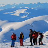
Portillo Re-Opens To Guests Arriving By Helicopter
Chile’s famous Portillo ski resort is reported to have re-opened to guests arriving by helicopter after being cut off by road for more than two weeks by over 6m/20 feet of snowfall.

Next 3 days weather summary:Lluvia moderada (totál 12.0mm), más pesada el lunes por la tarde. Muy templado (max 13°C el miércoles por la tarde, min 3°C el martes por la noche). El viento será generalmente ligero. | Días 4-6 Resúmen del Tiempo para Hemavan and TärnabyLluvia ligera (totál 8.0mm), cayendo mayormente el jueves por la tarde. Muy templado (max 13°C el jueves por la tarde, min 5°C el jueves por la noche). El viento será generalmente ligero. | ||||||||||||||||
lun 3 | martes 4 | miércoles 5 | jueves 6 | viernes 7 | sábado 8 | ||||||||||||
tarde | noche | mañana | tarde | noche | mañana | tarde | noche | mañana | tarde | noche | mañana | tarde | noche | mañana | tarde | noche | |
llovizna | llovizna | llovizna | llovizna | claro | semi nublado | semi nublado | nubl ado | chuba scos | chuba scos | chuba scos | nubl ado | nubl ado | llovizna | llovizna | llovizna | semi nublado | |
km/h | |||||||||||||||||
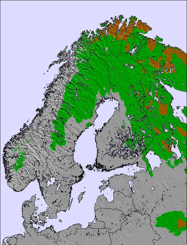
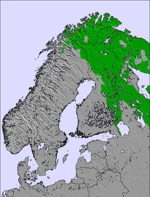
Mapa de Nieve |  |  |  | 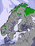 | 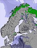 | 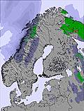 | |||||||||||
— | — | — | — | — | — | — | — | — | — | — | — | — | — | — | — | — | |
mm | 2 | 4 | 2 | 2 | — | — | — | — | 2 | 2 | 2 | — | — | 2 | 1 | 1 | — |
max °C | 9 | 7 | 7 | 8 | 8 | 11 | 13 | 11 | 12 | 13 | 13 | 8 | 9 | 8 | 8 | 11 | 10 |
min °C | 7 | 6 | 7 | 7 | 3 | 7 | 13 | 9 | 10 | 13 | 5 | 6 | 9 | 7 | 8 | 10 | 6 |
chill °C | 4 | 3 | 4 | 4 | 1 | 6 | 13 | 8 | 10 | 13 | 2 | 3 | 6 | 4 | 6 | 8 | 5 |
Humed. % | 88 | 90 | 86 | 84 | 85 | 66 | 52 | 61 | 65 | 57 | 85 | 80 | 72 | 91 | 84 | 64 | 71 |
Altura de Hielo m | 1550 | 1650 | 1650 | 1750 | 1750 | 1950 | 2200 | 2150 | 2050 | 2200 | 2100 | 1700 | 2000 | 1850 | 1800 | 2100 | 2150 |
— | — | 3:56 | — | — | 4:00 | — | — | 4:03 | — | — | 4:07 | — | — | 4:11 | — | — | |
— | 10:14 | — | — | 10:09 | — | — | 10:06 | — | — | 10:01 | — | — | 9:58 | — | — | 9:54 | |
Hazte pro y carve en:
Información de avalanchas: European Avalanche Warning Services (EAWS)
Ultimo parte de nieve cerca Hemavan and Tärnaby:
| Profundidad de nieve arriba: | 0 cm |
|---|---|
| Profundidad de nieve abajo: | 0 cm |
| Profundidad de la nevada fresca: | — |
| Última nevada: | 5 Jul 2026 |
0.0 | Dias de Nieve en Polvo Nieve fresca, mayormente soleado, viento suave. |
|---|---|
0.0 | Dias de nieve en polvo Nieve fresca, sol limitado, sin viento. |
0.0 | Dia perfecto para esquiar Nieve promedio, mayormente soleado, viento suave. |

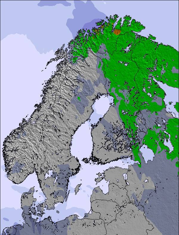
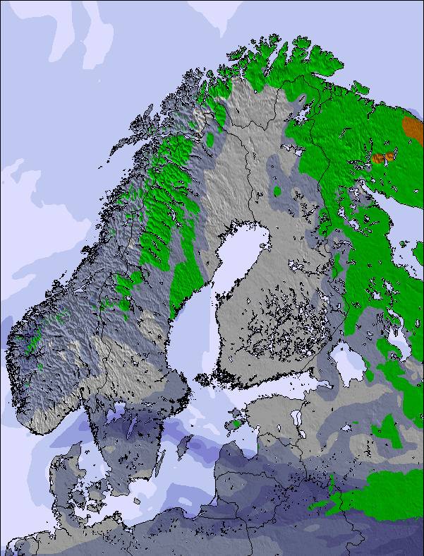
La tabla anterior muestra el pronóstico de tiempo para Hemavan and Tärnaby en la altitud específica de 648 m. Nuestros modelos meteorológicos sofisticados permiten prever pronósticos para la cumbre, la mitad y la base de Hemavan and Tärnaby. Para aceder a los pronósticos de tiempo a otras alturas, pinche en la navegación en la parte superior de la tabla. Para una visión general, consulte el Mapa meteorológico de Sweden.
Pinche aquí para más información sobre niveles de congelación y sobre cómo pronosticamos las temperaturas.
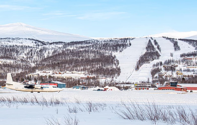
Nombre de la estación también escrito como Hemavan and Tarnaby.
Generalmente 4.8 En base a 11 votos y 2 comentarios
For beautiful nature,guaranteed snow and no large queues for the lifts,(Easter can be very hectic) I would recommend the small resorts of Tärnaby-Hemavan in Southern Lapland. Great runs, fantastic off-pist, heli-skiing, snowboarding, cross- country skiing and snow scooter paradise ! There's something for everyone .. even dog sledding ! Tärnaby is home of Alpine legends Ingemar Stenmark and Stig Strand, more recently, World Champion Anja Pärson. Best times to Ski - from February to end of April. However, November is great at the start of the season. It's a bit dark in December and January , but it's still a magical winter wonderland! Good New Years parties. For budget,comfortable accommodation with wonderful views check out www.TarnabyLapland.com . They're building a new Backpacker section ready for early 2006 season.
Sophia de Sweden escribe:
For beautiful nature,guaranteed snow and no large queues for the lifts,(Easter can be very hectic) I would recommend the small resorts of Tärnaby-Hemavan in Southern Lapland. Great runs, fantastic off-pist, heli-skiing, snowboarding, cross- country skiing and snow scooter paradise ! There's something for everyone .. even dog sledding ! Tärnaby is home of Alpine legends Ingemar Stenmark and Stig Strand, more recently, World Champion Anja Pärson. Best times to Ski - from February to end of April. However, November is great at the start of the season. It's a bit dark in December and January , but it's still a magical winter wonderland! Good New Years parties. For budget,comfortable accommodation with wonderful views check out www.TarnabyLapland.com . They're building a new Backpacker section ready for early 2006 season.
Lea 1 otras críticas de Hemavan and Tärnaby o entrega su propio comentario

 Nearest