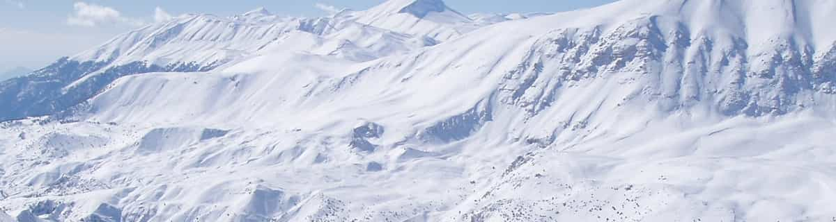


America’s Next Indoor Snow Centre Takes Shape
Construction of a new indoor snow centre for skiers, boarders and tubers appears to be making good progress at Heritage Farm in Wayne County, West Virginia.

Next 4 days weather summary:Lluvia ligera (totál 9.0mm), cayendo mayormente el martes por la mañana. Cálido (max 22°C el miércoles por la tarde, min 11°C el martes por la noche). El viento será generalmente ligero. | Días 5-7 Resúmen del Tiempo para Hauteluce Val JolyFuerte lluvia (totál 39.0mm), más pesada durante la noche de sábado. Cálido (max 24°C el sábado por la mañana, min 10°C el jueves por la noche). El viento será generalmente ligero. | |||||||||||||||
martes 21 | miércoles 22 | jueves 23 | viernes 24 | sábado 25 | ||||||||||||
noche | mañana | tarde | noche | mañana | tarde | noche | mañana | tarde | noche | mañana | tarde | noche | mañana | tarde | noche | |
chuba scos | riesgo truenos | riesgo truenos | claro | claro | claro | claro | semi nublado | claro | claro | claro | claro | claro | semi nublado | chuba scos | fuerte lluvia | |
km/h | ||||||||||||||||
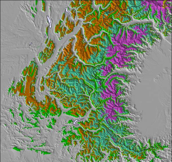
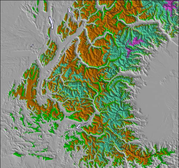
Mapa de Nieve |  |  |  |  |  |  | ||||||||||
— | — | — | — | — | — | — | — | — | — | — | — | — | — | — | — | |
mm | 2 | 4 | 3 | — | — | — | — | — | — | — | — | — | — | — | 1 | 32 |
max °C | 20 | 18 | 21 | 18 | 19 | 22 | 18 | 18 | 21 | 18 | 19 | 23 | 19 | 24 | 24 | 16 |
min °C | 13 | 14 | 20 | 11 | 14 | 22 | 12 | 14 | 21 | 10 | 14 | 22 | 14 | 17 | 19 | 10 |
chill °C | 13 | 14 | 20 | 11 | 14 | 22 | 12 | 14 | 21 | 10 | 14 | 22 | 14 | 17 | 19 | 10 |
Humed. % | 60 | 66 | 45 | 59 | 45 | 36 | 46 | 47 | 35 | 55 | 33 | 28 | 40 | 26 | 36 | 97 |
Altura de Hielo m | 3950 | 3650 | 3500 | 3850 | 3950 | 3850 | 3800 | 3600 | 3600 | 4150 | 4300 | 4100 | 4150 | 4200 | 4150 | 3400 |
— | 6:03 | — | — | 6:03 | — | — | 6:05 | — | — | 6:07 | — | — | 6:07 | — | — | |
— | — | — | 9:15 | — | — | 9:14 | — | — | 9:13 | — | — | 9:12 | — | — | 9:10 | |
Hazte pro y carve en:
Información de avalanchas: European Avalanche Warning Services (EAWS)
Ultimo parte de nieve cerca Hauteluce Val Joly:
No information received. Clear blue skies, all lifts open. desde La Giettaz en Aravis
| Profundidad de nieve arriba: | — |
|---|---|
| Profundidad de nieve abajo: | — |
| Profundidad de la nevada fresca: | — |
| Última nevada: | 15 May 2026 |
0.0 | Dias de Nieve en Polvo Nieve fresca, mayormente soleado, viento suave. |
|---|---|
0.0 | Dias de nieve en polvo Nieve fresca, sol limitado, sin viento. |
0.0 | Dia perfecto para esquiar Nieve promedio, mayormente soleado, viento suave. |
La tabla anterior muestra el pronóstico de tiempo para Hauteluce Val Joly en la altitud específica de 1150 m. Nuestros modelos meteorológicos sofisticados permiten prever pronósticos para la cumbre, la mitad y la base de Hauteluce Val Joly. Para aceder a los pronósticos de tiempo a otras alturas, pinche en la navegación en la parte superior de la tabla. Para una visión general, consulte el Mapa meteorológico de France.
Pinche aquí para más información sobre niveles de congelación y sobre cómo pronosticamos las temperaturas.
Generalmente 3.0 En base a 2 votos y 1 comentario
Hauteluce is a small resort in itself, but it is linked into the Espace Diamant at one end of the commune, and into Les Contamines Montjoie at the other end. Unfortunately, there's no common lift pass, but either area is plenty big enough for everyone except the "mileage" skiers of this world (and frankly I don't see the fun in any of that). Hauteluce is also very close to Albertville.
James Smith de United Kingdom escribe:
Hauteluce is a small resort in itself, but it is linked into the Espace Diamant at one end of the commune, and into Les Contamines Montjoie at the other end. Unfortunately, there's no common lift pass, but either area is plenty big enough for everyone except the "mileage" skiers of this world (and frankly I don't see the fun in any of that). Hauteluce is also very close to Albertville.
Haz clic aquí para entregar su propio comentario de Hauteluce Val Joly

 Nearest