

Portillo Storm Snowfall Total Passes 5m / 17 Feet
A snow storm that has now continued for nine days has taken Chilean ski resort Portillo to a snowfall total of 5.2 metres (17 feet) so far, with more snow forecast.

Next 3 days weather summary:Lluvia moderada (totál 16.0mm), más pesada el jueves por la mañana. Muy templado (max 11°C el miércoles por la tarde, min 6°C el jueves por la noche). Vientos crecientes (Vientos ligeros desde el O el miércoles por la noche, vientos frescos desde el OSO por la mañana de jueves). | Días 4-6 Resúmen del Tiempo para Glencoe Mountain ResortLluvia ligera (totál 9.0mm), cayendo mayormente el sábado por la mañana. Muy templado (max 12°C el lunes por la tarde, min 7°C el sábado por la noche). El viento será generalmente ligero. | |||||||||||||||||
miércoles 29 | jueves 30 | viernes 31 | sábado 1 | domingo 2 | lunes 3 | |||||||||||||
mañana | tarde | noche | mañana | tarde | noche | mañana | tarde | noche | mañana | tarde | noche | mañana | tarde | noche | mañana | tarde | noche | |
llovizna | llovizna | chuba scos | llovizna | chuba scos | chuba scos | chuba scos | chuba scos | llovizna | chuba scos | chuba scos | nubl ado | semi nublado | nubl ado | semi nublado | chuba scos | chuba scos | llovizna | |
km/h | ||||||||||||||||||
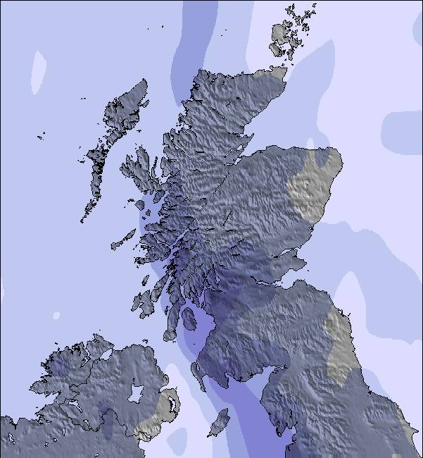
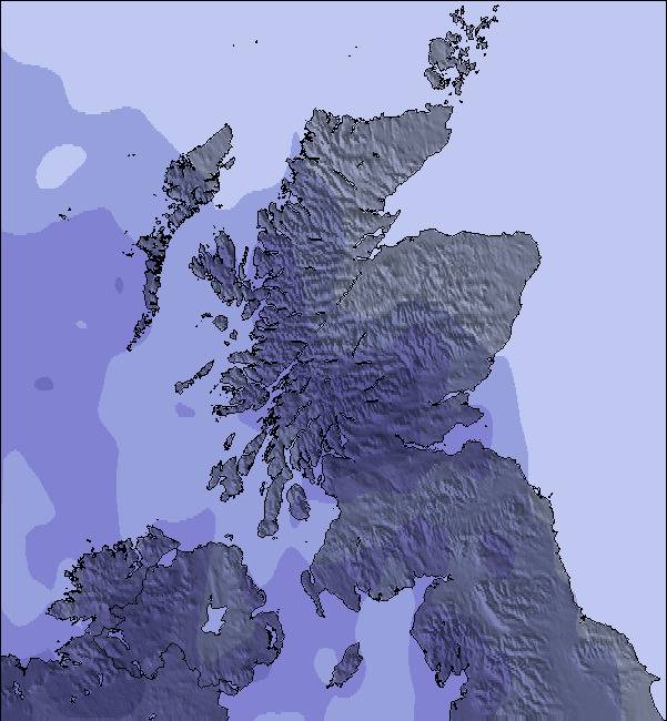
Mapa de Nieve |  |  |  | 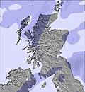 | 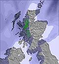 | 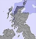 | ||||||||||||
— | — | — | — | — | — | — | — | — | — | — | — | — | — | — | — | — | — | |
mm | 2 | 1 | 1 | 3 | 2 | 1 | 2 | 2 | 2 | 2 | 2 | — | — | — | — | 1 | 2 | 2 |
max °C | 10 | 11 | 8 | 7 | 8 | 7 | 8 | 9 | 7 | 9 | 9 | 8 | 10 | 11 | 9 | 11 | 12 | 9 |
min °C | 9 | 9 | 7 | 7 | 8 | 6 | 7 | 9 | 6 | 8 | 9 | 7 | 8 | 10 | 8 | 10 | 11 | 9 |
chill °C | 6 | 7 | 5 | 4 | 4 | 3 | 4 | 6 | 3 | 5 | 6 | 4 | 6 | 10 | 8 | 10 | 11 | 8 |
Humed. % | 93 | 76 | 91 | 90 | 91 | 88 | 82 | 83 | 93 | 86 | 84 | 91 | 80 | 74 | 83 | 78 | 74 | 94 |
Altura de Hielo m | 2800 | 2600 | 2300 | 1700 | 2000 | 1700 | 1650 | 1850 | 1850 | 2000 | 2150 | 2050 | 2100 | 2400 | 2350 | 2300 | 2450 | 2400 |
5:13 | — | — | 5:15 | — | — | 5:16 | — | — | 5:18 | — | — | 5:20 | — | — | 5:22 | — | — | |
— | 9:37 | — | — | 9:35 | — | — | 9:32 | — | — | 9:30 | — | — | 9:29 | — | — | 9:25 | — | |
Hazte pro y carve en:
Información de avalanchas: European Avalanche Warning Services (EAWS)
Ultimo parte de nieve cerca Glencoe Mountain Resort:
| Profundidad de nieve arriba: | 0 cm |
|---|---|
| Profundidad de nieve abajo: | 0 cm |
| Profundidad de la nevada fresca: | — |
| Última nevada: | 12 May 2026 |
0.0 | Dias de Nieve en Polvo Nieve fresca, mayormente soleado, viento suave. |
|---|---|
0.0 | Dias de nieve en polvo Nieve fresca, sol limitado, sin viento. |
0.0 | Dia perfecto para esquiar Nieve promedio, mayormente soleado, viento suave. |
La tabla anterior muestra el pronóstico de tiempo para Glencoe Mountain Resort en la altitud específica de 706 m. Nuestros modelos meteorológicos sofisticados permiten prever pronósticos para la cumbre, la mitad y la base de Glencoe Mountain Resort. Para aceder a los pronósticos de tiempo a otras alturas, pinche en la navegación en la parte superior de la tabla. Para una visión general, consulte el Mapa meteorológico de United Kingdom.
Pinche aquí para más información sobre niveles de congelación y sobre cómo pronosticamos las temperaturas.
Generalmente 3.3 En base a 31 votos y 27 comentarios
Old lifts, a bit slow, windy, flat light but who cares! I've had some of my most enjoyable days skiing here and I'm taking Cham, La Grave, etc into account when I say this. The views can be staggering, the snow can be fantastic, the steepness is exciting; good for beginners and experts alike. I don't care about the quirks, if you want to be part of the skiing machine go to Zermatt where there's cham etc. but don't go the Glencoe and expect the same. If you are lucky you'll get one of the best views from a ski resort in Europe and quality skiing which will test you. Great memories, thank you.
Dickyboy de United Kingdom escribe:
Old lifts, a bit slow, windy, flat light but who cares! I've had some of my most enjoyable days skiing here and I'm taking Cham, La Grave, etc into account when I say this. The views can be staggering, the snow can be fantastic, the steepness is exciting; good for beginners and experts alike.
I don't care about the quirks, if you want to be part of the skiing machine go to Zermatt where there's cham etc. but don't go the Glencoe and expect the same. If you are lucky you'll get one of the best views from a ski resort in Europe and quality skiing which will test you. Great memories, thank you.
Lea 26 otras críticas de Glencoe Mountain Resort o entrega su propio comentario


 Nearest