
Ski Lessons by SkiBro
BOOK NOW
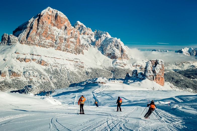
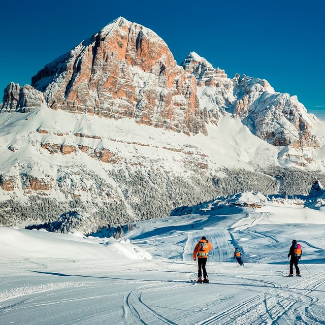
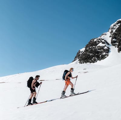
Ski lessons in Cortina
Book now


Cortina Weather (Next 3 days): The snow forecast for Cortina is: Lluvia moderada (totál 12.0mm), más pesada el domingo por la tarde. Temperaturas templadas (max 9°C el lunes por la tarde, min 2°C el sábado por la mañana). El viento será generalmente ligero.
Cortina Weather (Days 4-6): Fuerte lluvia (totál 59.0mm), más pesada durante la tarde de martes. Temperaturas templadas (max 8°C el jueves por la tarde, min 3°C el miércoles por la noche). El viento será generalmente ligero.
| Estación | Profundidad de Nieve | Temp. (°C) | Viento (km/h) | Tiempo | ||
|---|---|---|---|---|---|---|
| Remonte de arriba: | 0.0 m | -3 | ||||
| Remonte de la mitad: | 4 | |||||
| Remonte de abajo: | 0.0 m | 11 |
Ultimo parte de nieve cerca Cortina:
Continuous light rain reported from Passo Rolle at 2006 metres elevation 9 kms S of Passo San Pellegrino but it is forecast cold enough for snow at higher elevations in the ski area desde Passo San Pellegrino

Saturday 18 | Sunday 19 | Monday 20 | Tuesday 21 | Wednesday 22 | Thursday 23 | Friday 24 | |||||||||||||||
mañana | tarde | noche | mañana | tarde | noche | mañana | tarde | noche | mañana | tarde | noche | mañana | tarde | noche | mañana | tarde | noche | mañana | tarde | noche | |
semi nublado | llovizna | chuba scos | semi nublado | riesgo true- nos | chuba scos | semi nublado | chuba scos | chuba scos | lluvia mod. | fuerte lluvia | lluvia mod. | llovizna | fuerte lluvia | chuba scos | semi nublado | riesgo true- nos | llovizna | nubl ado | llovizna | llovizna | |
km/h | |||||||||||||||||||||
Snow map |  |  |  |  |  |  |  | ||||||||||||||
cm | — | — | — | — | — | — | — | — | — | — | — | — | — | — | — | — | — | — | — | — | — |
mm | — | 2.0 | 2.0 | — | 3 | 1.0 | — | 2.0 | 2.0 | 9 | 22 | 6 | 5 | 12 | 2.0 | — | 2.0 | 1.0 | — | 4 | 4 |
max°C | 4 | 5 | 4 | 6 | 7 | 6 | 7 | 9 | 7 | 6 | 5 | 5 | 4 | 5 | 4 | 7 | 8 | 7 | 7 | 6 | 5 |
min°C | 2 | 4 | 2 | 4 | 7 | 4 | 5 | 9 | 5 | 6 | 5 | 4 | 4 | 4 | 3 | 5 | 8 | 5 | 5 | 5 | 4 |
chill°C | 2 | 3 | 2 | 4 | 6 | 4 | 5 | 8 | 4 | 5 | 3 | 4 | 4 | 4 | 2 | 5 | 8 | 4 | 3 | 3 | 4 |
Humed.% | 79 | 79 | 88 | 74 | 80 | 80 | 69 | 70 | 81 | 98 | 98 | 96 | 88 | 91 | 85 | 74 | 76 | 80 | 82 | 98 | 96 |
Altura de Hielo (m) | 2600 | 2800 | 2600 | 2800 | 3000 | 3050 | 2900 | 3200 | 3250 | 3150 | 3000 | 2850 | 2700 | 2750 | 2800 | 2950 | 3200 | 3250 | 3100 | 3000 | 2850 |
5:33 | — | — | 5:31 | — | — | 5:31 | — | — | 5:30 | — | — | 5:28 | — | — | 5:28 | — | — | 5:26 | — | — | |
— | — | 8:42 | — | — | 8:43 | — | — | 8:45 | — | — | 8:45 | — | — | 8:46 | — | — | 8:47 | — | — | 8:49 | |
Lluvia moderada (totál 12.0mm), más pesada el domingo por la tarde. Temperaturas templadas (max 9°C el lunes por la tarde, min 2°C el sábado por la mañana). El viento será generalmente ligero.
Fuerte lluvia (totál 59.0mm), más pesada durante la tarde de martes. Temperaturas templadas (max 8°C el jueves por la tarde, min 3°C el miércoles por la noche). El viento será generalmente ligero.
Ultimo parte de nieve cerca Cortina:
Continuous light rain reported from Passo Rolle at 2006 metres elevation 9 kms S of Passo San Pellegrino but it is forecast cold enough for snow at higher elevations in the ski area desde Passo San Pellegrino
| Profundidad de nieve arriba: | 0 cm |
|---|---|
| Profundidad de nieve abajo: | 0 cm |
| Profundidad de la nevada fresca: | 34 cm |
| Última nevada: | 16 May 2024 |
0.0 | Dias de Nieve en Polvo Nieve fresca, mayormente soleado, viento suave. |
|---|---|
0.4 | Dias de nieve en polvo Nieve fresca, sol limitado, sin viento. |
0.1 | Dia perfecto para esquiar Nieve promedio, mayormente soleado, viento suave. |
La tabla anterior muestra el pronóstico de tiempo para Cortina en la altitud específica de 2107 m. Nuestros modelos meteorológicos sofisticados permiten prever pronósticos para la cumbre, la mitad y la base de Cortina. Para aceder a los pronósticos de tiempo a otras alturas, pinche en la navegación en la parte superior de la tabla. Para una visión general, consulte el Mapa meteorológico de Italy.
Pinche aquí para más información sobre niveles de congelación y sobre cómo pronosticamos las temperaturas.
Generalmente 3.7 En base a 13 votos y 7 comentarios
As always, a great alpine experience on and off the piste. Cortina is undergoing a major uplift in advance of the Olympics which is massively overdue. The lift system and connections have been significantly improved and it is now possible to get to the Sella Ronda with ease. Stayed in San Vito which is super pretty and has its own ski area which is much underrated and almost deserted apart from those in the know.
David Guppy de United Kingdom escribe:
As always, a great alpine experience on and off the piste.
Cortina is undergoing a major uplift in advance of the Olympics which is massively overdue. The lift system and connections have been significantly improved and it is now possible to get to the Sella Ronda with ease.
Stayed in San Vito which is super pretty and has its own ski area which is much underrated and almost deserted apart from those in the know.
Lea 6 otras críticas de Cortina o entrega su propio comentario
El widget del tiempo para esquiar para Cortina está disponible para ser empotrado en sitios web externos sin costo alguno. Proporciona un resumen diario de nuestro pronóstico de nieve en Cortina y estados de tiempo actuales. Vaya simplemente a la página para su configuración y siga los 3 pasos sencillos. Tome el código de transferencia del hipertexto y péguelo en su propio sitio web. Puede escoger la elevación en el pronóstico de nieve (cumbre, ascensor de medio-montaña o fondo) y unidades métrico/imperiales para el motor del pronóstico de nieve y convenir su propio website…. Click aquí para obtener el código
Panorama detallado del Pronóstico de Nieve para Cortina en:
snow-forecast.com


 Nearest