Últimos 6 díasDesplázate a la izquierda para los últimos 6 díasAhora
Next 4 days weather summary:
Lluvia moderada (totál 13.0mm), más pesada el domingo por la mañana. Muy templado (max 16°C el sábado por la noche, min 9°C el lunes por la noche). El viento será generalmente ligero.
Días 5-7 Resúmen del Tiempo para Arber
Lluvia ligera (totál 9.0mm), cayendo mayormente el jueves por la tarde. Muy templado (max 15°C el viernes por la tarde, min 8°C el jueves por la mañana). Vientos crecientes (Vientos ligeros desde el O el miércoles por la mañana, vientos frescos desde el OSO por la noche de miércoles).
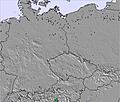
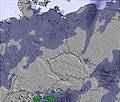
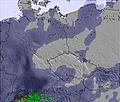
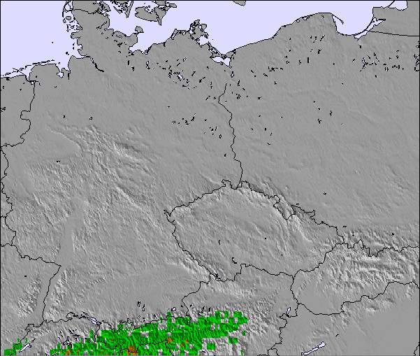
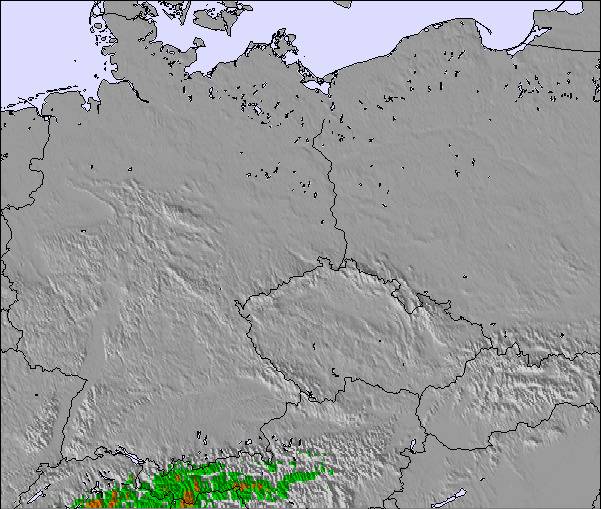
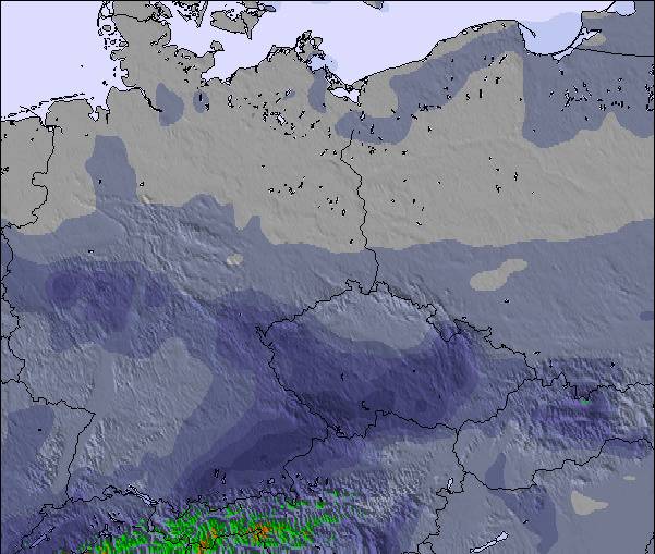
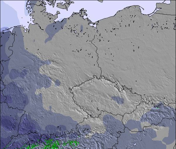
La tabla anterior muestra el pronóstico de tiempo para Arber en la altitud específica de 1253 m. Nuestros modelos meteorológicos sofisticados permiten prever pronósticos para la cumbre, la mitad y la base de Arber. Para aceder a los pronósticos de tiempo a otras alturas, pinche en la navegación en la parte superior de la tabla. Para una visión general, consulte el Mapa meteorológico de Germany.
Pinche aquí para más información sobre niveles de congelación y sobre cómo pronosticamos las temperaturas.
Comentarios de Visitantes para Arber
Generalmente 3.4 En base a 11 votos y 1 comentario
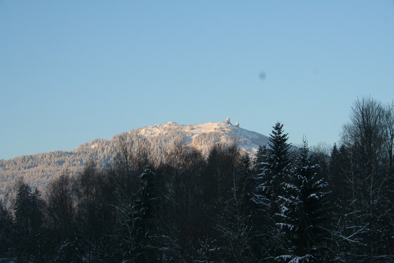
Arber is a smallish resort but the biggest in Germany outside the Alps. It has easy and difficult runs but go there low season to enjoy it because during high season it's extremely busy, especially when all the little ski areas in the region are shut due to lack of snow; queueing for 30 mins for 10 mins or less skiing is common. We've been twice,and experienced excellent snow conditions but you need patience waiting for uplift. The Arber is beautifully forested and the runs are scenic. Accommodation locally is excellent and good value with superb food. Arber is a great place to go for a couple of days but avoid busy periods.
Generalmente: 3.4 En base a 11 votos y 1 comentario
Nieve segura
4.0
Variedad de pistas
3.0
Después del esquí
3.0
Cañones de nieve
4.0
Avanzado
3.0
Roger Pitman de United Kingdom escribe:
Arber is a smallish resort but the biggest in Germany outside the Alps. It has easy and difficult runs but go there low season to enjoy it because during high season it's extremely busy, especially when all the little ski areas in the region are shut due to lack of snow; queueing for 30 mins for 10 mins or less skiing is common. We've been twice,and experienced excellent snow conditions but you need patience waiting for uplift. The Arber is beautifully forested and the runs are scenic. Accommodation locally is excellent and good value with superb food. Arber is a great place to go for a couple of days but avoid busy periods.
Gratis Snow-Forecast.com Widget del Tiempo para su sitio web
El widget del tiempo para esquiar para Arber está disponible para ser empotrado en sitios web externos sin costo alguno. Proporciona un resumen diario de nuestro pronóstico de nieve en Arber y estados de tiempo actuales. Vaya simplemente a la página para su configuración y siga los 3 pasos sencillos. Tome el código de transferencia del hipertexto y péguelo en su propio sitio web. Puede escoger la elevación en el pronóstico de nieve (cumbre, ascensor de medio-montaña o fondo) y unidades métrico/imperiales para el motor del pronóstico de nieve y convenir su propio website…. Click aquí para obtener el código


 Nearest