

America’s Next Indoor Snow Centre Takes Shape
Construction of a new indoor snow centre for skiers, boarders and tubers appears to be making good progress at Heritage Farm in Wayne County, West Virginia.

Next 3 days weather summary:Lluvia ligera (totál 2.0mm), cayendo mayormente el martes por la tarde. Muy templado (max 15°C el martes por la tarde, min 7°C el miércoles por la noche). El viento será generalmente ligero. | Días 4-6 Resúmen del Tiempo para ArberLluvia moderada (totál 10.0mm), más pesada el domingo por la tarde. Cálido (max 20°C el sábado por la tarde, min 9°C el domingo por la noche). Vientos crecientes (calma el viernes por la noche, vientos fuertes desde el OSO por la noche de domingo). | |||||||||||||||||
martes 21 | miércoles 22 | jueves 23 | viernes 24 | sábado 25 | domingo 26 | |||||||||||||
mañana | tarde | noche | mañana | tarde | noche | mañana | tarde | noche | mañana | tarde | noche | mañana | tarde | noche | mañana | tarde | noche | |
semi nublado | chuba scos | semi nublado | semi nublado | nubl ado | semi nublado | semi nublado | claro | claro | claro | claro | claro | semi nublado | claro | semi nublado | llovizna | llovizna | llovizna | |
km/h | ||||||||||||||||||
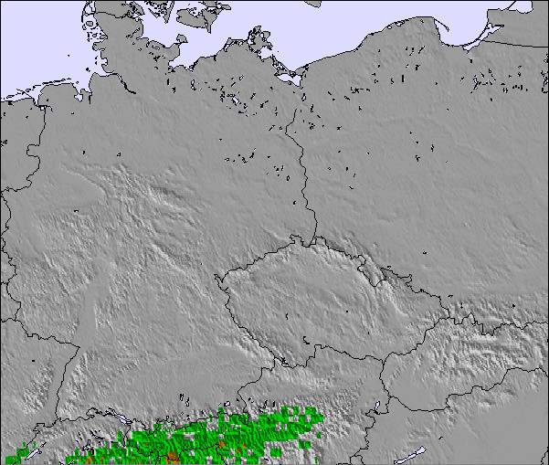
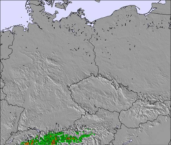
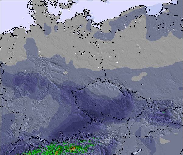
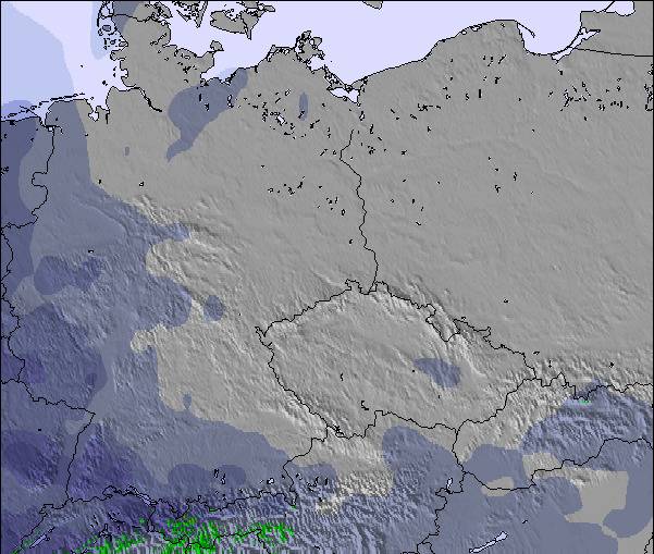
Mapa de Nieve | 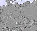 | 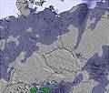 | 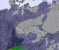 | 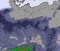 | 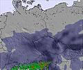 | 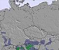 | ||||||||||||
— | — | — | — | — | — | — | — | — | — | — | — | — | — | — | — | — | — | |
mm | — | 2 | — | — | — | — | — | — | — | — | — | — | — | — | — | 1 | 4 | 5 |
max °C | 13 | 15 | 12 | 14 | 15 | 13 | 10 | 12 | 10 | 13 | 17 | 14 | 17 | 20 | 17 | 14 | 16 | 14 |
min °C | 10 | 13 | 9 | 11 | 15 | 7 | 9 | 11 | 7 | 10 | 16 | 10 | 13 | 20 | 14 | 12 | 13 | 9 |
chill °C | 10 | 11 | 8 | 9 | 14 | 3 | 6 | 9 | 5 | 9 | 16 | 10 | 13 | 20 | 12 | 10 | 13 | 6 |
Humed. % | 70 | 69 | 65 | 58 | 56 | 79 | 83 | 73 | 75 | 61 | 45 | 54 | 48 | 36 | 42 | 87 | 79 | 94 |
Altura de Hielo m | 2800 | 2700 | 2550 | 2800 | 2900 | 2800 | 2600 | 2700 | 2550 | 3100 | 3350 | 3600 | 3700 | 3800 | 3850 | 3350 | 3400 | 3150 |
5:24 | — | — | 5:26 | — | — | 5:26 | — | — | 5:28 | — | — | 5:28 | — | — | 5:31 | — | — | |
— | — | 9:01 | — | — | 9:00 | — | — | 8:59 | — | — | 8:58 | — | — | 8:57 | — | — | 8:55 | |
Hazte pro y carve en:
Información de avalanchas: European Avalanche Warning Services (EAWS)
Ultimo parte de nieve cerca Arber:
| Profundidad de nieve arriba: | 0 cm |
|---|---|
| Profundidad de nieve abajo: | 0 cm |
| Profundidad de la nevada fresca: | — |
| Última nevada: | 15 May 2026 |
0.0 | Dias de Nieve en Polvo Nieve fresca, mayormente soleado, viento suave. |
|---|---|
0.0 | Dias de nieve en polvo Nieve fresca, sol limitado, sin viento. |
0.0 | Dia perfecto para esquiar Nieve promedio, mayormente soleado, viento suave. |
La tabla anterior muestra el pronóstico de tiempo para Arber en la altitud específica de 1050 m. Nuestros modelos meteorológicos sofisticados permiten prever pronósticos para la cumbre, la mitad y la base de Arber. Para aceder a los pronósticos de tiempo a otras alturas, pinche en la navegación en la parte superior de la tabla. Para una visión general, consulte el Mapa meteorológico de Germany.
Pinche aquí para más información sobre niveles de congelación y sobre cómo pronosticamos las temperaturas.
Generalmente 3.4 En base a 11 votos y 1 comentario
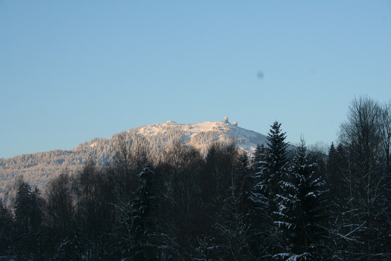
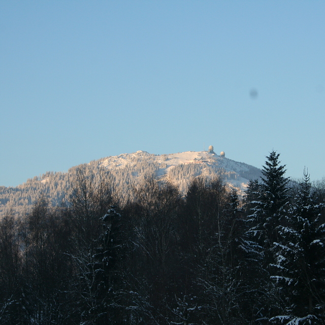
Arber is a smallish resort but the biggest in Germany outside the Alps. It has easy and difficult runs but go there low season to enjoy it because during high season it's extremely busy, especially when all the little ski areas in the region are shut due to lack of snow; queueing for 30 mins for 10 mins or less skiing is common. We've been twice,and experienced excellent snow conditions but you need patience waiting for uplift. The Arber is beautifully forested and the runs are scenic. Accommodation locally is excellent and good value with superb food. Arber is a great place to go for a couple of days but avoid busy periods.
Roger Pitman de United Kingdom escribe:
Arber is a smallish resort but the biggest in Germany outside the Alps. It has easy and difficult runs but go there low season to enjoy it because during high season it's extremely busy, especially when all the little ski areas in the region are shut due to lack of snow; queueing for 30 mins for 10 mins or less skiing is common. We've been twice,and experienced excellent snow conditions but you need patience waiting for uplift. The Arber is beautifully forested and the runs are scenic. Accommodation locally is excellent and good value with superb food. Arber is a great place to go for a couple of days but avoid busy periods.

 Nearest