

Portillo Re-Opens To Guests Arriving By Helicopter
Chile’s famous Portillo ski resort is reported to have re-opened to guests arriving by helicopter after being cut off by road for more than two weeks by over 6m/20 feet of snowfall.

Next 3 days weather summary:Fuerte lluvia (totál 35.0mm), más pesada durante la noche de miércoles. Muy templado (max 17°C el martes por la tarde, min 13°C el lunes por la noche). El viento será generalmente ligero. | Días 4-6 Resúmen del Tiempo para AndermattFuerte lluvia (totál 41.0mm), más pesada durante la noche de jueves. Muy templado (max 16°C el jueves por la mañana, min 10°C el jueves por la noche). El viento será generalmente ligero. | |||||||||||||||||
lunes 3 | martes 4 | miércoles 5 | jueves 6 | viernes 7 | sábado 8 | |||||||||||||
mañana | tarde | noche | mañana | tarde | noche | mañana | tarde | noche | mañana | tarde | noche | mañana | tarde | noche | mañana | tarde | noche | |
riesgo truenos | riesgo truenos | chuba scos | chuba scos | riesgo truenos | chuba scos | chuba scos | riesgo truenos | chuba scos | riesgo truenos | chuba scos | chuba scos | nubl ado | riesgo truenos | chuba scos | semi nublado | riesgo truenos | chuba scos | |
km/h | ||||||||||||||||||
Mapa de Nieve |  |  |  |  |  |  | ||||||||||||
— | — | — | — | — | — | — | — | — | — | — | — | — | — | — | — | — | — | |
mm | 3 | 5 | 6 | 1 | 1 | 4 | 1 | 7 | 7 | 1 | 12 | 17 | — | 2 | 1 | — | 5 | 3 |
max °C | 16 | 16 | 15 | 15 | 17 | 15 | 15 | 16 | 14 | 16 | 15 | 11 | 12 | 13 | 11 | 13 | 13 | 13 |
min °C | 14 | 16 | 13 | 14 | 17 | 14 | 14 | 15 | 13 | 14 | 13 | 10 | 10 | 12 | 11 | 11 | 13 | 12 |
chill °C | 14 | 16 | 12 | 14 | 17 | 14 | 14 | 15 | 13 | 14 | 13 | 10 | 10 | 12 | 11 | 11 | 13 | 12 |
Humed. % | 62 | 67 | 74 | 62 | 57 | 68 | 67 | 73 | 67 | 64 | 83 | 83 | 77 | 84 | 90 | 76 | 80 | 73 |
Altura de Hielo m | 4450 | 4450 | 4400 | 4300 | 4500 | 4400 | 4350 | 4500 | 4400 | 4300 | 4300 | 4200 | 4100 | 4100 | 4150 | 4050 | 4150 | 4200 |
6:07 | — | — | 6:07 | — | — | 6:09 | — | — | 6:11 | — | — | 6:11 | — | — | 6:13 | — | — | |
— | — | 8:54 | — | — | 8:52 | — | — | 8:52 | — | — | 8:50 | — | — | 8:49 | — | — | 8:46 | |
Hazte pro y carve en:
Información de avalanchas: European Avalanche Warning Services (EAWS)
Ultimo parte de nieve cerca Andermatt:
| Profundidad de nieve arriba: | 0 cm |
|---|---|
| Profundidad de nieve abajo: | 0 cm |
| Profundidad de la nevada fresca: | — |
| Última nevada: | 10 Jun 2026 |
0.0 | Dias de Nieve en Polvo Nieve fresca, mayormente soleado, viento suave. |
|---|---|
0.0 | Dias de nieve en polvo Nieve fresca, sol limitado, sin viento. |
0.0 | Dia perfecto para esquiar Nieve promedio, mayormente soleado, viento suave. |
La tabla anterior muestra el pronóstico de tiempo para Andermatt en la altitud específica de 2200 m. Nuestros modelos meteorológicos sofisticados permiten prever pronósticos para la cumbre, la mitad y la base de Andermatt. Para aceder a los pronósticos de tiempo a otras alturas, pinche en la navegación en la parte superior de la tabla. Para una visión general, consulte el Mapa meteorológico de Switzerland.
Pinche aquí para más información sobre niveles de congelación y sobre cómo pronosticamos las temperaturas.
Generalmente 3.9 En base a 24 votos y 15 comentarios
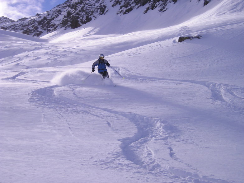
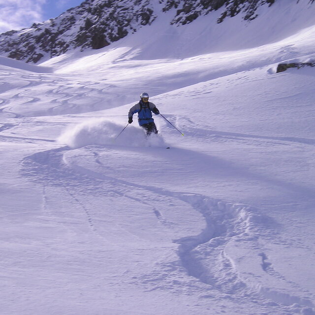
A quirky place, friendly village and different to other resorts. In fact, perhaps Andermatt is better described as a developing village that happens to have some fantastic opportunities for off-piste skiing/boarding on the doorstep. We didn't see a queue for any lift when we visited, it was the end of April though, and still we had some great conditions. New developments like the Chedi and Raddisson concert hall show there is investment and an attempt to bring a wealthy clientele to the area. Time will tell. For now it still has a different kind of charm, and did I mention the awesome off-piste?
PT de United Kingdom escribe:
A quirky place, friendly village and different to other resorts. In fact, perhaps Andermatt is better described as a developing village that happens to have some fantastic opportunities for off-piste skiing/boarding on the doorstep.
We didn't see a queue for any lift when we visited, it was the end of April though, and still we had some great conditions.
New developments like the Chedi and Raddisson concert hall show there is investment and an attempt to bring a wealthy clientele to the area. Time will tell. For now it still has a different kind of charm, and did I mention the awesome off-piste?
Lea 14 otras críticas de Andermatt o entrega su propio comentario


 Nearest