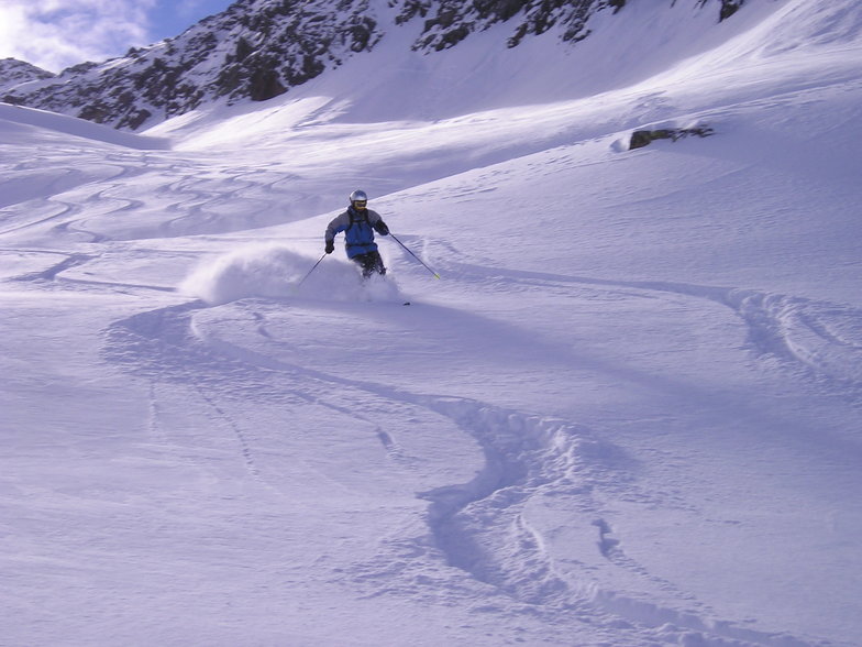


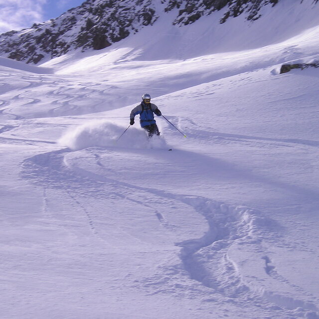
Portillo Storm Snowfall Total Passes 5m / 17 Feet
A snow storm that has now continued for nine days has taken Chilean ski resort Portillo to a snowfall total of 5.2 metres (17 feet) so far, with more snow forecast.

Next 4 days weather summary:Lluvia moderada (totál 14.0mm), más pesada el miércoles por la mañana. Cálido (max 27°C el jueves por la tarde, min 10°C el lunes por la noche). El viento será generalmente ligero. | Días 5-7 Resúmen del Tiempo para AndermattFuerte lluvia (totál 23.0mm), más pesada durante la tarde de sábado. Cálido (max 26°C el viernes por la tarde, min 15°C el sábado por la noche). El viento será generalmente ligero. | |||||||||||||||
martes 28 | miércoles 29 | jueves 30 | viernes 31 | sábado 1 | ||||||||||||
noche | mañana | tarde | noche | mañana | tarde | noche | mañana | tarde | noche | mañana | tarde | noche | mañana | tarde | noche | |
claro | claro | semi nublado | chuba scos | riesgo truenos | riesgo truenos | chuba scos | claro | claro | riesgo truenos | semi nublado | riesgo truenos | chuba scos | nubl ado | lluvia mod. | chuba scos | |
km/h | ||||||||||||||||
Mapa de Nieve |  |  |  |  |  |  | ||||||||||
— | — | — | — | — | — | — | — | — | — | — | — | — | — | — | — | |
mm | — | — | — | 2 | 4 | 5 | 3 | — | — | 3 | — | 1 | 4 | — | 7 | 5 |
max °C | 16 | 20 | 24 | 20 | 21 | 22 | 21 | 25 | 27 | 23 | 25 | 26 | 18 | 22 | 26 | 19 |
min °C | 10 | 15 | 23 | 15 | 18 | 22 | 16 | 20 | 27 | 17 | 20 | 24 | 17 | 20 | 18 | 15 |
chill °C | 10 | 15 | 23 | 15 | 18 | 22 | 16 | 20 | 27 | 17 | 20 | 24 | 17 | 20 | 18 | 15 |
Humed. % | 85 | 52 | 52 | 80 | 62 | 59 | 57 | 28 | 26 | 59 | 44 | 49 | 52 | 53 | 83 | 66 |
Altura de Hielo m | 4650 | 4600 | 4550 | 4450 | 4350 | 4450 | 4500 | 4600 | 4750 | 4550 | 4650 | 4650 | 4700 | 4550 | 4550 | 4700 |
— | 6:00 | — | — | 6:01 | — | — | 6:01 | — | — | 6:03 | — | — | 6:05 | — | — | |
— | — | — | 9:02 | — | — | 9:00 | — | — | 9:00 | — | — | 8:59 | — | — | 8:57 | |
Hazte pro y carve en:
Información de avalanchas: European Avalanche Warning Services (EAWS)
Ultimo parte de nieve cerca Andermatt:
| Profundidad de nieve arriba: | 0 cm |
|---|---|
| Profundidad de nieve abajo: | 0 cm |
| Profundidad de la nevada fresca: | — |
| Última nevada: | 10 Jun 2026 |
0.0 | Dias de Nieve en Polvo Nieve fresca, mayormente soleado, viento suave. |
|---|---|
0.0 | Dias de nieve en polvo Nieve fresca, sol limitado, sin viento. |
0.0 | Dia perfecto para esquiar Nieve promedio, mayormente soleado, viento suave. |
La tabla anterior muestra el pronóstico de tiempo para Andermatt en la altitud específica de 1436 m. Nuestros modelos meteorológicos sofisticados permiten prever pronósticos para la cumbre, la mitad y la base de Andermatt. Para aceder a los pronósticos de tiempo a otras alturas, pinche en la navegación en la parte superior de la tabla. Para una visión general, consulte el Mapa meteorológico de Switzerland.
Pinche aquí para más información sobre niveles de congelación y sobre cómo pronosticamos las temperaturas.
Generalmente 3.9 En base a 24 votos y 15 comentarios
I went to Andermatt late March/early April and skied mainly on Gemsstock and while the runs may not be as maintained as some of the larger European/American resorts, I had a great time. When we arrived there was about 6m of snow at mid-mountain and 2m at base. Over the 10 days we were there around 1.6m of snow fell and it was an incredible experience with all the fresh snow in the steep couloirs. The snow never seemed to get tracked out and there were absolutely no lift lines. Will definitely be coming back.
Jackson de Australia escribe:
I went to Andermatt late March/early April and skied mainly on Gemsstock and while the runs may not be as maintained as some of the larger European/American resorts, I had a great time. When we arrived there was about 6m of snow at mid-mountain and 2m at base. Over the 10 days we were there around 1.6m of snow fell and it was an incredible experience with all the fresh snow in the steep couloirs. The snow never seemed to get tracked out and there were absolutely no lift lines. Will definitely be coming back.
Lea 14 otras críticas de Andermatt o entrega su propio comentario


 Nearest