Previsión meteorológica para Meiringen en2432m altitud
Emitido: 7 am 31 Jul 2026 (hora local)
Previsión de nieve actualizada en hora Min
View forecast
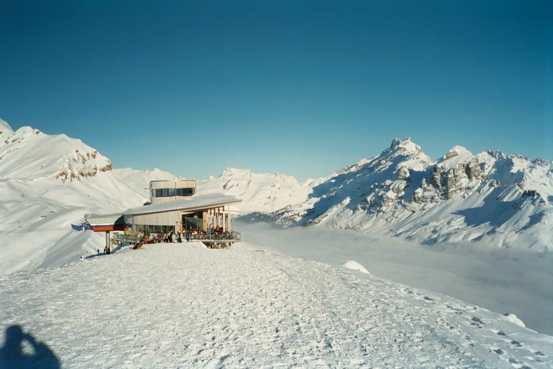
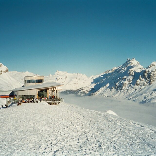
Meiringen-Haslibergat 2432 m altitud
Emitido por Snow-Forescast.com a:7 am (hora local) / 31 Jul 2026
Últimos 6 díasDesplázate a la izquierda para los últimos 6 díasAhora
Next 3 days weather summary:
Fuerte lluvia (totál 23.0mm), más pesada durante la tarde del viernes. Muy templado (max 17°C el viernes por la mañana, min 11°C el viernes por la tarde). El viento será generalmente ligero.
Días 4-6 Resúmen del Tiempo para Meiringen-Hasliberg
Fuerte lluvia (totál 20.0mm), más pesada durante la noche de miércoles. Muy templado (max 17°C el lunes por la tarde, min 14°C el lunes por la mañana). El viento será generalmente ligero.
La tabla anterior muestra el pronóstico de tiempo para Meiringen-Hasliberg en la altitud específica de 2432 m. Nuestros modelos meteorológicos sofisticados permiten prever pronósticos para la cumbre, la mitad y la base de Meiringen-Hasliberg. Para aceder a los pronósticos de tiempo a otras alturas, pinche en la navegación en la parte superior de la tabla. Para una visión general, consulte el Mapa meteorológico de Switzerland.
Pinche aquí para más información sobre niveles de congelación y sobre cómo pronosticamos las temperaturas.
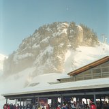
Nombre de la estación también escrito como Meiringen.
Comentarios de Visitantes para Meiringen-Hasliberg
Generalmente 4.1 En base a 14 votos y 3 comentarios
Stayed here 26Dec/3 nights at the Hotel Victoria, in Meiringen.
Enjoyed my stay here very much and 2 days on the slopes was enough here to cover the area. Great views, conditions, good runs, lifts.
Being a snowboarder though there were too many flat spots for my liking and the lifts were a bit spread out meaning walking between lifts sometimes.
Traditional resort, Swiss charm, had some sort of bell ringing tradition going on every night we were there. Enjoyed it but will probably try other resorts in the future and unlikely to go back here as a lot of other resorts in Switzerland to try!
Comentarios de Visitantes para Meiringen-Hasliberg
Generalmente: 4.1 En base a 14 votos y 3 comentarios
Nieve segura
4.1
Variedad de pistas
4.2
Fuera de pista
4.3
Escenografía
4.3
Después del esquí
2.9
christian de United Kingdom escribe:
Stayed here 26Dec/3 nights at the Hotel Victoria, in Meiringen.
Enjoyed my stay here very much and 2 days on the slopes was enough here to cover the area. Great views, conditions, good runs, lifts.
Being a snowboarder though there were too many flat spots for my liking and the lifts were a bit spread out meaning walking between lifts sometimes.
Traditional resort, Swiss charm, had some sort of bell ringing tradition going on every night we were there. Enjoyed it but will probably try other resorts in the future and unlikely to go back here as a lot of other resorts in Switzerland to try!
Gratis Snow-Forecast.com Widget del Tiempo para su sitio web
El widget del tiempo para esquiar para Meiringen-Hasliberg está disponible para ser empotrado en sitios web externos sin costo alguno. Proporciona un resumen diario de nuestro pronóstico de nieve en Meiringen-Hasliberg y estados de tiempo actuales. Vaya simplemente a la página para su configuración y siga los 3 pasos sencillos. Tome el código de transferencia del hipertexto y péguelo en su propio sitio web. Puede escoger la elevación en el pronóstico de nieve (cumbre, ascensor de medio-montaña o fondo) y unidades métrico/imperiales para el motor del pronóstico de nieve y convenir su propio website…. Click aquí para obtener el código


 Nearest