
North America Weekly Snow Roundup #321
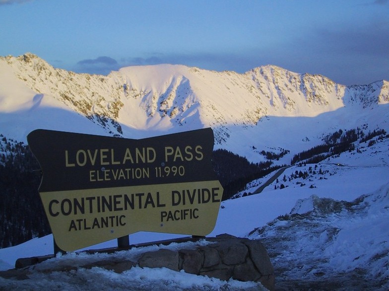
Weekly Snow News for North America, updated 2 July 2026: Beartooth Basin summer ski area ends 2026 season with fresh snow falling and Banff's Sunshine celebrates Canada Day on the slopes.

Next 3 days weather summary:Lluvia ligera (totál 6.0mm), cayendo mayormente el jueves por la tarde. Muy templado (max 19°C el martes por la mañana, min 7°C el martes por la noche). El viento será generalmente ligero. | Días 4-6 Resúmen del Tiempo para LovelandLluvia ligera (totál 2.0mm), cayendo mayormente el sábado por la tarde. Muy templado (max 19°C el sábado por la tarde, min 8°C el viernes por la noche). El viento será generalmente ligero. | |||||||||||||||||
martes 14 | miércoles 15 | jueves 16 | viernes 17 | sábado 18 | domingo 19 | |||||||||||||
mañana | tarde | noche | mañana | tarde | noche | mañana | tarde | noche | mañana | tarde | noche | mañana | tarde | noche | mañana | tarde | noche | |
claro | nubl ado | claro | claro | llovizna | claro | semi nublado | chuba scos | claro | semi nublado | semi nublado | claro | semi nublado | llovizna | semi nublado | semi nublado | llovizna | semi nublado | |
km/h | ||||||||||||||||||
Mapa de Nieve |  |  |  |  |  |  | ||||||||||||
— | — | — | — | — | — | — | — | — | — | — | — | — | — | — | — | — | — | |
mm | — | — | — | — | 2 | — | — | 4 | — | — | — | — | — | 1 | — | — | 1 | — |
max °C | 19 | 18 | 11 | 18 | 15 | 10 | 17 | 12 | 10 | 16 | 17 | 11 | 18 | 19 | 13 | 19 | 18 | 10 |
min °C | 15 | 17 | 7 | 14 | 14 | 8 | 13 | 11 | 8 | 13 | 16 | 8 | 14 | 18 | 9 | 16 | 17 | 9 |
chill °C | 15 | 17 | 7 | 14 | 13 | 8 | 13 | 10 | 8 | 13 | 16 | 8 | 14 | 18 | 9 | 16 | 17 | 9 |
Humed. % | 31 | 32 | 50 | 38 | 51 | 61 | 40 | 62 | 63 | 41 | 27 | 60 | 39 | 26 | 54 | 38 | 36 | 65 |
Altura de Hielo m | 5550 | 5600 | 4900 | 5450 | 5450 | 4950 | 5300 | 5250 | 4950 | 5450 | 5750 | 5150 | 5650 | 5850 | 5300 | 5600 | 5850 | 5300 |
5:47 | — | — | 5:48 | — | — | 5:48 | — | — | 5:48 | — | — | 5:50 | — | — | 5:50 | — | — | |
— | 8:30 | — | — | 8:30 | — | — | 8:30 | — | — | 8:29 | — | — | 8:28 | — | — | 8:28 | — | |
Hazte pro y carve en:
Información de avalanchas: Colorado Avalanche Information Center
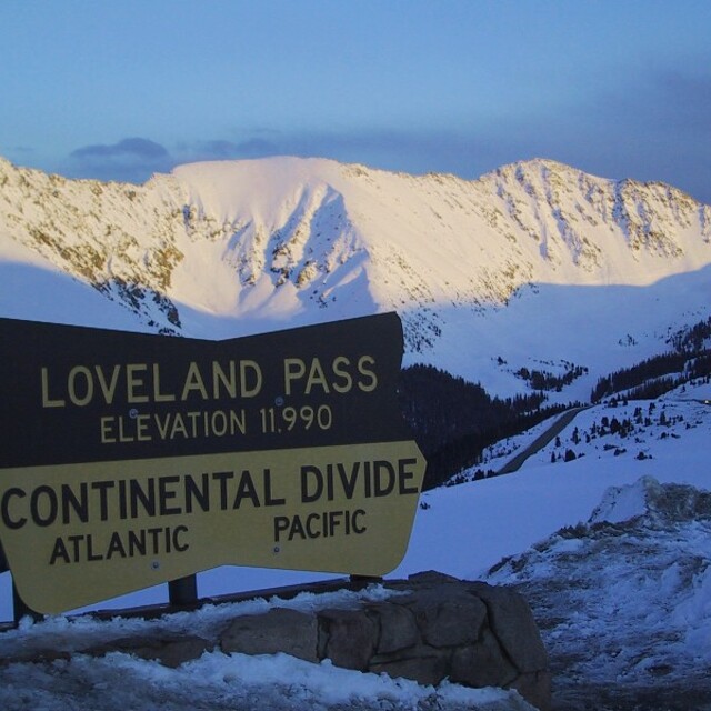
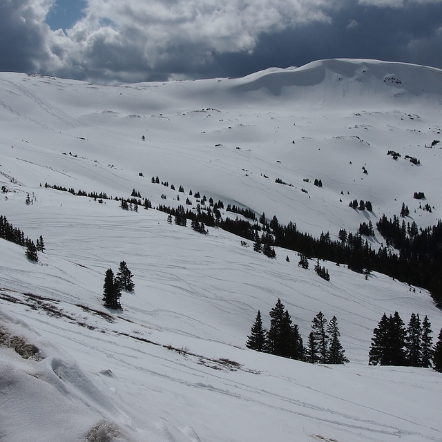
Ultimo parte de nieve cerca Loveland:
| Profundidad de nieve arriba: | 0 cm |
|---|---|
| Profundidad de nieve abajo: | 0 cm |
| Profundidad de la nevada fresca: | — |
| Última nevada: | 22 May 2026 |
0.0 | Dias de Nieve en Polvo Nieve fresca, mayormente soleado, viento suave. |
|---|---|
0.0 | Dias de nieve en polvo Nieve fresca, sol limitado, sin viento. |
0.0 | Dia perfecto para esquiar Nieve promedio, mayormente soleado, viento suave. |

La tabla anterior muestra el pronóstico de tiempo para Loveland en la altitud específica de 3551 m. Nuestros modelos meteorológicos sofisticados permiten prever pronósticos para la cumbre, la mitad y la base de Loveland. Para aceder a los pronósticos de tiempo a otras alturas, pinche en la navegación en la parte superior de la tabla. Para una visión general, consulte el Mapa meteorológico de United States.
Pinche aquí para más información sobre niveles de congelación y sobre cómo pronosticamos las temperaturas.
Generalmente 3.5 En base a 12 votos.

 Nearest