

Portillo Storm Snowfall Total Passes 5m / 17 Feet
A snow storm that has now continued for nine days has taken Chilean ski resort Portillo to a snowfall total of 5.2 metres (17 feet) so far, with more snow forecast.

Next 4 days weather summary:Mayormente seco. Cálido (max 29°C el jueves por la tarde, min 17°C el martes por la noche). El viento será generalmente ligero. | Días 5-7 Resúmen del Tiempo para ChampoussinLluvia ligera (totál 6.0mm), cayendo mayormente el sábado por la mañana. Cálido (max 28°C el domingo por la tarde, min 17°C el sábado por la noche). El viento será generalmente ligero. | |||||||||||||||
miércoles 29 | jueves 30 | viernes 31 | sábado 1 | domingo 2 | ||||||||||||
noche | mañana | tarde | noche | mañana | tarde | noche | mañana | tarde | noche | mañana | tarde | noche | mañana | tarde | noche | |
claro | claro | claro | claro | claro | claro | nubl ado | semi nublado | semi nublado | chuba scos | chuba scos | claro | chuba scos | claro | claro | semi nublado | |
km/h | ||||||||||||||||
Mapa de Nieve |  |  |  |  |  |  | ||||||||||
— | — | — | — | — | — | — | — | — | — | — | — | — | — | — | — | |
mm | — | — | — | — | — | — | — | — | — | 1 | 2 | — | 1 | — | — | — |
max °C | 21 | 24 | 27 | 23 | 27 | 29 | 24 | 27 | 29 | 21 | 23 | 26 | 22 | 25 | 28 | 24 |
min °C | 17 | 19 | 27 | 18 | 20 | 29 | 19 | 21 | 23 | 18 | 18 | 26 | 17 | 19 | 28 | 18 |
chill °C | 17 | 19 | 27 | 18 | 20 | 29 | 19 | 21 | 23 | 18 | 18 | 26 | 17 | 19 | 28 | 18 |
Humed. % | 57 | 46 | 26 | 32 | 23 | 22 | 38 | 33 | 45 | 50 | 50 | 36 | 58 | 39 | 28 | 48 |
Altura de Hielo m | 4500 | 4400 | 4500 | 4700 | 4600 | 4700 | 4750 | 4650 | 4450 | 4600 | 4400 | 4550 | 4600 | 4500 | 4650 | 4550 |
— | 6:09 | — | — | 6:11 | — | — | 6:11 | — | — | 6:13 | — | — | 6:13 | — | — | |
— | — | — | 9:07 | — | — | 9:06 | — | — | 9:05 | — | — | 9:02 | — | — | 9:01 | |
Hazte pro y carve en:
Información de avalanchas: European Avalanche Warning Services (EAWS)
Ultimo parte de nieve cerca Champoussin:
No information received. Another glorious day. desde La Giettaz en Aravis
| Profundidad de nieve arriba: | — |
|---|---|
| Profundidad de nieve abajo: | — |
| Profundidad de la nevada fresca: | — |
| Última nevada: | 16 May 2026 |
0.0 | Dias de Nieve en Polvo Nieve fresca, mayormente soleado, viento suave. |
|---|---|
0.0 | Dias de nieve en polvo Nieve fresca, sol limitado, sin viento. |
0.0 | Dia perfecto para esquiar Nieve promedio, mayormente soleado, viento suave. |
La tabla anterior muestra el pronóstico de tiempo para Champoussin en la altitud específica de 1310 m. Nuestros modelos meteorológicos sofisticados permiten prever pronósticos para la cumbre, la mitad y la base de Champoussin. Para aceder a los pronósticos de tiempo a otras alturas, pinche en la navegación en la parte superior de la tabla. Para una visión general, consulte el Mapa meteorológico de Switzerland.
Pinche aquí para más información sobre niveles de congelación y sobre cómo pronosticamos las temperaturas.
Generalmente 4.1 En base a 6 votos y 7 comentarios
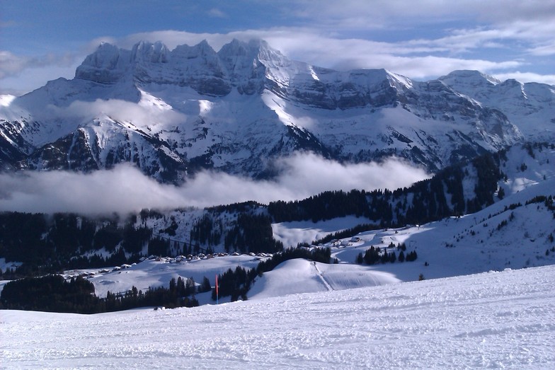
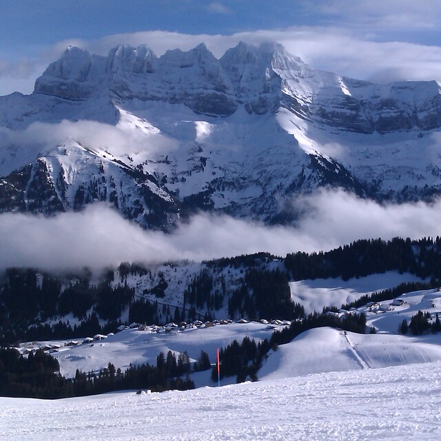
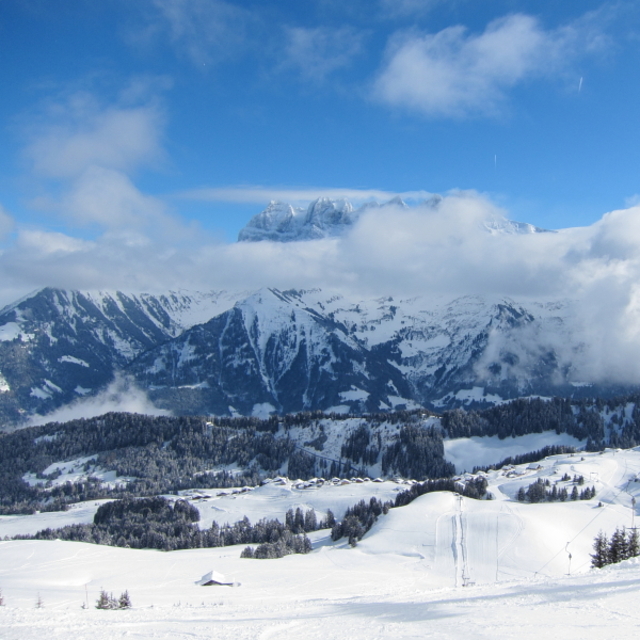
Champoussin was originally built around a Nederlands Ski-Club shed (now derelict), there are still more Dutch visitors than other nationalities, but increasing numbers of English as well in the last five years (we have an apartment there!). Skiing is best for intermediate skiers, with easy half-day access to a good variety of blue and red runs and a couple of black, between Les Crosets and Morgins. There are also short and highly visible off-piste areas. Go out for the day, and you have the full Portes de Soleil in reach. Nowhere in Champoussin is more than 100m from the piste. There are also snow-shoe trails, and a 3km sledge run (return by bus). The village has half a dozen bars and restaurants, but is mainly a family resort. There are a couple of ski shops, and a single general supplies shop. The road to Champoussin is narrow and winding, but locals (including the bus) drive it as if on a motorway. The nearest towns (Champery and Monthey) are 30 min by car – but snow chains may be needed (20% probability?) if you have no snow tyres. Geneva airport is 1h40m by car in good conditions, but can be reached by public transport in 3 hours (bus to Val d’Illiez, funicular to Aigle and main-line train to Geneva airport). Tim Lowe, Surrey
Tim Lowe de United Kingdom escribe:
Champoussin was originally built around a Nederlands Ski-Club shed (now derelict), there are still more Dutch visitors than other nationalities, but increasing numbers of English as well in the last five years (we have an apartment there!). Skiing is best for intermediate skiers, with easy half-day access to a good variety of blue and red runs and a couple of black, between Les Crosets and Morgins. There are also short and highly visible off-piste areas. Go out for the day, and you have the full Portes de Soleil in reach. Nowhere in Champoussin is more than 100m from the piste. There are also snow-shoe trails, and a 3km sledge run (return by bus). The village has half a dozen bars and restaurants, but is mainly a family resort. There are a couple of ski shops, and a single general supplies shop. The road to Champoussin is narrow and winding, but locals (including the bus) drive it as if on a motorway. The nearest towns (Champery and Monthey) are 30 min by car – but snow chains may be needed (20% probability?) if you have no snow tyres. Geneva airport is 1h40m by car in good conditions, but can be reached by public transport in 3 hours (bus to Val d’Illiez, funicular to Aigle and main-line train to Geneva airport).
Tim Lowe, Surrey
Lea 6 otras críticas de Champoussin o entrega su propio comentario


 Nearest