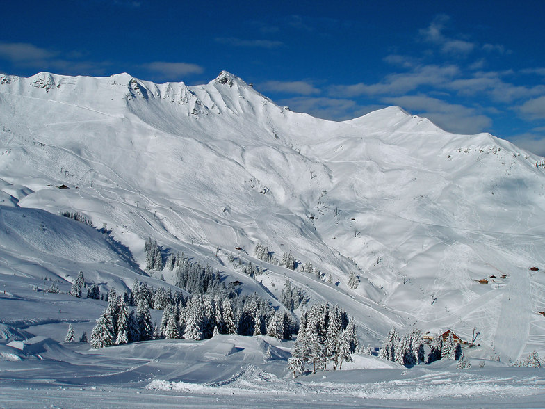


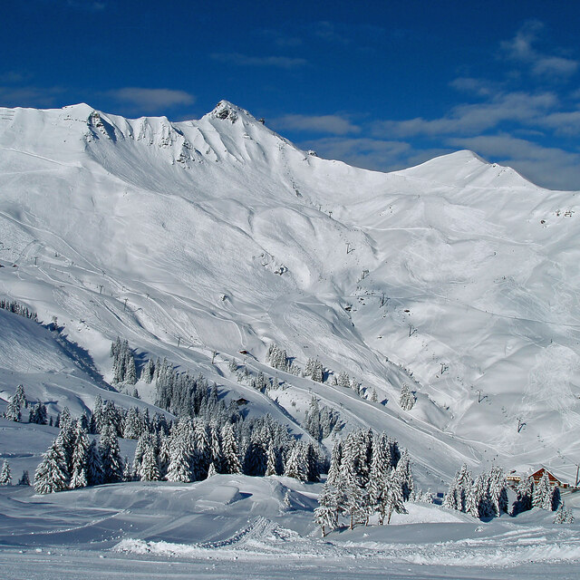
Portillo Storm Snowfall Total Passes 5m / 17 Feet
A snow storm that has now continued for nine days has taken Chilean ski resort Portillo to a snowfall total of 5.2 metres (17 feet) so far, with more snow forecast.

Next 4 days weather summary:Mayormente seco. Cálido (max 31°C el jueves por la tarde, min 13°C el lunes por la noche). El viento será generalmente ligero. | Días 5-7 Resúmen del Tiempo para ChampéryLluvia ligera (totál 7.0mm), cayendo mayormente el sábado por la noche. Cálido (max 31°C el viernes por la tarde, min 17°C el sábado por la noche). El viento será generalmente ligero. | |||||||||||||||
martes 28 | miércoles 29 | jueves 30 | viernes 31 | sábado 1 | ||||||||||||
noche | mañana | tarde | noche | mañana | tarde | noche | mañana | tarde | noche | mañana | tarde | noche | mañana | tarde | noche | |
claro | claro | claro | semi nublado | claro | claro | claro | claro | claro | chuba scos | semi nublado | semi nublado | semi nublado | chuba scos | semi nublado | chuba scos | |
km/h | ||||||||||||||||
Mapa de Nieve |  |  |  |  |  |  | ||||||||||
— | — | — | — | — | — | — | — | — | — | — | — | — | — | — | — | |
mm | — | — | — | — | — | — | — | — | — | 1 | — | — | — | 1 | — | 4 |
max °C | 19 | 23 | 27 | 23 | 26 | 28 | 24 | 29 | 31 | 26 | 27 | 31 | 25 | 28 | 31 | 22 |
min °C | 13 | 17 | 26 | 18 | 20 | 28 | 19 | 21 | 31 | 19 | 22 | 29 | 20 | 21 | 30 | 17 |
chill °C | 13 | 17 | 26 | 18 | 20 | 28 | 19 | 21 | 31 | 19 | 22 | 29 | 20 | 21 | 30 | 17 |
Humed. % | 78 | 50 | 44 | 58 | 48 | 28 | 36 | 24 | 23 | 46 | 40 | 33 | 40 | 36 | 29 | 51 |
Altura de Hielo m | 4800 | 4700 | 4650 | 4500 | 4450 | 4550 | 4700 | 4650 | 4700 | 4700 | 4650 | 4700 | 4700 | 4550 | 4700 | 4700 |
— | 6:09 | — | — | 6:09 | — | — | 6:11 | — | — | 6:11 | — | — | 6:13 | — | — | |
— | — | — | 9:07 | — | — | 9:07 | — | — | 9:06 | — | — | 9:05 | — | — | 9:02 | |
Hazte pro y carve en:
Información de avalanchas: European Avalanche Warning Services (EAWS)
Ultimo parte de nieve cerca Champéry:
No information received. Another glorious day. desde La Giettaz en Aravis
| Profundidad de nieve arriba: | 122 cm |
|---|---|
| Profundidad de nieve abajo: | 93 cm |
| Profundidad de la nevada fresca: | — |
| Última nevada: | 16 May 2026 |
0.0 | Dias de Nieve en Polvo Nieve fresca, mayormente soleado, viento suave. |
|---|---|
0.0 | Dias de nieve en polvo Nieve fresca, sol limitado, sin viento. |
0.0 | Dia perfecto para esquiar Nieve promedio, mayormente soleado, viento suave. |

La tabla anterior muestra el pronóstico de tiempo para Champéry en la altitud específica de 1040 m. Nuestros modelos meteorológicos sofisticados permiten prever pronósticos para la cumbre, la mitad y la base de Champéry. Para aceder a los pronósticos de tiempo a otras alturas, pinche en la navegación en la parte superior de la tabla. Para una visión general, consulte el Mapa meteorológico de Switzerland.
Pinche aquí para más información sobre niveles de congelación y sobre cómo pronosticamos las temperaturas.
Nombre de la estación también escrito como Champery.
Generalmente 4.1 En base a 20 votos y 12 comentarios
Have been to Champery over the last six years or so and have never skied such a large linked resort. You can spend most of a week there and hardly ski the same run twice. The village itself is quiet, even in high season; it feels fairly empty and you don't see many youngsters about 'till gone midnight. That said, there is plenty of places to get a few beers! You can get two types of lift passes, Swiss side or the Porters de Soleil pass which covers the French resorts which are a little higher with the snow being better if the season is not very snowy. All in all, if you like skiing more than nightlife this is a great place to ski, and if you get the train from Genova, like we do, it follows lake Carman then takes you up the mountains. The scenery is beautiful; no better way to start a ski break.
Ben Amos, bedfordshire de United Kingdom escribe:
Have been to Champery over the last six years or so and have never skied such a large linked resort. You can spend most of a week there and hardly ski the same run twice. The village itself is quiet, even in high season; it feels fairly empty and you don't see many youngsters about 'till gone midnight. That said, there is plenty of places to get a few beers!
You can get two types of lift passes, Swiss side or the Porters de Soleil pass which covers the French resorts which are a little higher with the snow being better if the season is not very snowy.
All in all, if you like skiing more than nightlife this is a great place to ski, and if you get the train from Genova, like we do, it follows lake Carman then takes you up the mountains. The scenery is beautiful; no better way to start a ski break.
Lea 11 otras críticas de Champéry o entrega su propio comentario


 Nearest