

Portillo Storm Snowfall Total Passes 5m / 17 Feet
A snow storm that has now continued for nine days has taken Chilean ski resort Portillo to a snowfall total of 5.2 metres (17 feet) so far, with more snow forecast.

Next 4 days weather summary:Lluvia ligera (totál 8.0mm), cayendo mayormente el miércoles por la tarde. Muy templado (max 14°C el jueves por la tarde, min 7°C el lunes por la noche). El viento será generalmente ligero. | Días 5-7 Resúmen del Tiempo para ArosaFuerte lluvia (totál 20.0mm), más pesada durante la noche de sábado. Muy templado (max 15°C el viernes por la tarde, min 10°C el sábado por la noche). El viento será generalmente ligero. | |||||||||||||||
martes 28 | miércoles 29 | jueves 30 | viernes 31 | sábado 1 | ||||||||||||
noche | mañana | tarde | noche | mañana | tarde | noche | mañana | tarde | noche | mañana | tarde | noche | mañana | tarde | noche | |
claro | claro | claro | claro | riesgo truenos | riesgo truenos | chuba scos | claro | claro | semi nublado | claro | riesgo truenos | chuba scos | semi nublado | llovizna | chuba scos | |
km/h | ||||||||||||||||
Mapa de Nieve |  |  |  |  |  |  | ||||||||||
— | — | — | — | — | — | — | — | — | — | — | — | — | — | — | — | |
mm | — | — | — | — | 1 | 3 | 4 | — | — | — | — | 1 | 5 | — | 1 | 11 |
max °C | 9 | 11 | 13 | 11 | 10 | 11 | 11 | 12 | 14 | 14 | 13 | 15 | 11 | 12 | 14 | 12 |
min °C | 7 | 10 | 11 | 9 | 9 | 11 | 10 | 11 | 13 | 12 | 13 | 13 | 11 | 12 | 13 | 10 |
chill °C | 6 | 10 | 11 | 9 | 9 | 11 | 10 | 10 | 13 | 12 | 13 | 12 | 8 | 11 | 12 | 8 |
Humed. % | 42 | 32 | 64 | 80 | 79 | 78 | 67 | 41 | 39 | 50 | 50 | 59 | 68 | 64 | 61 | 55 |
Altura de Hielo m | 4500 | 4550 | 4600 | 4450 | 4350 | 4500 | 4400 | 4600 | 4750 | 4600 | 4700 | 4750 | 4650 | 4550 | 4700 | 4650 |
— | 5:54 | — | — | 5:56 | — | — | 5:58 | — | — | 5:58 | — | — | 6:00 | — | — | |
— | — | — | 8:59 | — | — | 8:57 | — | — | 8:55 | — | — | 8:54 | — | — | 8:53 | |
Hazte pro y carve en:
Información de avalanchas: European Avalanche Warning Services (EAWS)
Ultimo parte de nieve cerca Arosa:
| Profundidad de nieve arriba: | 0 cm |
|---|---|
| Profundidad de nieve abajo: | 0 cm |
| Profundidad de la nevada fresca: | — |
| Última nevada: | 10 Jun 2026 |
0.1 | Dias de Nieve en Polvo Nieve fresca, mayormente soleado, viento suave. |
|---|---|
0.1 | Dias de nieve en polvo Nieve fresca, sol limitado, sin viento. |
0.2 | Dia perfecto para esquiar Nieve promedio, mayormente soleado, viento suave. |

La tabla anterior muestra el pronóstico de tiempo para Arosa en la altitud específica de 2865 m. Nuestros modelos meteorológicos sofisticados permiten prever pronósticos para la cumbre, la mitad y la base de Arosa. Para aceder a los pronósticos de tiempo a otras alturas, pinche en la navegación en la parte superior de la tabla. Para una visión general, consulte el Mapa meteorológico de Switzerland.
Pinche aquí para más información sobre niveles de congelación y sobre cómo pronosticamos las temperaturas.
Generalmente 4.4 En base a 20 votos y 12 comentarios
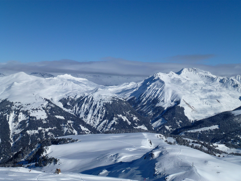
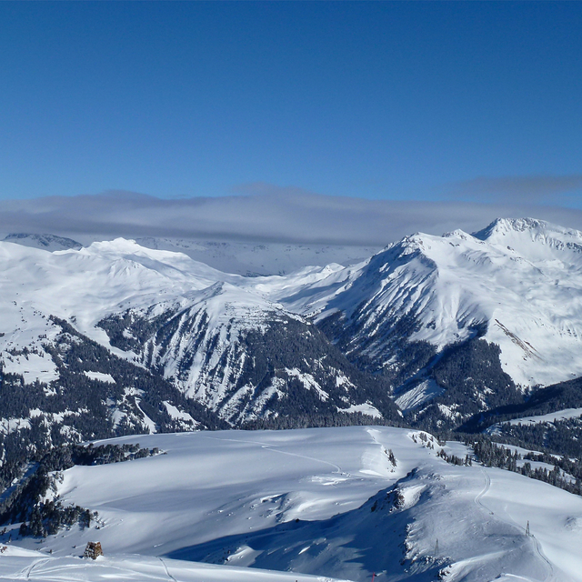
Arosa is a lovely place to ski. Great for families with varied slopes including a snow park and tracks through trees that little ones love. The shops are limited for gifts and it feels retro rather than traditional Alpine, yet Arosa has beautiful views which make up for this. Eating out is limited and quite expensive. Few places meant we found it hard to get a table in the village at lunch times, yet up the mountain was fine.
myko de United Kingdom escribe:
Arosa is a lovely place to ski. Great for families with varied slopes including a snow park and tracks through trees that little ones love. The shops are limited for gifts and it feels retro rather than traditional Alpine, yet Arosa has beautiful views which make up for this. Eating out is limited and quite expensive. Few places meant we found it hard to get a table in the village at lunch times, yet up the mountain was fine.
Lea 11 otras críticas de Arosa o entrega su propio comentario


 Nearest