
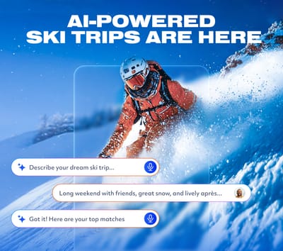
Is AI About to Change How We Plan Ski Trips?
Meet WeSki.ai - the new AI-powered trip planner from the ski experts at WeSki that turns your ideas into a fully planned ski trip in seconds, simply by describing what you want.

Next 3 days weather summary:Pesada caída de nieve, más pesada durante la tarde de jueves. condiciones de congelación y descongelación (max 1°C el miércoles por la tarde, min -6°C el martes por la mañana). El viento será generalmente ligero. | Days 4-6 weather summary:Caída moderada de nieve, más pesada el viernes por la noche. Temperaturas serán bajo cero (max 0°C el domingo por la tarde, min -5°C el viernes por la noche). El viento será generalmente ligero. | |||||||||||||||||
Tuesday 12 | Wednesday 13 | Thursday 14 | Friday 15 | Saturday 16 | Sunday 17 | |||||||||||||
mañana | tarde | noche | mañana | tarde | noche | mañana | tarde | noche | mañana | tarde | noche | mañana | tarde | noche | mañana | tarde | noche | |
nieve ligera | nevadas | semi nublado | semi nublado | nubl ado | nieve ligera | nieve ligera | nieve mod. | nieve mod. | nieve ligera | nieve ligera | nieve mod. | nieve ligera | nieve ligera | nieve ligera | semi nublado | nevadas | nevadas | |
km/h | ||||||||||||||||||
Snow map |  |  |  |  |  |  | ||||||||||||
4 | 1 | — | — | — | 1 | 3 | 6 | 7 | 2 | 2 | 5 | 2 | 1 | — | — | — | — | |
— | — | — | — | — | — | — | — | — | — | — | — | — | — | — | — | — | — | |
max °C | -5 | -5 | -3 | -1 | 1 | 0 | -2 | -3 | -3 | -4 | -3 | -4 | -4 | -3 | -3 | -2 | 0 | 0 |
min °C | -6 | -6 | -3 | -2 | 0 | -2 | -2 | -3 | -4 | -4 | -3 | -5 | -5 | -4 | -5 | -4 | -1 | -2 |
-12 | -11 | -3 | -2 | 0 | -5 | -2 | -3 | -7 | -4 | -7 | -10 | -10 | -8 | -5 | -4 | -1 | -2 | |
88 | 78 | 54 | 63 | 82 | 97 | 98 | 97 | 97 | 97 | 87 | 97 | 96 | 83 | 79 | 76 | 80 | 86 | |
1350 | 1600 | 1100 | 2000 | 2250 | 1950 | 1800 | 1700 | 1500 | 1650 | 1700 | 1500 | 1550 | 1750 | 1500 | 1900 | 2250 | 1750 | |
5:50 | — | — | 5:50 | — | — | 5:48 | — | — | 5:47 | — | — | 5:46 | — | — | 5:45 | — | — | |
— | — | 8:44 | — | — | 8:45 | — | — | 8:46 | — | — | 8:47 | — | — | 8:49 | — | — | 8:51 | |
Ultimo parte de nieve cerca Arosa:
Light snow reported from Samedan Airport at 1706 metres elevation one km E of Samedan/Engadin Ski Resort desde Samedan/Engadin
Light snow reported from Samedan Airport at 1706 metres elevation one km E of Samedan/Engadin but it is probably falling as rain apart from near the top of the ski area desde Samedan/Engadin
Light rain reported from Samedan Airport at 1706 metres elevation only 3 kms NE of Corviglia-Marguns but it is forecast cold enough for snow at higher elevations in the ski area desde Corviglia-Marguns
| Profundidad de nieve arriba: | — |
|---|---|
| Profundidad de nieve abajo: | — |
| Profundidad de la nevada fresca: | 13 cm |
| Última nevada: | 11 May 2026 |
0.2 | Dias de Nieve en Polvo Nieve fresca, mayormente soleado, viento suave. |
|---|---|
0.5 | Dias de nieve en polvo Nieve fresca, sol limitado, sin viento. |
0.1 | Dia perfecto para esquiar Nieve promedio, mayormente soleado, viento suave. |

La tabla anterior muestra el pronóstico de tiempo para Arosa en la altitud específica de 2179 m. Nuestros modelos meteorológicos sofisticados permiten prever pronósticos para la cumbre, la mitad y la base de Arosa. Para aceder a los pronósticos de tiempo a otras alturas, pinche en la navegación en la parte superior de la tabla. Para una visión general, consulte el Mapa meteorológico de Switzerland.
Pinche aquí para más información sobre niveles de congelación y sobre cómo pronosticamos las temperaturas.
Generalmente 4.4 En base a 20 votos y 12 comentarios
I am coming to Arosa with my family on my winter holiday for 4 years. Everything is not good but perfect.
Jacek de Poland escribe:
I am coming to Arosa with my family on my winter holiday for 4 years. Everything is not good but perfect.
Lea 11 otras críticas de Arosa o entrega su propio comentario


 Nearest