

Portillo Re-Opens To Guests Arriving By Helicopter
Chile’s famous Portillo ski resort is reported to have re-opened to guests arriving by helicopter after being cut off by road for more than two weeks by over 6m/20 feet of snowfall.

Next 3 days weather summary:Lluvia moderada (totál 14.0mm), más pesada el miércoles por la tarde. Cálido (max 21°C el martes por la tarde, min 14°C el miércoles por la noche). El viento será generalmente ligero. | Días 4-6 Resúmen del Tiempo para Alpe di SiusiFuerte lluvia (totál 31.0mm), más pesada durante la tarde del viernes. Cálido (max 21°C el jueves por la tarde, min 12°C el jueves por la noche). El viento será generalmente ligero. | ||||||||||||||||
lun 3 | martes 4 | miércoles 5 | jueves 6 | viernes 7 | sábado 8 | ||||||||||||
tarde | noche | mañana | tarde | noche | mañana | tarde | noche | mañana | tarde | noche | mañana | tarde | noche | mañana | tarde | noche | |
claro | claro | claro | riesgo truenos | chuba scos | claro | riesgo truenos | chuba scos | riesgo truenos | riesgo truenos | chuba scos | riesgo truenos | riesgo truenos | chuba scos | riesgo truenos | riesgo truenos | chuba scos | |
km/h | |||||||||||||||||
Mapa de Nieve |  |  |  |  |  |  | |||||||||||
— | — | — | — | — | — | — | — | — | — | — | — | — | — | — | — | — | |
mm | — | — | — | 1 | 1 | — | 7 | 4 | 1 | 2 | 4 | 2 | 7 | 5 | 1 | 5 | 5 |
max °C | 20 | 19 | 19 | 21 | 18 | 19 | 21 | 16 | 19 | 21 | 16 | 14 | 17 | 14 | 16 | 18 | 15 |
min °C | 20 | 15 | 16 | 20 | 15 | 16 | 17 | 14 | 16 | 17 | 12 | 12 | 17 | 12 | 13 | 17 | 12 |
chill °C | 20 | 15 | 16 | 20 | 15 | 16 | 17 | 14 | 16 | 17 | 12 | 12 | 17 | 12 | 13 | 17 | 12 |
Humed. % | 49 | 63 | 52 | 51 | 72 | 52 | 69 | 70 | 55 | 64 | 81 | 76 | 67 | 81 | 65 | 68 | 76 |
Altura de Hielo m | 4500 | 4400 | 4400 | 4550 | 4400 | 4500 | 4500 | 4500 | 4400 | 4500 | 4350 | 4250 | 4200 | 4250 | 4150 | 4300 | 4300 |
— | — | 5:56 | — | — | 5:58 | — | — | 5:58 | — | — | 6:01 | — | — | 6:01 | — | — | |
— | 8:43 | — | — | 8:40 | — | — | 8:39 | — | — | 8:37 | — | — | 8:37 | — | — | 8:35 | |
Hazte pro y carve en:
Información de avalanchas: European Avalanche Warning Services (EAWS)
Ultimo parte de nieve cerca Alpe di Siusi:
| Profundidad de nieve arriba: | 0 cm |
|---|---|
| Profundidad de nieve abajo: | 0 cm |
| Profundidad de la nevada fresca: | — |
| Última nevada: | 10 Jun 2026 |
0.0 | Dias de Nieve en Polvo Nieve fresca, mayormente soleado, viento suave. |
|---|---|
0.0 | Dias de nieve en polvo Nieve fresca, sol limitado, sin viento. |
0.0 | Dia perfecto para esquiar Nieve promedio, mayormente soleado, viento suave. |
La tabla anterior muestra el pronóstico de tiempo para Alpe di Siusi en la altitud específica de 1905 m. Nuestros modelos meteorológicos sofisticados permiten prever pronósticos para la cumbre, la mitad y la base de Alpe di Siusi. Para aceder a los pronósticos de tiempo a otras alturas, pinche en la navegación en la parte superior de la tabla. Para una visión general, consulte el Mapa meteorológico de Italy.
Pinche aquí para más información sobre niveles de congelación y sobre cómo pronosticamos las temperaturas.
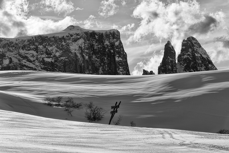
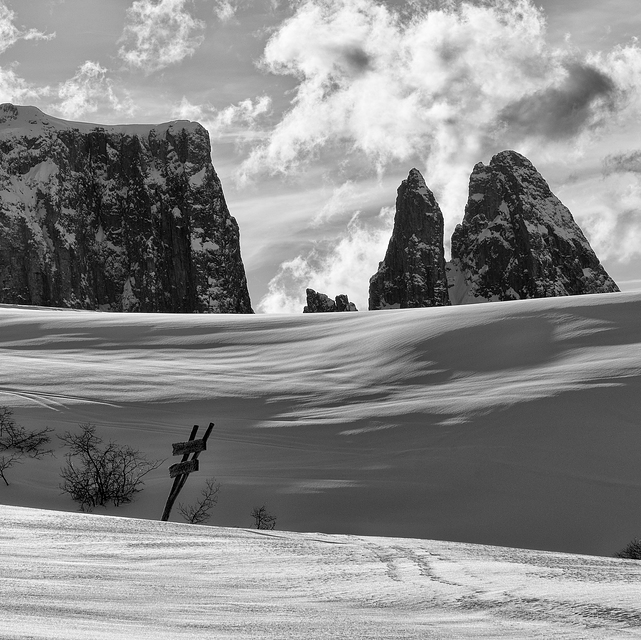
Nombre de la estación también escrito como Alpe Di Siusi.
Generalmente 4.1 En base a 14 votos y 1 comentario
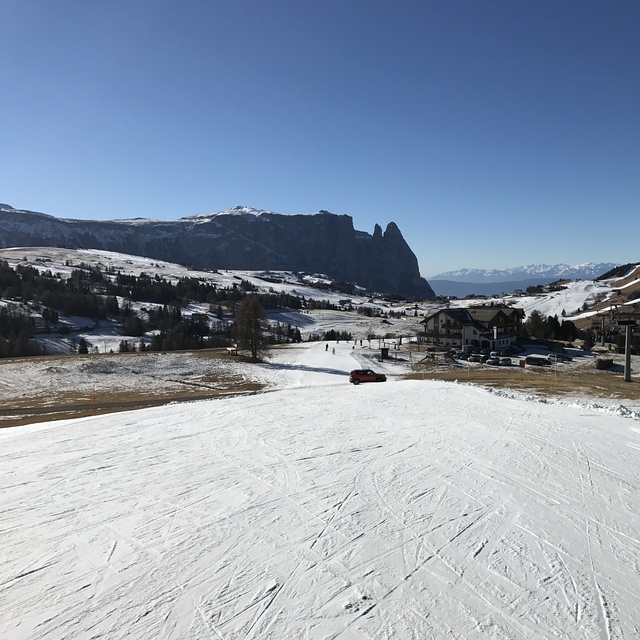
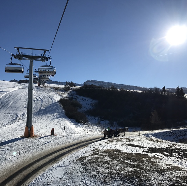
We have skied Alpe Di Siusi 2 years, both times in February. It is a lovely resort with great beginner and intermediate conditions. Not crowded, very scenic and picturesque. I love the wonderful Italian food available in the many small restaurants on the slopes. I am advanced/expert and so there is not much to challenge me but the entire Val Gardena area is close by and you can buy a Dolomite superski pass. One negative is, because the resort was built in organic fashion (used to be individual hotels with their own lifts), there is a bit more of flat areas between lifts than I would like. But it is a great family ski destination.
peter thomson de The Netherlands escribe:
We have skied Alpe Di Siusi 2 years, both times in February. It is a lovely resort with great beginner and intermediate conditions. Not crowded, very scenic and picturesque. I love the wonderful Italian food available in the many small restaurants on the slopes. I am advanced/expert and so there is not much to challenge me but the entire Val Gardena area is close by and you can buy a Dolomite superski pass. One negative is, because the resort was built in organic fashion (used to be individual hotels with their own lifts), there is a bit more of flat areas between lifts than I would like. But it is a great family ski destination.
Haz clic aquí para entregar su propio comentario de Alpe di Siusi


 Nearest