

Global Weekly Snow Roundup #314
Weekly Global Snow News, updated 14 May 2026: Fresh snowfall in Argentina, Australia and Lesotho signals winter’s approach, while Japan maintains the world’s deepest snowpack.

Next 4 days weather summary:Nueva capa fina de nieve, cayendo mayormente el lunes por la tarde. condiciones de congelación y descongelación (max 1°C el martes por la tarde, min -6°C el sábado por la noche). El viento será generalmente ligero. | Days 5-7 weather summary:Lluvia ligera (totál 3.0mm), cayendo mayormente el miércoles por la tarde. Muy templado (max 11°C el viernes por la tarde, min 1°C el martes por la noche). El viento será generalmente ligero. | |||||||||||||||
Sunday 17 | Monday 18 | Tuesday 19 | Wednesday 20 | Thursday 21 | ||||||||||||
noche | mañana | tarde | noche | mañana | tarde | noche | mañana | tarde | noche | mañana | tarde | noche | mañana | tarde | noche | |
nevadas | claro | nieve ligera | nieve ligera | nieve ligera | nieve mod. | nieve ligera | nubl ado | nieve ligera | nieve ligera | semi nublado | chuba scos | chuba scos | claro | semi nublado | claro | |
km/h | ||||||||||||||||
Snow map |  |  |  |  |  |  | ||||||||||
— | — | — | — | — | 6 | 2 | — | 1 | 1 | — | — | — | — | — | — | |
— | — | — | — | — | — | — | — | — | — | — | 2 | 1 | — | — | — | |
max °C | -5 | -2 | 0 | 0 | -2 | -1 | -2 | -1 | 1 | 1 | 2 | 4 | 4 | 6 | 8 | 8 |
min °C | -6 | -3 | -1 | -2 | -2 | -2 | -2 | -1 | 0 | 1 | 1 | 3 | 3 | 5 | 7 | 7 |
-9 | -3 | -1 | -4 | -4 | -4 | -4 | -3 | -3 | -2 | -2 | 1 | 1 | 4 | 7 | 7 | |
75 | 48 | 81 | 84 | 94 | 92 | 95 | 89 | 98 | 95 | 76 | 82 | 60 | 40 | 59 | 45 | |
1200 | 2150 | 2400 | 2150 | 2250 | 2250 | 2100 | 2400 | 2650 | 2600 | 2800 | 2950 | 3200 | 3500 | 3600 | 3850 | |
— | 5:52 | — | — | 5:50 | — | — | 5:48 | — | — | 5:48 | — | — | 5:47 | — | — | |
— | — | — | 8:57 | — | — | 8:58 | — | — | 8:59 | — | — | 9:00 | — | — | 9:00 | |
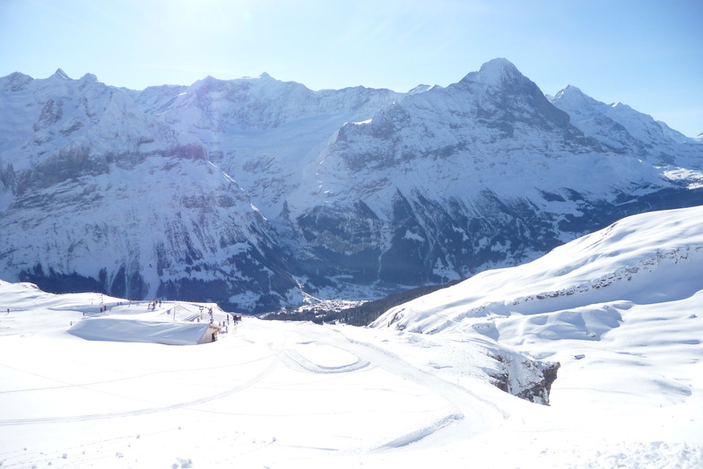
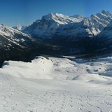
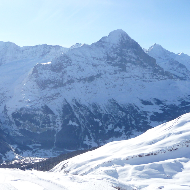
Ultimo parte de nieve cerca Grindelwald:
Light rain reported from Buochs Airport at 450 metres elevation 6 kms N of Dallenwil Wirzweli but it is forecast cold enough for snow at the ski area desde Dallenwil Wirzweli
Shower light rain shower reported from Alpnach Airport at 444 metres elevation only 4 kms SE of Pilatus / Luzern but it is forecast cold enough for snow at higher elevations in the ski area desde Pilatus / Luzern
Shower moderate rain shower reported from Alpnach Airport at 444 metres elevation only 4 kms SE of Pilatus / Luzern but it is forecast cold enough for snow at higher elevations in the ski area desde Pilatus / Luzern
| Profundidad de nieve arriba: | — |
|---|---|
| Profundidad de nieve abajo: | — |
| Profundidad de la nevada fresca: | 10 cm |
| Última nevada: | 15 May 2026 |
0.3 | Dias de Nieve en Polvo Nieve fresca, mayormente soleado, viento suave. |
|---|---|
0.6 | Dias de nieve en polvo Nieve fresca, sol limitado, sin viento. |
0.3 | Dia perfecto para esquiar Nieve promedio, mayormente soleado, viento suave. |
La tabla anterior muestra el pronóstico de tiempo para Grindelwald en la altitud específica de 2473 m. Nuestros modelos meteorológicos sofisticados permiten prever pronósticos para la cumbre, la mitad y la base de Grindelwald. Para aceder a los pronósticos de tiempo a otras alturas, pinche en la navegación en la parte superior de la tabla. Para una visión general, consulte el Mapa meteorológico de Switzerland.
Pinche aquí para más información sobre niveles de congelación y sobre cómo pronosticamos las temperaturas.
Generalmente 4.4 En base a 37 votos y 13 comentarios
Very disappointed with Grindelwald. It feels like a cheap tourist village but with exorbitant costs. Not value for money and not worth it. Full of non-skiing Asian tourists who clog up the lift systems for insta opportunities. If you manage to get on the mountain the skiing is ok but very crowded. People skiing far too fast on blue runs. Better options in Austria in my opinion and better value for money.
Dan de United Arab Emirates escribe:
Very disappointed with Grindelwald. It feels like a cheap tourist village but with exorbitant costs. Not value for money and not worth it. Full of non-skiing Asian tourists who clog up the lift systems for insta opportunities.
If you manage to get on the mountain the skiing is ok but very crowded. People skiing far too fast on blue runs. Better options in Austria in my opinion and better value for money.
Lea 12 otras críticas de Grindelwald o entrega su propio comentario


 Nearest