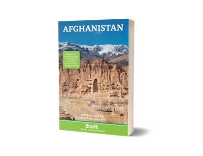
comScore pixel
snowy resort image
Esquí Austria

Pronóstico de Nieve para Lunz am See

Pronóstico de tiempo para Lunz am See a 791 m
Emitido: 12 am  25 Feb 2026 (hora local)

Nueva nieve en Lunz am See

1.0cm0.4in
Vie 6th (NGT)
El pronostico del tiempo para Lunz am See es: Lluvia ligera (totál 2.0mm), cayendo mayormente el martes por la noche. Muy templado (max 10°C el viernes por la mañana, min 1°C el martes por la noche). El viento será generalmente ligero.

Lunz am See Weather (Next 3 days): The snow forecast for Lunz am See is: Lluvia ligera (totál 2.0mm), cayendo mayormente el martes por la noche. Muy templado (max 10°C el viernes por la mañana, min 1°C el martes por la noche). El viento será generalmente ligero.

Lunz am See Weather (Days 4-6): Lluvia ligera (totál 4.0mm), cayendo mayormente el lunes por la tarde. Muy templado (max 10°C el sábado por la mañana, min 3°C el viernes por la noche). El viento será generalmente ligero.


Tiempo actual en Lunz am See

EstaciónProfundidad de NieveTemp. (°C)Viento (km/h)Tiempo
Remonte de arriba: 
2
10
part cloud
Remonte de abajo: 
1
10
part cloud
6 Day Forecast
Emitido: 12 am 25 Feb 2026 / Actualizaciones en ::
Cambiar altura de pronóstico
Elegir pronóstico
Last 6 daysScroll left for last 6 daysNow
Wednesday
25
Thursday
26
Friday
27
Saturday
28
Sunday
1
noche
mañana
tarde
noche
mañana
tarde
noche
mañana
tarde
noche
mañana
tarde
noche
mañana
tarde
noche
light rain
cloud
part cloud
clear
cloud
part cloud
clear
part cloud
clear
part cloud
part cloud
part cloud
part cloud
part cloud
clear
rain showers
lloviz­na
nubl
ado
semi
nublado
claro
nubl
ado
semi
nublado
claro
semi
nublado
claro
semi
nublado
semi
nublado
semi
nublado
semi
nublado
semi
nublado
claro
chuba
scos
 km/h
5
W
5
WNW
5
NW
5
SSE
0
WSW
5
W
5
W
5
SE
5
SE
10
SSE
5
SSE
5
S
0
SW
5
SE
5
S
5
SW
Snow map
2
1
max °C
3
6
6
2
7
7
3
10
8
4
10
9
5
9
9
4
min °C
1
5
4
1
6
3
2
8
5
3
8
5
3
8
5
3
-2
4
4
1
6
2
1
8
3
1
7
5
3
8
5
3
94
85
74
59
59
60
56
61
63
55
52
65
75
68
74
84
1400
1950
2500
2900
2950
2900
2750
2800
2850
2950
2900
2850
2450
2400
2350
2000
nivel del mar1000m2000m3000m4000m5000m
25668871010910867742652753974974974
6:48
6:47
6:45
6:43
6:41
5:37
5:38
5:39
5:42
5:43

Radar de nieve

Presentar el reporte Eyeball Reporter

Ultimo parte de nieve cerca Lunz am See:

  • Hace 5 hour
    weather station observation

    Rain reported from Lunz at 615 metres elevation only 4 kms WSW of Lunz am See but it is forecast cold enough for snow at the ski area desde Lunz am See

  • 22 km lejos desde Lunz am See

    Hace 14 hour
    weather station observation

    Rain reported from Sankt Sebastian/Mariazell at 865 metres elevation only 3 kms NW of Mariazeller Land but it is forecast cold enough for snow at higher elevations in the ski area desde Mariazeller Land

Condiciones de Nieve en Lunz am See

Profundidad de nieve arriba:
Profundidad de nieve abajo:
Profundidad de la nevada fresca:3cm
Última nevada:21 Feb 2026
Otras estaciones en Austria están reportando: Nieve en polvo (38) / buena pista (47)


Historial de nevadas

Semana 4 of February tiene en promedio:
0.1
Dias de Nieve en Polvo
Nieve fresca, mayormente soleado, viento suave.
0.8
Dias de nieve en polvo
Nieve fresca, sol limitado, sin viento.
0.4
Dia perfecto para esquiar
Nieve promedio, mayormente soleado, viento suave.

Map placeholder