

Global Weekly Snow Roundup #314
Weekly Global Snow News, updated 14 May 2026: Fresh snowfall in Argentina, Australia and Lesotho signals winter’s approach, while Japan maintains the world’s deepest snowpack.

Next 3 days weather summary:Nueva capa fina de nieve, cayendo mayormente el sábado por la mañana. Volviéndose más templado con lluvia ligera (totál 9.0mm) el lunes por la tarde. condiciones de congelación y descongelación (max 7°C el lunes por la tarde, min -2°C el sábado por la mañana). El viento será generalmente ligero. | Days 4-6 weather summary:Lluvia moderada (totál 16.0mm), más pesada el martes por la noche. Muy templado (max 11°C el jueves por la tarde, min 3°C el martes por la mañana). El viento será generalmente ligero. | |||||||||||||||||
Saturday 16 | Sunday 17 | Monday 18 | Tuesday 19 | Wednesday 20 | Thursday 21 | |||||||||||||
mañana | tarde | noche | mañana | tarde | noche | mañana | tarde | noche | mañana | tarde | noche | mañana | tarde | noche | mañana | tarde | noche | |
nieve ligera | nieve ligera | nevadas | claro | nubl ado | semi nublado | chuba scos | lluvia mod. | nieve ligera | semi nublado | nubl ado | llovizna | chuba scos | llovizna | llovizna | chuba scos | claro | claro | |
km/h | ||||||||||||||||||
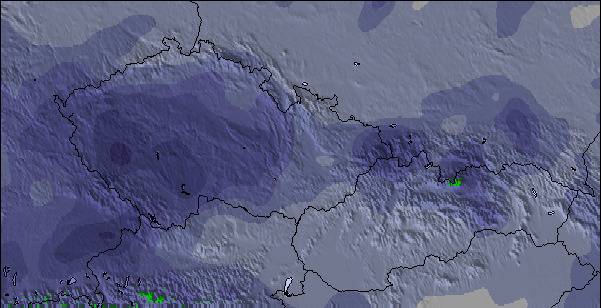
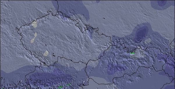
Snow map |  |  |  |  |  |  | ||||||||||||
4 | 2 | 1 | — | — | — | — | — | 2 | — | — | — | — | — | — | — | — | — | |
— | — | — | — | — | — | 1 | 6 | 2 | — | — | 5 | 2 | 2 | 5 | 2 | — | — | |
max °C | -2 | 0 | 0 | 2 | 5 | 5 | 5 | 7 | 3 | 5 | 7 | 6 | 5 | 7 | 7 | 7 | 11 | 9 |
min °C | -2 | -1 | 0 | 0 | 4 | 5 | 5 | 4 | 1 | 3 | 6 | 4 | 5 | 6 | 6 | 6 | 11 | 8 |
-8 | -4 | -4 | 0 | 4 | 4 | 5 | 1 | -2 | 3 | 6 | 1 | 2 | 3 | 3 | 3 | 9 | 8 | |
98 | 95 | 72 | 69 | 62 | 62 | 69 | 95 | 88 | 70 | 68 | 95 | 87 | 84 | 86 | 78 | 59 | 69 | |
1400 | 1650 | 1750 | 1950 | 2300 | 2400 | 2400 | 2350 | 2050 | 2400 | 2600 | 2450 | 2550 | 2750 | 2750 | 2800 | 3050 | 3300 | |
5:35 | — | — | 5:33 | — | — | 5:33 | — | — | 5:31 | — | — | 5:31 | — | — | 5:28 | — | — | |
— | — | 8:45 | — | — | 8:45 | — | — | 8:46 | — | — | 8:47 | — | — | 8:50 | — | — | 8:51 | |
Ultimo parte de nieve cerca Lenggries:
| Profundidad de nieve arriba: | — |
|---|---|
| Profundidad de nieve abajo: | — |
| Profundidad de la nevada fresca: | 7 cm |
| Última nevada: | 15 May 2026 |
0.0 | Dias de Nieve en Polvo Nieve fresca, mayormente soleado, viento suave. |
|---|---|
0.3 | Dias de nieve en polvo Nieve fresca, sol limitado, sin viento. |
0.0 | Dia perfecto para esquiar Nieve promedio, mayormente soleado, viento suave. |
La tabla anterior muestra el pronóstico de tiempo para Lenggries en la altitud específica de 1700 m. Nuestros modelos meteorológicos sofisticados permiten prever pronósticos para la cumbre, la mitad y la base de Lenggries. Para aceder a los pronósticos de tiempo a otras alturas, pinche en la navegación en la parte superior de la tabla. Para una visión general, consulte el Mapa meteorológico de Germany.
Pinche aquí para más información sobre niveles de congelación y sobre cómo pronosticamos las temperaturas.
Generalmente 4.2 En base a 11 votos y 2 comentarios
A great working bavarian village, an hours drive from Munich airport, probably more suited to a long weekend rather than a week. Our children learnt to ski on the small uncrowded, and cheap runs of the wegshied. Very limited skiing for the Big kids, just a couple of blacks and a handful of reds on the brauneck, all skied in a morning. However as a first ski for kids it cannot be faulted, it is very child friendly. when youve had enough skiing hire a toboggan or go to the swimming pool/spa (half inside, half outside)and swim whilst admiring the slopes. Great restaurants, not crowded or overpriced. Great Bavarian fodder...filling with a sprinkling of lederhosen. We thoroughly recommend the 'bunker' for a great meal by an open fire, and schwarz on the crossing for strudel and hot chocolates. Lots of good accomodation to be found. Chocolate box houses, and very large apartments. We have stayed in a couple, very clean and very reasonably priced even at Easter/half term. If you go self catering use the small shops rather than the supermarket...much more fun even if your German is limited. Important to note...little english spoken(hooray!) and credit cards not readily accepted...they like their cash!! As a ski experience it is very different from the tour packages, full of locals doing what locals do,and the odd ski bodies like our good selves.Don't expect wild apres ski! Finally if you get there and the snow disappears, head south to Austria....Seefeld only an hours drive away and also great for kids. Garmish and kitzbul are aslo close if you are easily lured to the glitzy resorts...we know which we prefer. Hope you enjoy your stay.
t tHOMPSON de United Kingdom escribe:
A great working bavarian village, an hours drive from Munich airport, probably more suited to a long weekend rather than a week. Our children learnt to ski on the small uncrowded, and cheap runs of the wegshied. Very limited skiing for the Big kids, just a couple of blacks and a handful of reds on the brauneck, all skied in a morning. However as a first ski for kids it cannot be faulted, it is very child friendly. when youve had enough skiing hire a toboggan or go to the swimming pool/spa (half inside, half outside)and swim whilst admiring the slopes. Great restaurants, not crowded or overpriced. Great Bavarian fodder...filling with a sprinkling of lederhosen. We thoroughly recommend the 'bunker' for a great meal by an open fire, and schwarz on the crossing for strudel and hot chocolates. Lots of good accomodation to be found. Chocolate box houses, and very large apartments. We have stayed in a couple, very clean and very reasonably priced even at Easter/half term. If you go self catering use the small shops rather than the supermarket...much more fun even if your German is limited. Important to note...little english spoken(hooray!) and credit cards not readily accepted...they like their cash!!
As a ski experience it is very different from the tour packages, full of locals doing what locals do,and the odd ski bodies like our good selves.Don't expect wild apres ski!
Finally if you get there and the snow disappears, head south to Austria....Seefeld only an hours drive away and also great for kids.
Garmish and kitzbul are aslo close if you are easily lured to the glitzy resorts...we know which we prefer.
Hope you enjoy your stay.
Lea 1 otras críticas de Lenggries o entrega su propio comentario

 Nearest