
Ski Hire by Skiset
extra 5% off

Radstadt/Altenmarkt Weather (Next 3 days): The snow forecast for Radstadt/Altenmarkt is: Lluvia ligera (totál 4.0mm), cayendo mayormente el jueves por la tarde. condiciones de congelación y descongelación (max 13°C el sábado por la tarde, min -2°C el jueves por la noche). El viento será generalmente ligero.
Radstadt/Altenmarkt Weather (Days 4-6): Mayormente seco. Cálido (max 22°C el martes por la tarde, min 6°C el domingo por la noche). El viento será generalmente ligero.
| Estación | Profundidad de Nieve | Temp. (°C) | Viento (km/h) | Tiempo | ||
|---|---|---|---|---|---|---|
| Remonte de arriba: | -1 | |||||
| Remonte de la mitad: | 3 | |||||
| Remonte de abajo: | 6 |
Ultimo parte de nieve cerca Radstadt/Altenmarkt:
Rain reported from Obertauern (automatic) at 1742 metres elevation one km N of Obertauern but it is forecast cold enough for snow at the ski area desde Obertauern
Rain reported from Bischofshofen at 550 metres elevation 6 kms N of St Johann-Alpendorf but it is forecast cold enough for snow at higher elevations in the ski area desde St Johann-Alpendorf
Rain reported from Bischofshofen at 550 metres elevation 6 kms N of St Johann-Alpendorf but it is forecast cold enough for snow at the ski area desde St Johann-Alpendorf

Thu 25 | Friday 26 | Saturday 27 | Sunday 28 | Monday 29 | Tuesday 30 | Wednesday 1 | ||||||||||||||
tarde | noche | mañana | tarde | noche | mañana | tarde | noche | mañana | tarde | noche | mañana | tarde | noche | mañana | tarde | noche | mañana | tarde | noche | |
chuba scos | chuba scos | claro | llovizna | claro | claro | semi nublado | claro | semi nublado | semi nublado | semi nublado | semi nublado | claro | claro | claro | claro | semi nublado | claro | semi nublado | chuba scos | |
km/h | ||||||||||||||||||||
Snow map |  |  |  |  |  |  |  | |||||||||||||
cm | — | — | — | — | — | — | — | — | — | — | — | — | — | — | — | — | — | — | — | — |
mm | 2.0 | 1.0 | — | 1.0 | — | — | — | — | — | — | — | — | — | — | — | — | — | — | — | 1.0 |
max°C | 6 | 1 | 8 | 10 | 4 | 10 | 13 | 7 | 13 | 16 | 10 | 18 | 21 | 14 | 19 | 22 | 15 | 20 | 22 | 15 |
min°C | 5 | -2 | 3 | 9 | 0 | 4 | 12 | 3 | 7 | 16 | 6 | 11 | 21 | 8 | 12 | 21 | 9 | 13 | 22 | 9 |
chill°C | 5 | -5 | 1 | 8 | -3 | 2 | 11 | 0 | 5 | 16 | 4 | 10 | 21 | 6 | 11 | 21 | 7 | 12 | 22 | 8 |
Humed.% | 65 | 86 | 62 | 64 | 83 | 59 | 59 | 89 | 62 | 57 | 82 | 47 | 36 | 75 | 31 | 32 | 80 | 43 | 38 | 77 |
Altura de Hielo (m) | 1600 | 950 | 1900 | 2050 | 1400 | 2400 | 2550 | 3050 | 3250 | 3600 | 3600 | 3500 | 3300 | 3450 | 3450 | 3300 | 3400 | 3300 | 3400 | 3300 |
— | — | 5:56 | — | — | 5:54 | — | — | 5:54 | — | — | 5:52 | — | — | 5:50 | — | — | 5:48 | — | — | |
— | 8:08 | — | — | 8:10 | — | — | 8:12 | — | — | 8:14 | — | — | 8:15 | — | — | 8:15 | — | — | 8:17 | |
Lluvia ligera (totál 4.0mm), cayendo mayormente el jueves por la tarde. condiciones de congelación y descongelación (max 13°C el sábado por la tarde, min -2°C el jueves por la noche). El viento será generalmente ligero.
Mayormente seco. Cálido (max 22°C el martes por la tarde, min 6°C el domingo por la noche). El viento será generalmente ligero.
Ultimo parte de nieve cerca Radstadt/Altenmarkt:
Rain reported from Obertauern (automatic) at 1742 metres elevation one km N of Obertauern but it is forecast cold enough for snow at the ski area desde Obertauern
Rain reported from Bischofshofen at 550 metres elevation 6 kms N of St Johann-Alpendorf but it is forecast cold enough for snow at higher elevations in the ski area desde St Johann-Alpendorf
Rain reported from Bischofshofen at 550 metres elevation 6 kms N of St Johann-Alpendorf but it is forecast cold enough for snow at the ski area desde St Johann-Alpendorf
| Profundidad de nieve arriba: | — |
|---|---|
| Profundidad de nieve abajo: | — |
| Profundidad de la nevada fresca: | 12 cm |
| Última nevada: | 24 Apr 2024 |
0.0 | Dias de Nieve en Polvo Nieve fresca, mayormente soleado, viento suave. |
|---|---|
0.0 | Dias de nieve en polvo Nieve fresca, sol limitado, sin viento. |
0.0 | Dia perfecto para esquiar Nieve promedio, mayormente soleado, viento suave. |
La tabla anterior muestra el pronóstico de tiempo para Radstadt/Altenmarkt en la altitud específica de 856 m. Nuestros modelos meteorológicos sofisticados permiten prever pronósticos para la cumbre, la mitad y la base de Radstadt/Altenmarkt. Para aceder a los pronósticos de tiempo a otras alturas, pinche en la navegación en la parte superior de la tabla. Para una visión general, consulte el Mapa meteorológico de Austria.
Pinche aquí para más información sobre niveles de congelación y sobre cómo pronosticamos las temperaturas.
Generalmente 4.2 En base a 4 votos y 2 comentarios
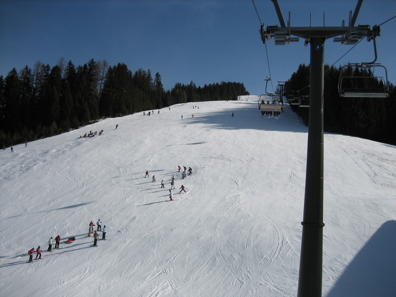
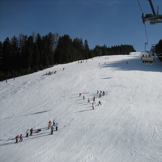
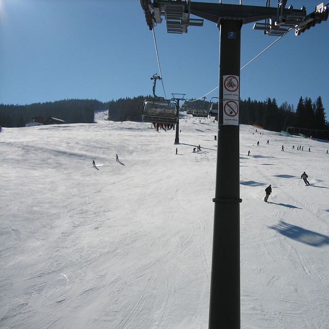
Radstadt is a small town with a few hotels, bars and restaurants, just over an hour from Salzburg. The ski area is fairly small, about 30kms of runs and 5 lifts. The runs are nice, tree lined and mostly red or blue. There is a fast gondola from the village and the other lifts are all quad chairs, fast and efficient. The lift pass covers the whole Salzburgerland ski area, so places like Flachau, Schladming, Zauchenzee, Filzmoos and Obertauern are included. So if you fancy a change just get the bus to the other local resorts, most are within 30min bus ride. A good tip is to get the gondola up, ski down the Altenmarkt side of the mountain and get the ski bus from there 15 minutes down the valley to the higher Zauchensee area which has guaranteed snow and about 20 lifts and links to Kleinarl. Although Radstadt ski area is low (900 - 1700m) it is mostly north facing so can survive warm weather. When I was there is was 18 degrees in mid March but most runs were still open and you could ski to the bottom despite the warmest and most snow-less winter for decades (2006-07). Would recommend Radstadt for good links, cheap accommodation and for families. If you want to party then go to Flachau or Schladming.
David Hosking de United Kingdom escribe:
Radstadt is a small town with a few hotels, bars and restaurants, just over an hour from Salzburg. The ski area is fairly small, about 30kms of runs and 5 lifts. The runs are nice, tree lined and mostly red or blue. There is a fast gondola from the village and the other lifts are all quad chairs, fast and efficient. The lift pass covers the whole Salzburgerland ski area, so places like Flachau, Schladming, Zauchenzee, Filzmoos and Obertauern are included. So if you fancy a change just get the bus to the other local resorts, most are within 30min bus ride. A good tip is to get the gondola up, ski down the Altenmarkt side of the mountain and get the ski bus from there 15 minutes down the valley to the higher Zauchensee area which has guaranteed snow and about 20 lifts and links to Kleinarl. Although Radstadt ski area is low (900 - 1700m) it is mostly north facing so can survive warm weather. When I was there is was 18 degrees in mid March but most runs were still open and you could ski to the bottom despite the warmest and most snow-less winter for decades (2006-07). Would recommend Radstadt for good links, cheap accommodation and for families. If you want to party then go to Flachau or Schladming.
Lea 1 otras críticas de Radstadt/Altenmarkt o entrega su propio comentario
El widget del tiempo para esquiar para Radstadt/Altenmarkt está disponible para ser empotrado en sitios web externos sin costo alguno. Proporciona un resumen diario de nuestro pronóstico de nieve en Radstadt/Altenmarkt y estados de tiempo actuales. Vaya simplemente a la página para su configuración y siga los 3 pasos sencillos. Tome el código de transferencia del hipertexto y péguelo en su propio sitio web. Puede escoger la elevación en el pronóstico de nieve (cumbre, ascensor de medio-montaña o fondo) y unidades métrico/imperiales para el motor del pronóstico de nieve y convenir su propio website…. Click aquí para obtener el código
Panorama detallado del Pronóstico de Nieve para Radstadt/Altenmarkt en:
snow-forecast.com


 Nearest